
Discover Markowo: History and Routes in the Włocławek Municipality
Accommodation in Markowo
Markowo combines a historical reference from the 16th century with its classification as a settlement. For your planning, the wider context of the Włocławek Municipality is also important: it includes areas of a landscape park, designated hiking trails, and the airfield in Kruszyn.
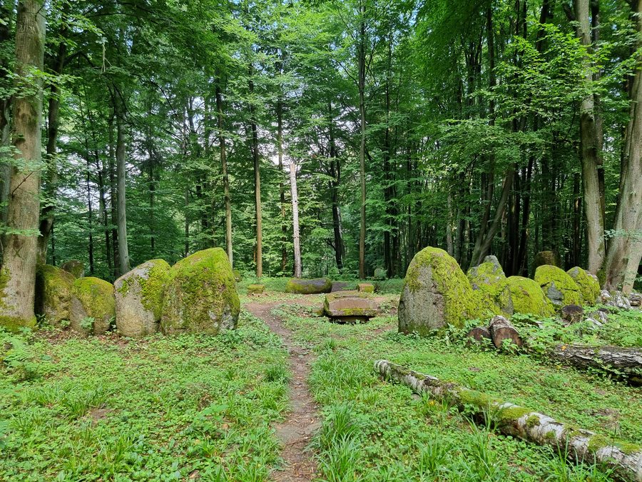
Markowo at a glance
- 16th-century sources mention Markowo as noble property.
- The settlement of Markowo is listed as a settlement in the heritage protection records.
- The entire area of the Włocławek Municipality belongs to the “Lasy Gostynińsko-Włocławskie” Forest Promotion Complex.
- 12,049 ha of the Gostynińsko-Włocławski Landscape Park, established in 1979, lie within the municipality.
- Three PTTK hiking trails, with total lengths of 71 km, 35.4 km, and 18 km, are designated in the municipality.
What does Markowo’s history tell us?
16th-century sources mention Markowo as noble property. In addition, the heritage protection records list the settlement of Markowo as a settlement. These are two distinct perspectives: a historical connection to property ownership and the place’s classification in heritage records. For travelers interested in cultural history, this offers a factual way to approach Markowo’s history, with the place itself at the center.
What is the wider context of the Włocławek Municipality?
For geographical context, it is useful to distinguish Markowo from the municipal area. The entire area of the Włocławek Municipality belongs to the “Lasy Gostynińsko-Włocławskie” Forest Promotion Complex. In addition, 12,049 ha of the Gostynińsko-Włocławski Landscape Park, established in 1979, lie within the municipality. The two figures refer to different areas: the Forest Promotion Complex covers the municipality as a whole, while the park figure refers to the 12,049 ha located there.
This places Markowo within a broader landscape context without conflating municipality-wide information with the settlement itself. If you are weighing nature and cultural heritage as part of your trip, this distinction is useful: the historical background concerns Markowo, while the areas mentioned are in the Włocławek Municipality.
Which hiking trails are designated in the municipality?
Three PTTK hiking trails with different markings and lengths are designated in the Włocławek Municipality. The yellow-marked “Północny,” also called “Szlak główny Kotliny Płockiej,” is 71 km long. The black “Martyrologii” trail covers 35.4 km, while the blue “Łącznikowy” is 18 km long.
By total length, the Północny is approximately twice as long as the Martyrologii, while the Łącznikowy is the shortest of the three designated routes. This comparison gives you an initial sense of the distances and helps you distinguish the names, colors, and lengths when including the trails in your plans.
What other activities are available in the municipality?
Another option to consider when planning your trip is the Aeroklub Włocławski airfield in Kruszyn. Training is offered there for glider, balloon, and skydiving pilots. This makes air sports another municipality-wide activity alongside the designated hiking trails. If you are considering training, check the participation requirements directly with the provider in advance.
How do you choose a hotel for your trip?
If you also plan to explore hiking trails in the municipality or visit the airfield in Kruszyn, compare their proximity to your accommodation based on its specific location. This will help you choose according to whether Markowo itself or a broader area with a range of activities is the focus of your trip.
Discover more destinations: Wieniec, Lubień Kujawski, Augustynowo, Baruchowo, Smólnik, Skoki Duże, Kruszyn and Huta Chodecka.
FAQ
What is known about Markowo’s history?
16th-century sources mention Markowo as noble property. The heritage protection records list the settlement of Markowo as a settlement.
Which hiking trails are designated in the Włocławek Municipality?
The yellow “Północny” is 71 km long, the black “Martyrologii” is 35.4 km long, and the blue “Łącznikowy” is 18 km long. The Północny is also called “Szlak główny Kotliny Płockiej.”
What training is available at the airfield in Kruszyn?
The Aeroklub Włocławski airfield offers training for glider, balloon, and skydiving pilots. If you are interested, check the participation requirements directly with the provider in advance.
For the wider travel overview: Włocławek.

