
Rupniów: Valley, Mountain Ridges and Culture
Accommodation in Rupniów
Rupniów combines its valley location on the Bednarka with three named massifs, a hiking route and cultural heritage. Riding lessons and a paved route through several villages are also practical topics to consider when planning your trip.
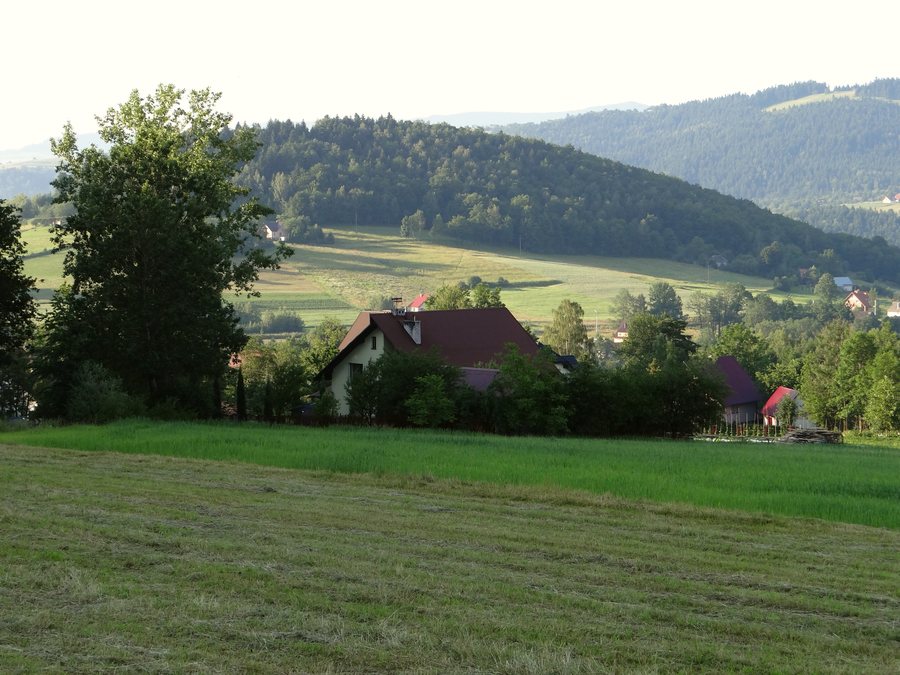
Rupniów at a glance
- Rupniów lies in the valley of the Bednarka stream, between Kostrza (730 m above sea level), Zęzowa (705 m above sea level) and Pasierbiecka Góra (764 m above sea level).
- A hiking route between Tymbark and Bochnia is associated with Rupniów.
- A paved route runs from Limanowa to Rupniów, passing through places including Łososina Górna, Walowa Góra, Pasierbiec and Kisielówka.
- The Rodzinna Stadnina Koni Złoty Dukat stud offers riding lessons under the guidance of qualified professionals.
- KGW Rupniów-Centrum promotes the folk culture of Limanowa municipality and takes part in folklore presentations, competitions and festivals.
- A 19th-century wayside chapel shrine is listed in the register of monuments of the Lesser Poland Voivodeship.
How can the mountain ridges be compared?
Rupniów lies in the valley of the Bednarka stream, between the massifs of Kostrza, Zęzowa and Pasierbiecka Góra. Their elevations are 730, 705 and 764 m above sea level, respectively. Zęzowa is therefore the lowest and Pasierbiecka Góra the highest of the three named massifs, with Kostrza in between. The difference between the two extremes is 59 m. This gives you a direct comparison of the surrounding elevations, while the valley setting defines the area’s geographical context.
Which routes can help with trip planning?
The hiking route between Tymbark and Bochnia passes through Rupniów. Another, paved route runs from Limanowa to Rupniów. It goes through several places, including Łososina Górna, Walowa Góra, Pasierbiec and Kisielówka. The two routes can be distinguished by different features: one is identified as a hiking route and names Tymbark and Bochnia; the other is described as paved and names Limanowa and Rupniów, along with several other places. If you are comparing routes for your trip, these place names and the stated route type can help guide you.
What cultural and equestrian activities are associated with Rupniów?
The Rodzinna Stadnina Koni Złoty Dukat stud offers riding lessons under the guidance of qualified professionals. The KGW Rupniów-Centrum association takes part in folklore presentations, competitions and festivals at municipal, county and regional levels. In doing so, it promotes the folk culture of Limanowa municipality.
Another point of interest is a 19th-century wayside chapel shrine. It was entered in the register of monuments of the Lesser Poland Voivodeship in 2022. A report dated December 25, 2025, announced the completion of restoration work. The 19th century refers to the age of the shrine; the date in 2025 belongs to the report about its restoration.
How can you choose what to focus on when looking for accommodation?
Would you mainly like to get a sense of the valley and the three massifs, include a hiking route in your trip plans, consider riding lessons, or explore the region’s folk culture? First decide which of these matters most, then compare hotels in light of your travel plans. This way, your choice will reflect the things that matter for your stay.
Discover more destinations: Mecina, Mstów, Poręba Wielka, Kasina Wielka, Kobyłczyna, Jodłownik, Pogorzany, Mszana Dolna.
FAQ
Which of the three massifs is the highest?
Pasierbiecka Góra reaches 764 m above sea level, making it higher than Kostrza at 730 m and Zęzowa at 705 m.
What should you bear in mind before setting out on the hiking route?
Check the local trail markings before setting out.
How should the dates relating to the wayside chapel shrine be understood?
The shrine dates from the 19th century; it was entered in the register of monuments in 2022. December 25, 2025, is the date of the report on the completion of the restoration work.
Go to the broader travel overview: Limanowa.

