
Rąbkowa: Łososińska Route, Views and Local History
Accommodation in Rąbkowa
Three features are especially useful for getting your bearings in Rąbkowa: the Łososińska Route, with a viewpoint above Tabaszowa; the chapel in the village centre; and a local history whose beginnings are dated to 1400–1440. This gives you a basis for weighing up the landscape and cultural history when choosing a destination.
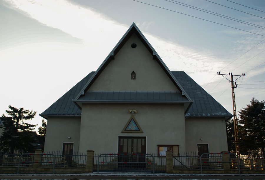
Rąbkowa at a glance
- The approximately 28 km Łososińska Route passes through Rąbkowa, among other places; its kilometre markers refer to points along the route.
- At the 7.7 km point, the trail leads to a 470 m-high hill above Tabaszowa.
- A chapel dedicated to Our Lady of Częstochowa stands in the centre of Rąbkowa.
- The village’s beginnings are dated to 1400–1440; its earlier names were first Romakowa and later Robkowa.
What is the route of the Łososińska Route near Rąbkowa?
The approximately 28 km Łososińska Route begins at a crossroads in Kąty. It passes through Michalczowa towards Łososina Dolna and runs alongside the Aeroklub Podhalański airfield before reaching the municipal centre. After crossing the bridge over the Łososinka, it follows the right bank of the river, passes the KS „Łosoś“ stadium, and climbs a hill above Tabaszowa. There, you can take a break, enjoy the view or descend to the historic St Nicholas Church in Tabaszowa.
At the 7.7 km point near Rąbkowa, the route leads to the 470 m-high hill above Tabaszowa. At the 10.1 km point, a blue hiking trail leads to Rożnów; you can also take a break there or descend towards the church in Tabaszowa, visible in the distance. These markers describe sections of the longer route, not distances from the village centre.
At kilometre 13, the route reaches Znamirowice. The YC PTTK „Beskid“ water station is about 200 m from the route; sailing courses are held there every year. If specific dates are important for your plans, check the latest information. At the 15.4 km point, the route turns left at a crossroads in Rąbkowa towards Just and continues along a blue hiking trail. The route description also notes the climb from Znamirowice to Rąbkowa via switchbacks.
What viewpoints are there in the area?
From the hill above Tabaszowa, you can see Jezioro Rożnowskie, Gródek nad Dunajcem, the Beskid Sądecki, the Beskid Wyspowy and the Pogórze. On the way towards Just, the route passes a historic church at an elevation of 486 m; there are scenic views along the way. Another viewpoint is nearby: from the hamlet of Szczołby, you can see far across the Łososina Valley.
The viewpoints offer different perspectives: the hill above Tabaszowa combines a view of the lake with a sweeping mountain panorama. Szczołby looks out over the Łososina Valley. At the church on the way towards Just, the landscape and a historic building go hand in hand. This gives you a way to consider scenic experiences and cultural connections as different interests when planning your trip.
What do the chapel and local history tell us?
The chapel dedicated to Our Lady of Częstochowa stands in the centre of Rąbkowa. Local residents built it in less than six months. A local publication from 2011 dates the beginnings of Rąbkowa to the years 1400 to 1440. It gives the earlier names first as Romakowa and later as Robkowa.
Along with its viewpoints and the route sections described here, Rąbkowa also offers a tangible connection to the village’s history. When comparing destinations and accommodation, you can consider whether you would prefer to focus on the scenery along the Łososińska Route or the local cultural heritage.
Discover more destinations: Muszyna, Rytro, Krynica-Zdrój, Mochnaczka Niżna, Berest, Świdnik, Barcice, Kąclowa.
FAQ
How does the 7.7 km point differ from the 15.4 km point?
At the 7.7 km point, the trail leads to a 470 m-high hill above Tabaszowa. At the 15.4 km point, the route turns towards Just at a crossroads in Rąbkowa and continues along a blue hiking trail.
What were Rąbkowa’s earlier names?
The local history gives the earlier names first as Romakowa and later as Robkowa. The beginnings of the village are dated to 1400–1440.
Where are the sailing courses held?
The annual sailing courses are held at the YC PTTK „Beskid“ water station in Znamirowice. The station is about 200 m from the Łososińska Route; check specific dates in advance.
For the broader travel overview: Nowy Sącz.

