
Załęcze Wielkie
Accommodation in Załęcze Wielkie
With the ZHP Training and Recreation Centre “Nadwarciański Gród,” Załęcze Wielkie has a specific point of reference in the landscape park. The routes range from a walk of around an hour and a half to longer hiking and cycling routes.
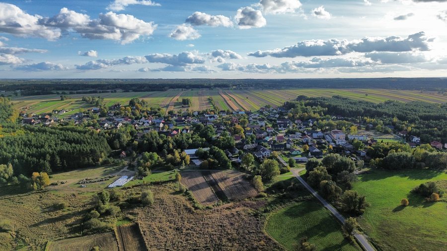
Key facts about Załęcze Wielkie
- The “Nadwarciański Gród” centre is located in Załęcze Wielkie, within Załęczański Park Krajobrazowy.
- “Trasa Nr 1” is a circular hiking or cycling route of around 23 km, starting from the centre.
- “Trasa Nr 2” is an approximately 15 km hiking route that starts and ends at the centre.
- The “Ośrodek” educational trail is 3 km long; the walk takes about 1.5 hours.
What makes this starting point distinctive?
The ZHP Training and Recreation Centre “Nadwarciański Gród” is located in the landscape park and serves as the starting point for several named routes. This is a useful reference for planning excursions: some routes start and end at the centre, while other routes in the wider travel area lead there. This makes it possible to distinguish routes by length, mode of travel and course, rather than just by name.
The route details provide specific points of comparison, but they do not make different routes one and the same excursion.
Which hiking and cycling routes start at the centre?
“Trasa Nr 1” is an approximately 23 km circular route via Kępowizna, Bieniec, Przywóz, Ogroble and Madeły, returning to “Nadwarciański Gród.” It is designated as a hiking or cycling route. “Trasa Nr 2” is shorter, at about 15 km, and is a hiking route: from the centre, it goes via Kępowizna, Bieniec and Dzietrzniki to the “Objawienie” spring and back to the centre.
Both routes share the same start and finish, but differ in length and designated mode of travel. If you are planning a walking loop, you can choose between routes of approximately 15 and 23 km; cycling is also listed as an option for “Trasa Nr 1.” No walking time is given for these two routes, so it cannot be determined from the route lengths alone.
Another option from the centre is “Trasa A” of the “Załęczański Łuk Warty.” This 10.2 km main route for hikers and cyclists goes via Bukowce to the bridge in Bobrownie. Its described course differs from that of the two circular routes: the bridge is listed as the endpoint, rather than a return to the starting point.
Which routes are in the wider travel area?
In the wider travel area, “Trasa B” of the “Załęczański Łuk Warty” is designated as a 15 km northern hiking or cycling route. It starts at the quarry near Bobrowniki, runs via Ogroble, Kurhany Książęce and Wąwóz Królowej Bony, and ends at “Nadwarciański Gród.” The southern “Trasa C” runs from the “Węże” nature reserve via Mount “Wapiennik” to the centre; it is 12.5 km long and is also described as suitable for hikers and cyclists. The routes differ in direction and stated starting points, as well as in length.
If you are interested in a route’s themes as well as its course, the wider travel area offers the “Wielki Łuk Warty” geological educational trail. It covers natural features, geology and the landscape park’s present-day terrain, and helps visitors understand geological processes. The “Źródełko” forest educational and recreation trail is about 6 km long. Both trails complement the routes whose course explicitly starts or ends at “Nadwarciański Gród.”
How much time should you allow for the “Ośrodek” educational trail?
The “Ośrodek” educational trail runs through the centre’s grounds and surrounding area. It is 3 km long, and the walk takes about 1.5 hours. This means that, alongside the route length, there is also an approximate time estimate to help with day planning. If needed, you can check the trail’s condition locally before your trip.
Discover more destinations: Brójce, Górka Pabianicka, Pławno, Dobryszyce, Starowa Góra, Borowa, Andrespol, Koluszki.
FAQ
Which routes are designated as hiking or cycling routes?
“Trasa Nr 1,” “Trasa A,” “Trasa B” and “Trasa C” are described as hiking or cycling routes. “Trasa Nr 2” is a hiking route.
Which circular routes start and end at “Nadwarciański Gród”?
“Trasa Nr 1” runs via Kępowizna, Bieniec, Przywóz, Ogroble and Madeły, returning to the centre. “Trasa Nr 2” also returns there, running via Kępowizna, Bieniec, Dzietrzniki and the “Objawienie” spring.
How long is the “Ośrodek” educational trail?
It is 3 km long; the walk takes about 1.5 hours. The trail runs through the centre’s grounds and surrounding area.
What does the “Wielki Łuk Warty” educational trail cover?
It covers natural features, geology and the present-day terrain of Załęczański Park Krajobrazowy, and helps visitors understand geological processes.
Go to the wider travel overview: Lodz.

