
Kąty Bystrzyckie: Hotels and Accommodations
Accommodation in Kąty Bystrzyckie
Kąty Bystrzyckie is recorded in a municipal historical account from 1346 under the historical name Winklerdorf. For travelers interested in local history, this documented name provides a specific cultural point of reference.
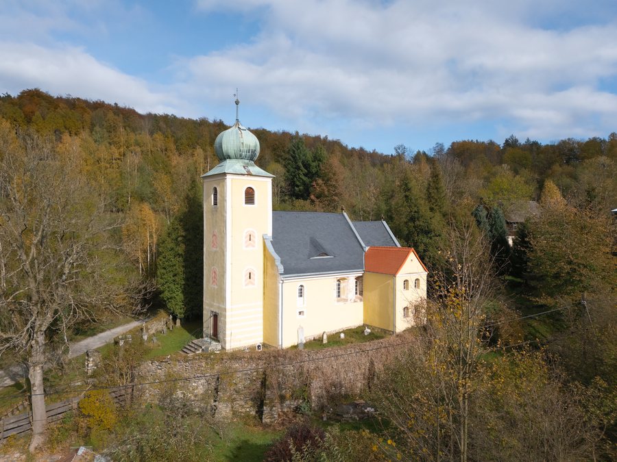 Saint Catherine of Alexandria church in Kąty Bystrzyckie
Photo: Jacek Halicki via Source, CC BY-SA 4.0
Saint Catherine of Alexandria church in Kąty Bystrzyckie
Photo: Jacek Halicki via Source, CC BY-SA 4.0
You can book a hotel in Kąty Bystrzyckie.
History
A parish church is also documented for the locality for the period between 1364 and 1404.
Nature
Kąty Bystrzyckie is located in the eastern part of the Krowiarki mountain range, at approximately 490 to 610 meters above sea level.
Surroundings
The surrounding area of Kąty Bystrzyckie includes Trzebieszowice, Radochów – Jaskinia Radochowska, Gorzanów – Pałac, and Żelazno – Zamek.
Chłopek, Wilczyniec, and Sowia Kopa are also located in the immediate vicinity of Kąty Bystrzyckie.
The Muzeum Ziemi Klodzkiej is located in the wider regional area surrounding Kąty Bystrzyckie.
Cycling
A catalogued mountain biking excursion associated with Kąty Bystrzyckie is recorded as being 27 kilometers long, with 320 meters of ascent and 314 meters of descent. For visitors interested in a mountain biking experience, this recorded route provides a specific point of reference.
After the church in Kąty Bystrzyckie, the route description directs cyclists to a cycle path.
Further destinations can be opened via this selection: Lewin Kłodzki, Gorzanów, Wójtowice, Leśna, Stojków, Bystrzyca Kłodzka, Sokolec, Młynowiec.
To the overview of the higher-level destination: Kłodzki.

.jpg)