
Kostrzyn: Old Town, Fortress and Routes by the Water
Accommodation in Kostrzyn
The Old Town, destroyed in 1945, the structures of a 16th-century bastion fortress and routes for walking, kayaking or cycling give Kostrzyn a clear focus on history and activity. This lets you consider different interests when planning your trip, without reducing it to a single experience.
Kostrzyn at a glance
- The Old Town was destroyed in 1945 and was not rebuilt; the structures of the bastion fortress date from the 16th century.
- The Old Town site is open daily, year-round, from sunrise to sunset. Check the current visitor rules before your visit.
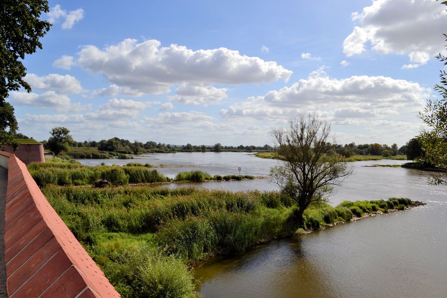
- There is a promenade along the crown of the fortifications on the Oder for walks; kayaking and cycling routes also start in the town.
What do the Old Town and fortress tell us?
The destroyed, unreconstructed Old Town and the fortress structures are part of the Muzeum Twierdzy Kostrzyn museum complex. The history of the place can be understood as a succession of two very different periods: the fortress structures date back to the 16th century, while the Old Town was destroyed in 1945. Anyone interested in architectural and urban history will find both aspects within a shared historical context.
The casemates of Bastion Filip house a permanent exhibition on key moments in the history of the fortress town. It covers both the destruction of 1945 and the creation and development of the fortress. This adds historical context to the surviving structures.
How can you experience Kostrzyn on foot and on the water?
A promenade along the crown of the fortifications on the Oder invites you to take a walk; from there, you can look out over the Oder Valley. As you walk through the Old Town, you can see the remains of old tenement houses, cobbled lanes and footpaths. The damaged walls rise no more than 1.5 metres above the ground. Their low height changes the impression of the ruins: you can take in the surviving forms and the course of the paths, rather than experiencing the walls as tall, continuous façades.
A kayaking route starts at the municipal MOSiR landing stage. It first runs 1.5 kilometres upstream on the Warta, then continues through canals and former river channels along the Warta’s right bank. The route thus shifts from an upstream stretch to narrower waterways. Check current local conditions before setting off. A landing stage for passenger boats was also built in Kostrzyn to allow sightseeing boats to make possible stopovers.
What options are there for cycling and finding your way around?
The international R1 cycle route runs from Lubniewice via Sulęcin and Czarnów to Kostrzyn nad Odrą, then continues into Germany. This gives you a specific sequence of places to follow when planning your route; check the current signage locally. Together with the kayaking route, the R1 appeals to travellers who want to include Kostrzyn in a cycling or water-based leg of their journey. The routes offer different ways to explore the town and its surroundings, rather than the same kind of outing.
The tourist information point at the Berlin Gate offers maps, guidebooks, publications and souvenirs. You can also get information there about sightseeing routes, current events and what the Muzeum Twierdzy Kostrzyn has to offer. If you are planning a visit around an event, check its date in advance. The information point and your own route planning serve different purposes: here you can find information about sightseeing and events, while there you decide which routes or topics suit your stay.
How do you choose a hotel for your stay?
The experiences described offer different starting points for planning your trip; which ones take centre stage depends on your interests.
Discover more destinations: Santoczno, Wojcieszyce, Kłodawa, Deszczno, Landsberg an der Warthe, Witnica, Zdroisko, Rybakowo.
FAQ
When is the Old Town site open?
It is open daily, year-round, from sunrise to sunset. Check the current visitor rules before your visit.
What does the exhibition at Bastion Filip cover?
The permanent exhibition in the casemates covers the destruction of the fortress town in 1945 and the creation and development of the fortress.
What is the kayaking route like?
It starts at the municipal MOSiR landing stage, first runs 1.5 kilometres upstream on the Warta, then continues through canals and former river channels along the Warta’s right bank. Check current local conditions before setting off.
Where does the R1 cycle route go?
The international R1 runs from Lubniewice via Sulęcin and Czarnów to Kostrzyn nad Odrą, then continues into Germany. Check the current signage locally.
For the main travel overview: Landsberg an der Warthe.

