
Marcinowice: Landscape and Local History
Accommodation in Marcinowice
Marcinowice lies on a hill above the Oder. A red Nordic walking route leads through the village; its historic buildings and Evangelical cemetery also invite visitors to learn about local history. This information can help you assess Marcinowice as a travel destination and decide whether to focus on outdoor activity or culture.
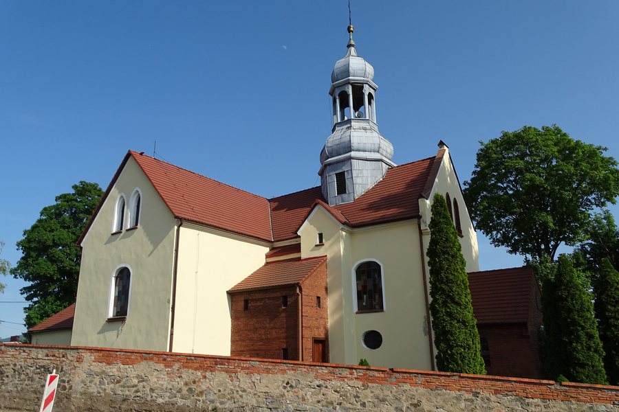 File:Kościół św. Wacława Marcinowice.jpg
Photo: Robert Niedźwiedzki via Wikimedia Commons, CC BY-SA 4.0
File:Kościół św. Wacława Marcinowice.jpg
Photo: Robert Niedźwiedzki via Wikimedia Commons, CC BY-SA 4.0
Marcinowice at a glance
- The village lies on a hill above the Oder.
- A red Nordic walking route leads from Krosno Odrzańskie through Marcinowice and Osiecznica and back to Krosno Odrzańskie.
- A circular Nordic walking route passes through a rural, forested landscape with moderate changes in elevation.
- The historical features described include residential and farm buildings, as well as an Evangelical cemetery.
What defines Marcinowice’s location?
Its hilltop location above the Oder is a prominent feature of the village’s setting. For trip planning, this location provides a clear geographical reference point.
There are different descriptions of Nordic walking routes and their surroundings. The red route leads from Krosno Odrzańskie through Marcinowice and Osiecznica and back to Krosno Odrzańskie. A circular route through Marcinowice is described as passing through a rural, forested landscape, with moderate changes in elevation and access to nature. Check the current route markings and conditions before setting out.
What historical features are described?
Residential and farm buildings in Marcinowice were listed in heritage protection records. The layout of the Evangelical cemetery was clearly discernible, and numerous gravestones had been preserved. Both details offer insight into the village’s built and historical character.
When exploring Marcinowice, you can consider these topics separately: its location above the Oder, routes through the surrounding area, and the historical landmarks described here. This makes it easier to choose accommodation based on your planned focus, without conflating local history and outdoor activity into a single promise of an experience.
What else does the wider destination of Crossen An Der Oder offer?
The wider destination of Crossen An Der Oder includes the municipality of Krosno Odrzańskie in Lubusz Voivodeship and Krosno County, in the Central Oder Valley on the Oder and at the mouth of the Bóbr. In Krosno Odrzańskie, Piast Castle stands on the site of the residence of Henry the Bearded, dating from the early 13th century; it is considered one of the valuable castles in Lubusz Voivodeship. These regional landmarks complement the information about Marcinowice, but are separate destinations within the wider travel area.
Route information in the wider area also varies by activity and distance. A described 60-kilometre kayaking route on the Oder runs from Nietkowice through Radnica, Krosno Odrzańskie, Osiecznica and Połęcko to Szydłowo. For cycling, a 65-kilometre route is listed from Krosno Odrzańskie through Bytnica, Gryżyna, Grabin and Radnica and back to Krosno Odrzańskie.
Two hiking loops of different lengths are described: the black PTTK forest trail is 33.5 kilometres long, while the red Szlak Przeszłości is 15.4 kilometres long. The shorter loop runs through Bielów, Lake Gnilec, Lake Glibiel, Łochowice and Kamień, then returns to Krosno Odrzańskie. The 33.5-kilometre loop runs through Bielów, Czetowice, Budachów, Bytnica, Struga and Łochowice before returning. Check the current route markings before setting out; for the kayaking route, also check the starting point, river and safety conditions.
The natural landscape of Crossen An Der Oder includes Gryżyński Landscape Park. In the eastern part of Krosno Odrzańskie municipality, it covers 342.6 hectares and protects the natural features of the glacial trough of Gryżyński Potok. The wider destination therefore offers not only local history, but also landscapes and routes of varying lengths, while Marcinowice itself is characterised by its hilltop location and the Nordic walking routes described there.
FAQ
Where is Marcinowice located in relation to the Oder?
Marcinowice lies on a hill above the Oder. Its hilltop location is described as a permanent feature of the landscape.
Which Nordic walking route passes through Marcinowice?
A red route leads from Krosno Odrzańskie through Marcinowice and Osiecznica and back to Krosno Odrzańskie. Check the current route markings and conditions before setting out.
What historical features are mentioned for Marcinowice?
Residential and farm buildings in Marcinowice were listed in heritage protection records. The layout of the Evangelical cemetery was clearly discernible, and numerous gravestones had been preserved.
For the wider travel overview: Crossen An Der Oder.

