
Discover Przeborowo: Nature, Trails and Culture
Accommodation in Przeborowo
Przeborowo can be explored through three interests: nature, outdoor activities and local history. When planning your trip, the specific differences matter—for example, a loop that starts and ends in the village or a longer hiking route that passes through Przeborowo.
Przeborowo at a glance
- A 7 km circular route starts and ends in Przeborowo and follows the Drawa to the Smolarz Forest District office. It is designated as a Nordic walking route.
- The hiking route from Drawiny to Stare Osieczno passes through Przeborowo and is 18.8 km long in total.
- A Norway maple along the path in the park around the old church is listed as a natural monument. It is 30 m tall and has a trunk circumference of 350 cm.
- Kayaks can be rented in Przeborowo for paddling trips; check current availability before your trip.
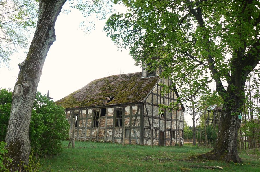
- A 2025 caption describes the Church of Our Lady of Częstochowa in Przeborowo as a ruin.
- Przeborowo is included in the municipal register of monuments as a rural settlement.
What natural and cultural features characterize Przeborowo?
A Norway maple (Acer platanoides), listed as a natural monument, grows along the path in the park around the old church. Its trunk circumference is 350 cm and its height is 30 m. The two measurements describe different aspects of the tree: 350 cm is the measurement around the trunk, while 30 m indicates its height. This makes nature in Przeborowo tangible through a single tree—its species, location and measurable size.
The rural settlement is also included in the municipal register of monuments. This focuses attention on Przeborowo as a place, distinguishing it from the natural monument, which refers to an individual tree. A 2025 caption describes the Church of Our Lady of Częstochowa in Przeborowo as a ruin. The settlement, tree and church building thus offer different perspectives on the village.
Which routes can you compare?
The comparison is about more than just distance; the shape of the route matters too. The 7 km circular route starts and ends in Przeborowo, follows the Drawa to the Smolarz Forest District office and is designated as a Nordic walking route. On this route, Przeborowo is both the starting point and the destination.
Another hiking route runs from Drawiny to Stare Osieczno and passes through Przeborowo; its total length is 18.8 km. It is 11.8 km longer than the circular route and has two named endpoints outside Przeborowo. When planning, you can therefore consider both the distance and the route format: a loop with the same start and finish, or a route between Drawiny and Stare Osieczno.
Is kayaking an option in Przeborowo?
Kayaks can be rented in Przeborowo for paddling trips. If you would like to include this option in your plans, confirm current availability before your trip. This allows you to consider paddling as a separate focus alongside the routes described.
Discover more destinations: Radecin, Dlugie, Głęboczek, Drezdenko, Mierzęcin, Zagórze, Strzelce Krajenskie, Bobrówko.
FAQ
How long is the circular route from Przeborowo?
It is 7 km long, starts and ends in Przeborowo, and follows the Drawa to the Smolarz Forest District office.
Which tree is listed as a natural monument?
It is a Norway maple (Acer platanoides) along the path in the park around the old church. Its trunk circumference is listed as 350 cm and its height as 30 m.
Can you rent kayaks in Przeborowo?
Yes, kayaks can be rented there for paddling trips. Confirm current availability before your trip.
Go to the main travel overview: Strzelecko-Drezdenecki.

