
Oliszki: Cycling Route and History
Accommodation in Oliszki
Oliszki can be explored through two specific points of interest: the 20 km Światowida Cycling Route and a settlement history dating back to the late 15th century. When choosing your destination, you can therefore consider both a route through the area and its historical context.
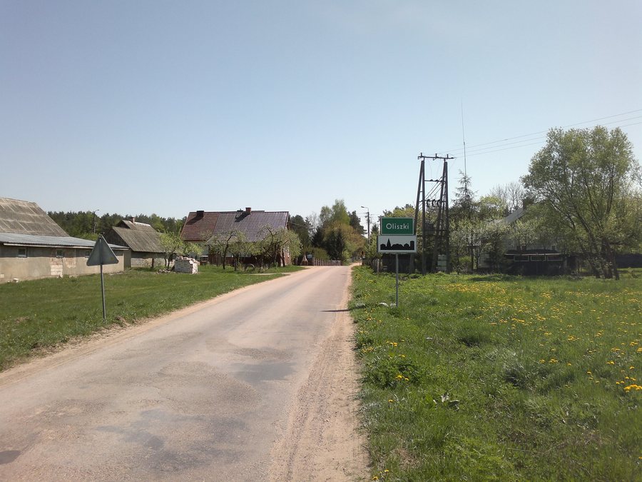
Oliszki at a glance
- The green-marked Światowida Cycling Route is 20 km long and passes through Oliszki.
- In the wider region, the route connects Białystok with Narwiański National Park.
- It crosses the blue-marked Obwodnica Narwiańskiego Parku Narodowego and the Szlak Włókniarzy, which is also marked in blue.
- A settlement established with the involvement of officials from Suraż is dated to the late 15th century.
What does the Światowida Cycling Route offer for your planning?
The green-marked route passes through Oliszki and is 20 km long. At the same time, the Światowida Cycling Route connects Białystok with Narwiański National Park. This gives it both a connection to the area and a broader regional context: Oliszki lies along the described route, while the destinations mentioned extend beyond the area.
The stated distance describes the route, not how long your ride will take. If you include the cycling route in your travel plans, calculate the riding time for your own stage separately. It is worth checking the current condition of the route before setting out.
How should you understand the other marked routes?
In the wider region, the Światowida Cycling Route crosses two routes marked in blue: the Obwodnica Narwiańskiego Parku Narodowego and the Szlak Włókniarzy. The markings distinguish the green route that passes through Oliszki from the two blue routes. This makes it possible to consider the route through the area and the crossings in the wider region as different spatial levels.
If you want to include several routes in your plans, their names and colors can help you tell them apart. For a specific ride, check which connection you want to use and where the relevant crossing is. The route information therefore gives you a regional frame of reference; it does not replace planning your own route.
What role does history play in choosing a destination?
A historical connection to Oliszki dates back to the late 15th century. At that time, officials from Suraż settled the Klepaczewiczów (Klepacze), Oliszków (Oliszki), and boyars from Suraż. This account connects the area with Suraż and names both the officials involved and the groups who were settled. It offers a specific historical perspective, distinct from the present-day route information.
When weighing different destinations, you can consider these two topics separately: the cycling route is a reference point for planning your route, while the settlement history provides a historical perspective and a point in time. If you are interested in both, Oliszki offers a specific route distance as well as a dated glimpse into the area’s history.
Discover more destinations: Grabówka, Zamczysk, Mińce, Woronicze, Niewodnica Kościelna, Supraśl, Białystok and Szymki.
FAQ
How long is the Światowida Cycling Route?
The green-marked cycling route is 20 km long and passes through Oliszki.
Which routes does the Światowida Cycling Route cross?
In the wider region, it crosses the blue-marked Obwodnica Narwiańskiego Parku Narodowego and the Szlak Włókniarzy, which is also marked in blue.
What historical connection is mentioned for Oliszki?
In the late 15th century, officials from Suraż settled the Klepaczewiczów (Klepacze), Oliszków (Oliszki), and boyars from Suraż.
For the wider travel overview: Białostocki.

