
Cimochowizna: Hills and Paths by Lake Wigry
Accommodation in Cimochowizna
Cimochowizna combines distinctive hills with paths by Lake Wigry. A view from the hill, different route layouts and an entry about the village’s history give you concrete points of reference for understanding the place according to your interests.
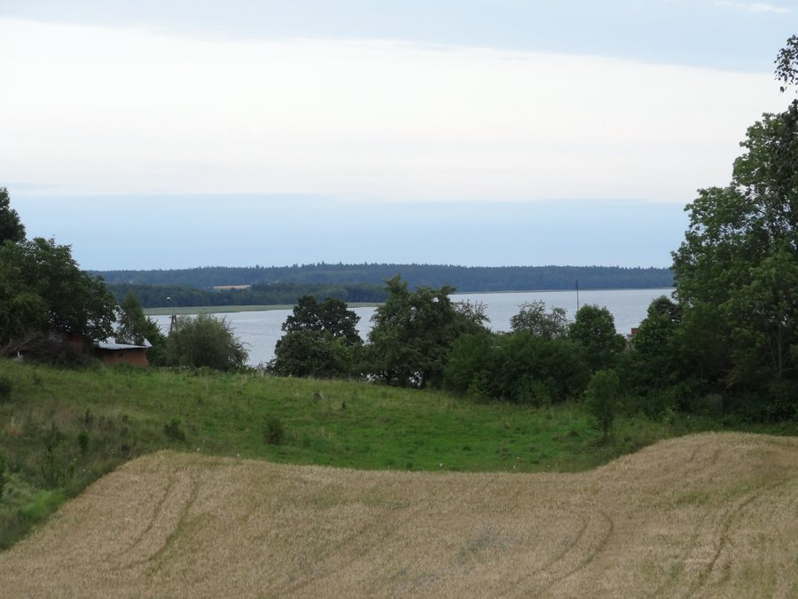 File:Suwałki, Poland - panoramio (50).jpg
Photo: Wojciech Zabolotny via Wikimedia Commons, CC BY-SA 3.0
File:Suwałki, Poland - panoramio (50).jpg
Photo: Wojciech Zabolotny via Wikimedia Commons, CC BY-SA 3.0
Cimochowizna at a glance
- A hill on the green hiking trail offers a view of Lake Wigry and the former Camaldolese monastery.
- The green trail leads from a trail junction up a hill and then along the western shore of the lake.
- The Rowerem wokół Wigier cycling route runs from Stary Folwark via Cimochowizna and Kładka to Słupie.
- The high hills in the village are terminal moraines. A municipal inventory of historic monuments also lists a wooden house and a wooden barn from the 1920s.
What can you see from the hill?
The viewpoint is on a hill along the green hiking trail. From there, the view extends to Lake Wigry and the former Camaldolese monastery. This brings the lake and a distinctive building together in a single landscape view. To understand Cimochowizna, you can distinguish between the view of the landscape and the route of a trail: the hill is both a viewpoint and part of the setting described for the green trail.
The route provides another point of reference to help you find your way. At a junction, the green trail climbs the hill and then continues along the western shore of Lake Wigry. The viewpoint and the lakeshore section thus offer two different aspects of the green trail: the ascent in the village and the continuation along the lake.
How do the described routes differ?
The green trail and the Rowerem wokół Wigier cycling route can be distinguished mainly by their routes. The green trail is defined by the junction, the climb over a hill and its continuation along the western shore. The cycling route is described as a longer sequence of places: it runs from Stary Folwark via Cimochowizna and Kładka to Słupie. Cimochowizna is one section of this listed sequence.
When comparing routes, pay attention to the type of information given: hills and the lakeshore are the focus for the green trail, while the cycling route is described through its sequence of places. Before setting out on the cycling route, it is advisable to check the latest park information.
What shapes the hills around the village?
The high hills in Cimochowizna are terminal moraines. This refers to landforms that mark the front line of a glacier during a period when it is stationary and then gradually retreats. The term explains why the hills are interesting not only as viewpoints but also as characteristic landforms of the village.
For your trip planning, this geological aspect complements the views of the lake and the routes: the viewpoint describes what you can see from a hill, while the classification as a terminal moraine explains how this distinctive landform was created. This brings the landscape and its formation history together without presupposing a particular route or length of stay.
What architectural history is documented?
A municipal planning document from 2020 lists a wooden house and a wooden barn, both from the 1920s, at Zagroda No. 2 in Cimochowizna.
Discover more destinations: Ryżówka, Głuszyn, Oszkinie, Ogrodniki, Mikołajewo, Hołny Wolmera, Radziucie and Puńsk.
FAQ
What can you see from the hill in Cimochowizna?
The hill on the green hiking trail offers a view of Lake Wigry and the former Camaldolese monastery.
What is the route of the green trail?
At a trail junction, it climbs a hill and then continues along the western shore of Lake Wigry.
Which places are mentioned in the description of the cycling route?
Rowerem wokół Wigier runs from Stary Folwark via Cimochowizna and Kładka to Słupie.
Which buildings are listed at Zagroda No. 2?
A municipal planning document from 2020 lists a wooden house and a wooden barn from the 1920s there.
For the broader travel overview: Sejny.

.jpg)