
Pierszczewo on Lake Patulskie
Accommodation in Pierszczewo
Pierszczewo lies on Lake Patulskie and combines access to the water with a preserved village structure and several cycling routes. This gives you various points of interest when planning your trip: the lake and kayaking, cycling routes through the countryside, and traces of local history.
Pierszczewo at a glance
- Pierszczewo lies on Lake Patulskie; a promenade leads downhill from the rest area to the lake.
- The “Kaszëbskô Stegna” cycling route is about 20 km long and runs through the Kashubian Landscape Park.
- The village landscape includes farmsteads and a network of roads that are partially preserved.
- The documented history of the village dates back to 1284.
What makes the location on Lake Patulskie distinctive?
Lake Patulskie is a prominent landmark for a visit to Pierszczewo. A promenade leads downhill from the rest area to the lake and provides access to the water. This means you can include a walk to the lake during your stay without needing to plan for a specific walking time or distance. The promenade also serves a purpose for kayaking trips: trips on the “Kółkiem jezior raduńskich” route can start and end here.
Two different ways to experience the lake are therefore available at the same location: the path down to the water and the connection to a kayaking route. If you are interested in the trip, you can use the name “Kółkiem jezior raduńskich” as a guide when planning your route. The promenade is relevant both as access to the lake and in connection with the start and end of kayaking trips.
Which cycling routes pass through Pierszczewo?
The “Kaszëbskô Stegna” and “Jezôrno Stegna” routes pass through Pierszczewo. The first is about 20 km long and runs through the Kashubian Landscape Park. It heads towards Szymbark, Stężyca and Wieżyca. The approximate distance refers to this route; the places mentioned also give you an idea of its direction.
“Jezôrno Stegna” is described as a scenic route through forests and over hills. This distinguishes the two routes in the available information: for “Kaszëbskô Stegna,” an approximate total distance, the landscape park and the direction towards three places are given; for “Jezôrno Stegna,” forests and hills are the focus. There is a map of the cycling routes at the rest area in Pierszczewo, which you can use to find your way along the routes.
What traces of local history can you find?
Pierszczewo retains the character of a linear village. Partially preserved farmsteads and a partially preserved network of roads are part of this village landscape, along with paved areas and stone edging on embankments and property boundaries. These features give the village’s built form a tangible character: in addition to the farmsteads, roads, paving and property boundaries are also part of its inherited character.
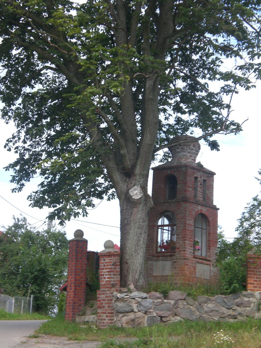
A brick chapel from the early 20th century has been preserved in Pierszczewo. A chapel next to building 42a is also listed in the cultural heritage register. A former school building at Pierszczewo 44 is also listed there; the building houses the headquarters of a foundation. The documented history of the village dates back to 1284. An information board about the history of Pierszczewo at the rest area complements these architectural and historical points of interest.
The rest area also features an illustration showing how women used to wash clothes and carry water. It is complemented by a sculpture of a woman carrying water. Together with the information board, it highlights a particular aspect of everyday life in the past; the illustration specifically depicts activities from earlier times.
For more ideas on places to visit, you can also explore Puzdrowo, Prokowo, Zukowo, Przewóz, Kczewo, Ręboszewo, Długi Kierz and Smołdzino.
FAQ
How do you get to Lake Patulskie in Pierszczewo?
A promenade leads downhill from the rest area to Lake Patulskie and provides access to the water.
Where can kayaking trips on the “Kółkiem jezior raduńskich” route start and end?
The promenade in Pierszczewo allows these kayaking trips to start and end there.
How long is the “Kaszëbskô Stegna” cycling route?
It is about 20 km long and runs through the Kashubian Landscape Park.
What does the display at the rest area show?
It shows how women used to wash clothes and carry water, and is complemented by a sculpture of a woman carrying water.
For the broader travel overview: Karthaus.

