
Lewinko: Lake, Trails and History
Accommodation in Lewinko
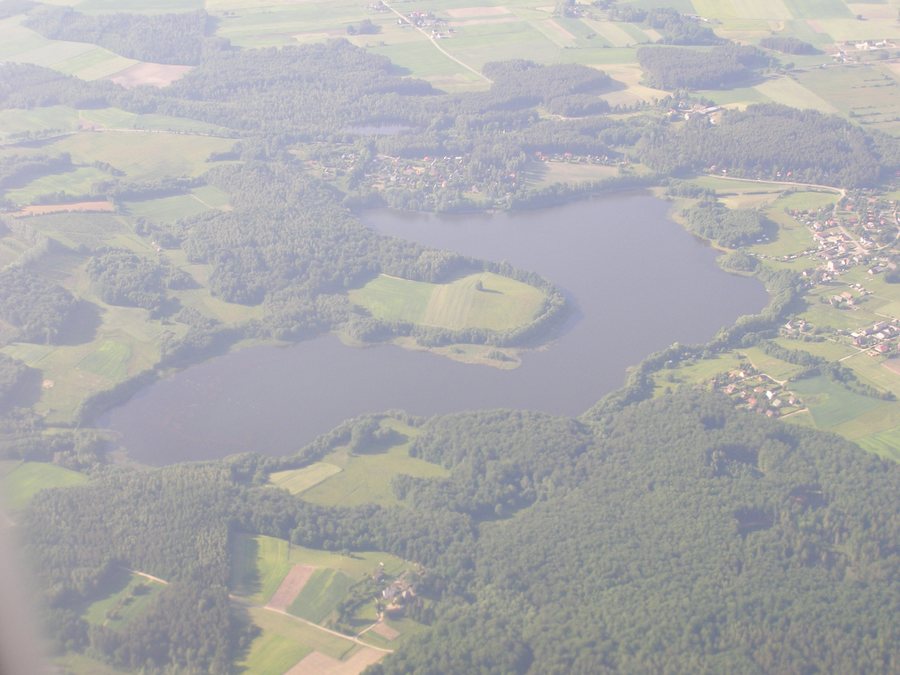
Lewinko lies between Pobłocie and Lewino, not far from Lake Jezioro Lewinko. For planning your trip, the lake, a walking and cycling route through meadows and hilly terrain, and the burial mound cemetery in Lewino offer useful reference points.
Lewinko at a glance
- Lewinko lies between Pobłocie and Lewino and close to Lake Jezioro Lewinko.
- The lake is one of the largest in the Linia municipality and is a through-flow lake.
- Municipal information lists the lake’s area as 51.5 hectares and its maximum depth as 12 meters.
- The “Jezioro Lewinko–Lewino ‘cmentarzysko kurhanowe’” route is listed as a walking and cycling route.
- Near Lewinko, Lewino is home to a burial mound cemetery with 16 earthen mounds.
How is Lewinko situated in relation to the surrounding area?
Its position between Pobłocie and Lewino and its proximity to Jezioro Lewinko help place Lewinko within the surrounding area. The lake is described as nearby, not as a feature necessarily located in the center of the village. The Bolszewka is also part of the local landscape: the river rises at the lake. This establishes a direct, named connection between a body of water and the source of a river.
Jezioro Lewinko is a through-flow lake, meaning that water flows through it. Municipal information gives the lake’s area as 51.5 hectares and its depth as up to 12 meters. Combined with its ranking among the largest lakes in the Linia municipality, this gives a more specific picture than simply mentioning a body of water: Lewinko lies near a lake described as a major landscape feature in the municipality.
What is the route between the lake and Lewino like?
The “Jezioro Lewinko–Lewino ‘cmentarzysko kurhanowe’” route is listed in the municipal overview of walking and cycling routes. Its name links the lake with the burial mound cemetery in Lewino. The route description first mentions a paved road, followed by a field section through meadows and hilly terrain.
For navigation, the destination is not the only important detail: the sequence of landscapes is also described. The road section is followed by a field section through meadows and over hilly terrain. If you choose routes based on their surroundings, this description offers specific clues about the landscape you can expect along the way. It does not provide a walking time; it simply records the stated route and terrain features.
What historical traces can be found near Lewinko?
The archaeological site in Lewino, near Lewinko, lies at the edge of a forest. The burial mound cemetery dates from the 10th to the 12th century and comprises 16 earthen mounds. Their ground plans are oval or rectangular. The date and varying shapes give the site a specific historical dimension, without requiring any assumptions about how it was used.
There are historical details in Lewinko itself, too: a house at ul. Leśna 4 dates from the 1920s or 1930s. A report dated April 15, 2025, also stated that Rujawc had been installed in Lewinko along the “Poczuj Kaszubskiego Ducha” trail. The report described Rujawc as the guardian spirit of pilgrims and hikers. These details refer to different traces: a house with a dated period of construction and a description from 2025.
Discover more destinations: Osetnik, Smazyno, Wejherowo, Bolszewo, Luzino, Kamien, Łężyce and Słajkowo.
FAQ
Where is Lewinko in relation to Pobłocie and Lewino?
Lewinko lies between Pobłocie and Lewino and not far from Lake Jezioro Lewinko.
What types of road surfaces and landscapes does the route include?
The description first mentions a paved road, followed by a field section through meadows and hilly terrain.
What is known about the burial mound cemetery in Lewino?
The burial mound cemetery near Lewinko dates from the 10th to the 12th century. It comprises 16 earthen mounds with oval or rectangular ground plans.
For the broader travel overview: Neustadt.

