
Szczyrk
Accommodation in Szczyrk
Szczyrk combines the mountain landscape of the Beskid Śląski with hiking trails, mountain railways, and cultural attractions.
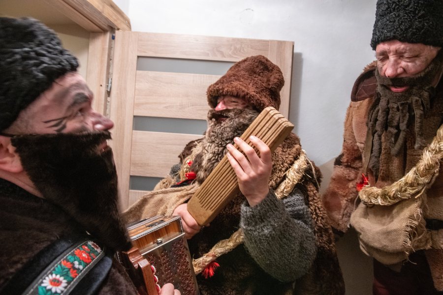 File:Kolędnicy - pochód grupy kolędniczej-Szczyrk-2024-0005-RIKiWK-MCD.jpg
Photo: Robert Garstka / Regionalny Instytut Kultury w Katowicach via Source, CC BY 4.0
File:Kolędnicy - pochód grupy kolędniczej-Szczyrk-2024-0005-RIKiWK-MCD.jpg
Photo: Robert Garstka / Regionalny Instytut Kultury w Katowicach via Source, CC BY 4.0
Szczyrk at a glance
Szczyrk lies between the slopes of Skrzyczne and Klimczok. Skrzyczne reaches 1,257 m and Klimczok 1,117 m; the town extends across elevations of 460 to 600 m. Hiking trails converge in the center. From there, trails lead to Skrzyczne, Klimczok, Przełęcz Karkoszczonka, Błatnia, Przełęcz Salmopolska, and Skalite. In addition to these natural and mountain experiences, there is a sanctuary, an art gallery, a mountain museum, and the Skalite Amphitheater.
What characterizes the mountain landscape around Szczyrk?
The elevations provide an initial sense of the terrain: Szczyrk lies at 460 to 600 m, while the two prominent mountains rise considerably higher. At 1,257 m, Skrzyczne is the higher of the two peaks mentioned; Klimczok reaches 1,117 m. If you stay overnight in Szczyrk, you can consider the town both a cultural destination and a starting point for exploring the mountain landscape.
What hikes can you plan from the center?
The trail junction in the center offers connections in several directions: to Skrzyczne and Klimczok, as well as to Przełęcz Karkoszczonka, Błatnia, Przełęcz Salmopolska, and Skalite. Trails starting in the center reach Skrzyczne in about 2.5 hours. This approximate time helps you make the peak a key part of your day’s plans; it applies to the trails to Skrzyczne and not automatically to the other destinations mentioned.
Which routes are suited to different kinds of outings?
The Pętla Szczyrkowska is described as a family route and connects several sections: almost 6 km of mountain railway rides, 2 km through Szczyrk, and 2 km along a scenic mountain ridge. One ticket gives you access to four mountain railways, which can be used in any direction. The route therefore combines mountain railway rides with sections on foot; you can take these components into account when deciding whether you want a route that includes both.
Another option is the paved trail along the Żylica. It leads from the town hall via Plac św. Jakuba and the Skalite Amphitheater to Skalite. The round trip is about 20 km long. The trail is used year-round by residents and tourists, is suitable for cyclists, and, when weather conditions allow, can also be used for cross-country skiing. It then connects to the cycling route in Buczkowice and Rybarzowice. This makes it possible to consider a longer route along the river, a cycling outing, and—when conditions are suitable—cross-country skiing as different uses of the same trail.
Which cultural attractions can you find in Szczyrk?
The wooden Sanctuary of Saint James the Greater, more than 200 years old, has an ornate interior that highlights the parish’s highland traditions. Those interested in sacred architecture and regional traditions will find a cultural counterpoint here to the mountain trails.
The Bator Art Gallery was established in 1995 at the initiative of Barbara and Mirosław Bator. The mountain museum is located in the grandstand building of the Skalite Amphitheater. The amphitheater is a venue for major cultural, entertainment, and sporting events. The gallery, museum, and amphitheater represent different cultural attractions; when planning your trip, you can choose the ones that best match your interests.
Where does the ride to Hala Skrzyczeńska begin?
In the Salmopol district, a gondola lift’s valley station is located on the main road. It takes you to Hala Skrzyczeńska at an elevation of 1,000 m. If you would like to plan this mountain railway excursion, Salmopol is a specific point of reference within Szczyrk; the valley station is located there on the main road.
What other destinations can you explore?
If you would like to research places beyond Szczyrk, you can also find Zebrzydowice, Hażlach, Skoczów, Koniaków, Wisła, Kostkowice, Cieszyn and Międzyświeć here.
FAQ
How long does it take to walk from the center of Szczyrk to Skrzyczne?
Trails starting in the center reach the summit in about 2.5 hours.
What does the Pętla Szczyrkowska include?
The family route includes almost 6 km of mountain railway rides, 2 km through Szczyrk, and 2 km along a scenic mountain ridge. One ticket is valid for four mountain railways, which can be used in any direction.
Where is the valley station for Hala Skrzyczeńska?
The gondola lift’s valley station is in the Salmopol district on the main road. The lift goes to Hala Skrzyczeńska at an elevation of 1,000 m.
Back to the main travel overview: Teschen.

