
Nieledwia between a cycling route and hiking trail
Accommodation in Nieledwia
Nieledwia lies in the southern part of the Milówka municipality and in the valley of a stream of the same name. A cycling route and the “Szlak z Rajczy” hiking trail pass through the village. There is also a sports and recreation centre and a folk explanation of the village’s name.
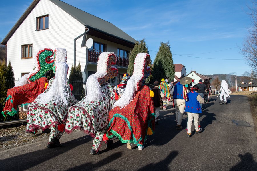 Dziady noworoczne-Nieledwia-2024-0001-RIKiWK-MCD.jpg
Photo: Robert Garstka / Regionalny Instytut Kultury w Katowicach via Wikimedia Commons, CC BY 4.0
Nieledwia at a glance
- Location: in the valley of a stream of the same name, in the southern part of the Milówka municipality.
- Cycling route: 22.8 km long, with 500 metres of elevation gain; it runs from Milówka through Nieledwia and other places before returning.
- Hiking trail: “Szlak z Rajczy”, 21.5 km, 477 metres of elevation gain and an estimated walking time of 6 hours and 7 minutes.
- Local highlights: a sports and recreation centre at the primary school building and a bear legend about the village’s name.
Which routes pass through Nieledwia?
The cycling route starts in Milówka and runs through Nieledwia, Kotelnica, Kiczora, Tarliczne, Suche and Popręcinka. It returns to Milówka via Nieledwia. The village is therefore on both the outward and return legs of this described route. The total distance is 22.8 kilometres, with 500 metres of elevation gain listed.
The “Szlak z Rajczy” hiking trail also passes through Nieledwia. It is listed as 21.5 kilometres long, with 477 metres of elevation gain and an estimated walking time of 6 hours and 7 minutes. The cycling route is 1.3 kilometres longer than the hiking trail. To plan your trip, you can compare the stated route figures and use the walking time as a guide for your hiking day, not as a fixed time requirement.
What does the sports and recreation centre include?
A sports and recreation centre with two sports fields is located at the primary school building. The sports listed are handball, football, volleyball and basketball. The centre also has a children’s playground and equipment for outdoor exercise. Its different facilities support a range of activities: the fields are intended for four ball sports, while the playground and exercise equipment offer additional options.
Which legend explains the village’s name?
Andrzej Komoniecki’s “Dziejopis Żywiecki” recounts a folk explanation of the name Nieledwia. It tells of two bears said to have fought all day. According to the story, they scattered as dusk fell. The legend gives the village’s name its own narrative connection and complements the practical information about routes and facilities with local lore.
Discover more destinations: Jeleśnia, Sól, Korbielow, Kocierz Moszczanicki, Lodygowice, Bierna, Rycerka Górna, Glinka.
FAQ
How long is the cycling route through Nieledwia?
The route is 22.8 kilometres long and has 500 metres of elevation gain.
How long does the “Szlak z Rajczy” hiking trail take?
The estimated walking time is 6 hours and 7 minutes. The trail is also 21.5 kilometres long, with 477 metres of elevation gain.
Which sports are listed at the sports and recreation centre?
The two sports fields are described as being for handball, football, volleyball and basketball.
Go to the regional travel overview: Żywiec.

