
Discover Rabe: Gołoborze, trails and history
Accommodation in Rabe
Rabe brings together a rockslide area, marked trails and a turbulent history. This gives you different points of interest to consider when planning your trip: you can explore natural attractions and trail routes, or learn about traces of the past.
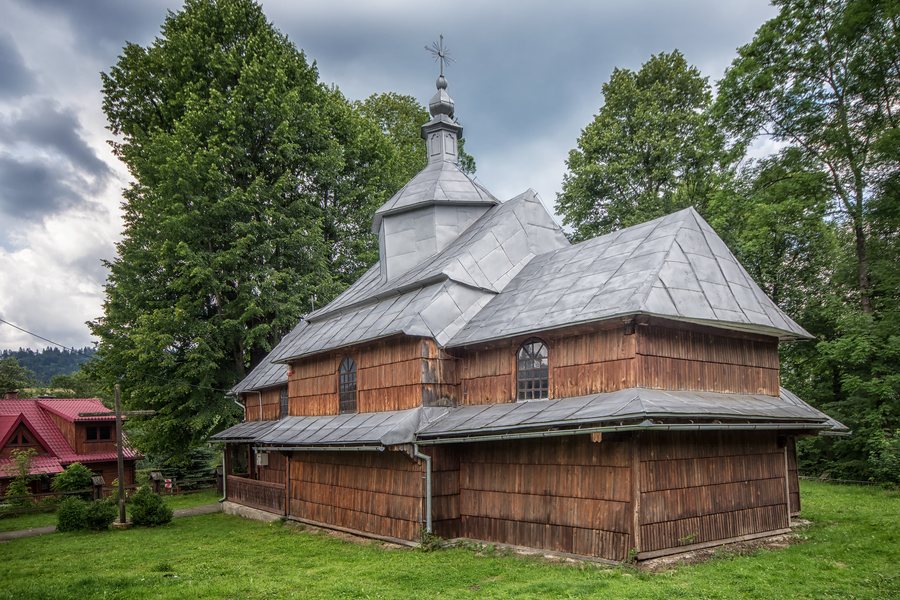 File:SM Rabe Kościół Świętej Rodziny 2020 (6).jpg
Photo: Sławomir Milejski via Wikimedia Commons, CC BY 3.0
File:SM Rabe Kościół Świętej Rodziny 2020 (6).jpg
Photo: Sławomir Milejski via Wikimedia Commons, CC BY 3.0
Rabe at a glance
- The Gołoborze nature reserve is located in Rabe and covers 13.9 ha.
- A blue-marked educational trail leads from Rabe to the “Synarewo” chapel on the wooded slope of Łysy Wierch (Manyłowa), at an elevation of 815 m.
- Another point of interest described in the nature reserve is the lowest-lying block fields in the Bieszczady Mountains.
- The paved “Doliną Rabskiego Potoku” route has trails leading towards Jeziorko Bobrowe and Przełęcz Żebrak.
- After 1945, Rabe was forcibly depopulated and destroyed; remnants of the Greek Catholic cemetery have survived.
What makes Gołoborze in Rabe interesting?
The nature reserve is defined by its rockslide area. Its 13.9 ha give a tangible sense of the extent of the protected landscape. The focus here is not a broad overview of the village, but a clearly identified natural feature: the block fields.
A blue-marked educational trail leads to the lowest-lying block fields in the Bieszczady Mountains. These provide a distinct landmark for anyone interested in this type of landscape. The trail to the “Synarewo” chapel is also marked blue; the chapel stands at an elevation of 815 m on the wooded slopes of Łysy Wierch, also known as Manyłowa. When planning a trip, you can therefore consider both the block fields and a specific destination on the slope.
Which trails and destinations are mentioned?
The educational trail from Rabe to the “Synarewo” chapel links the village with a destination in the forest. The chapel is at an elevation of 815 m.
There is also the paved “Doliną Rabskiego Potoku” route. Trails from it lead towards Jeziorko Bobrowe and Przełęcz Żebrak. These directions offer another way to orient your plans: here, the possible onward destinations are the focus.
The different place and destination names help make your trip planning specific: the chapel, the block fields and the directions along the Rabskiego Potok are distinct points of reference. When choosing, consider which destination suits your interests rather than treating the trails as interchangeable just because they share the same marking.
What facilities help you find your way around?
There is a forest car park at the entrance to the quarry. Further up the valley, a tourist shelter has a designated outdoor fire pit and a grill inside.
The information about the car park and shelter adds practical landmarks to the trail destinations. Their locations matter: the car park is at the quarry entrance, while the shelter is further up the valley. This makes it clear that these are two separate facilities, not stops right next to each other.
What traces of history have survived in Rabe?
The village’s history is also marked by a profound upheaval: after 1945, Rabe was forcibly depopulated and destroyed. Only remnants of the Greek Catholic cemetery have survived to this day. This historical connection is distinct from the natural and trail destinations and offers another perspective on Rabe.
When exploring the village, you can consider the landscape and the surviving traces separately: Gołoborze represents the rockslide area, while the cemetery remnants recall the forced depopulation and destruction after 1945. Both are part of getting to know Rabe, without needing to treat the destinations as one and the same.
If you’d like to discover more destinations: Bóbrka, Przysłup, Hoczew, Górzanka, Zwierzyń, Terka, Manasterzec and Myczków.
FAQ
Where does the educational trail from Rabe lead?
A blue-marked educational trail leads to the “Synarewo” chapel on the wooded slopes of Łysy Wierch (Manyłowa). The chapel is at an elevation of 815 m.
Which destinations can you reach from the “Doliną Rabskiego Potoku” route?
Trails from the paved route lead towards Jeziorko Bobrowe and Przełęcz Żebrak.
What has survived from the Greek Catholic cemetery?
Following Rabe’s forced depopulation and destruction after 1945, only remnants of the cemetery have survived to this day.
For the wider travel overview: Leski.

.jpg)