
Brylińce: Church, Chapels and Hiking Trails
Accommodation in Brylińce
Brylińce combines historic buildings with a described hiking trail through the village. To plan your trip, you can compare cultural history and hiking as two specific interests: the church and other buildings shape the village’s appearance, while the trail details describe the route and several stream crossings.
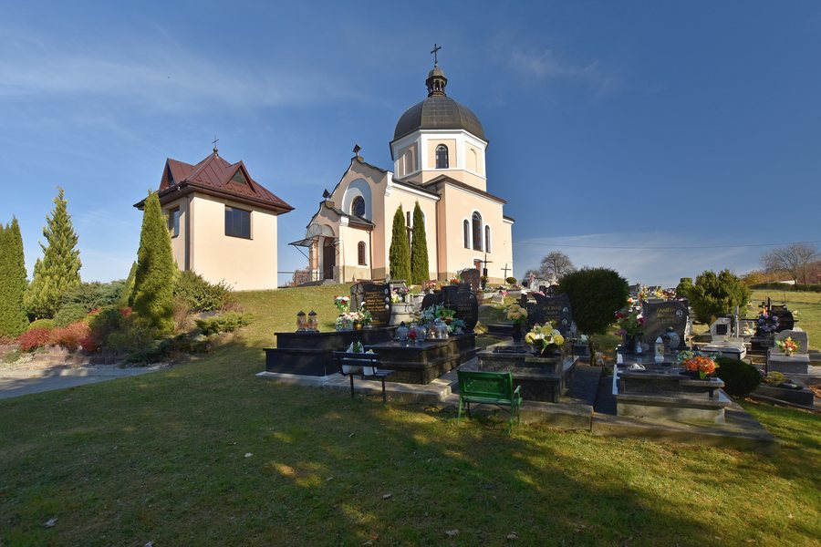 File:Brylińce, cerkiew św. Bazylego Wielkiego (HB4).jpg
Photo: Henryk Bielamowicz via Wikimedia Commons, CC BY-SA 4.0
Brylińce at a glance
- Brylińce lies south of Krasiczyn, at the foot of the Kopystnianka.
- The Greek Catholic Church of St. Basil the Great stands on a hill in the village center. The brick building, with its central dome, dates from 1883 and is still used as a church today.
- Numerous 19th-century chapels stand along the roads toward Rokszyce and Koniusza.
- A described hiking trail runs south through the village and crosses a stream several times. The red Przemyśl–Bircza–Sanok hiking trail also passes through Brylińce.
Which buildings shape the village?
The Church of St. Basil the Great has several distinctive features: it stands on a hill in the village center, is built of brick and has a central dome. Its construction date, 1883, provides a historical context; today, the building is used as a church. The church’s location, construction and dome are therefore central to an appreciation of the village’s architecture, without requiring any specialist knowledge.
The church is not the only religious building in Brylińce. Numerous 19th-century chapels stand along the roads toward Rokszyce and Koniusza. Several surviving houses built in the Przysłup style add a residential architectural perspective to these religious buildings. This makes it possible to compare different types of buildings: the central church, the chapels along the roads and the surviving houses.
Southeast of the church, in a group of trees, lies a First World War military cemetery with twelve mass graves. Its location contrasts clearly with the church’s hilltop position in the village center. Together, the group of trees, the direction and the number of mass graves provide a clear spatial and historical context for the cemetery.
Which hiking trails pass through Brylińce?
The described hiking trail runs from Olszany along a paved road to Brylińce, then turns left to reach the village. Within the village, the route heads south through all of Brylińce, crossing a stream several times. The details therefore cover both the journey from Olszany to the village and the route through it.
The red Przemyśl–Bircza–Sanok hiking trail also passes through Brylińce. If you use both trail descriptions to plan your trip, note that they provide different levels of detail: the description from Olszany gives the specific route, while the name of the red trail identifies its route. Check current trail conditions before setting out.
How should you plan your hotel search?
If you are looking for a hotel for a trip to Brylińce, first decide what matters most: would you like to focus on the historic buildings, or include the described hiking trail in your plans? Then compare the location and specific details of each offer with your requirements. Check the current details of each offer before booking.
Discover more destinations: Tarnawka, Wapowce and Przemyśl.
FAQ
Which church stands in the center of Brylińce?
It is the Greek Catholic Church of St. Basil the Great. It stands on a hill, dates from 1883 and is still used as a church today.
Where are the 19th-century chapels located?
Numerous chapels stand along the roads toward Rokszyce and Koniusza.
What characterizes the military cemetery?
The First World War cemetery lies southeast of the church in a group of trees and contains twelve mass graves.
See the broader travel overview: Prömsel.

