
Discover Pogobie Średnie
Accommodation in Pogobie Średnie
Pogobie Średnie offers several route options and historical sites from different periods. Approximate distances and difficulty ratings make it easier to compare them; wooden houses from the interwar period and a former cemetery add to the picture of the village.
Pogobie Średnie at a glance
- The red route runs via Pisz, Jabłoń, Kulik, Pogobie Tylne and Pogobie Średnie before returning to Pisz. It is about 28.5 km long, has a low difficulty level and is especially recommended for families with children.
- The blue route runs via Pisz, Szast, Wądołek, Piskorzewo and Pogobie Średnie before returning to Pisz. It is about 33.4 km long, moderately difficult and runs mostly through forests.
- A black connecting route, about 3.5 km long, runs from Pogobie Średnie to Szast and provides a shortcut on the blue route.
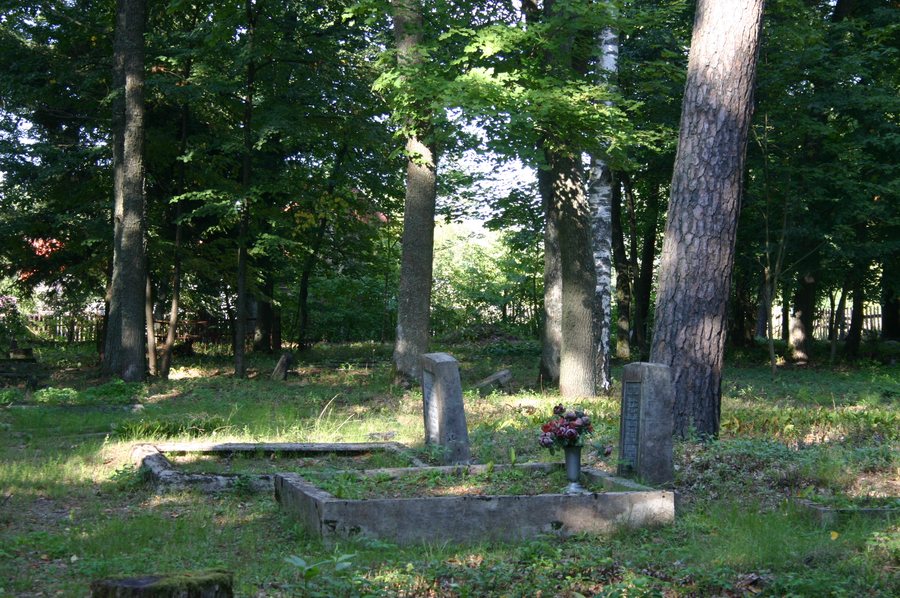
- The village has two wooden houses from the interwar period, numbered 45 and 47. The former Evangelical cemetery dates from the first quarter of the 20th century.
Which route suits your plans?
Both the red and blue routes pass through Pogobie Średnie and return to Pisz, but differ in length and difficulty. At about 28.5 km, the red route is shorter and described as easy. Because of its low difficulty level, it is especially recommended for families with children.
At about 33.4 km, the blue route is longer and moderately difficult. Most of it runs through forests. When choosing between these two routes, you can therefore consider the approximate distance, the stated difficulty and the amount of forest along the blue route.
As an additional option, the black route connects Pogobie Średnie with Szast. At about 3.5 km, it provides a shortcut on the blue route. This offers a way to change the route option described without mistaking the black connection for a standalone circular route. Before planning your route, check current trail conditions with the local forest authority.
What historical sites are there in the village?
Two wooden houses, numbered 45 and 47, date from the interwar period. The former Evangelical cemetery is older: it dates from the first quarter of the 20th century. These details point to two different historical periods that can be distinguished when exploring the village’s history.
These sites offer a different perspective for planning a trip than the routes do. Those interested in a place’s history can consider the buildings and cemetery as subjects in their own right. The route information, in turn, provides specific, comparable details about distance and difficulty.
In the wider destination of Piski, the Muzeum Ziemi Piskiej is located in Pisz Town Hall. Its exhibits include the fauna and flora of the Puszcza Piska, Polish-language literature from Masuria, and documents about the history of Pisz. This regional cultural connection complements the village information with topics from the wider destination of Piski.
Discover more destinations: Ukta, Wielki Las, Szczechy Wielkie, Wierzba, Wygryny, Jaśkowo, Okartowo and Orzysz.
FAQ
Which route is especially recommended for families with children?
The red route is especially recommended for families with children because of its low difficulty level. It is about 28.5 km long.
How do the red and blue routes differ?
The red route is about 28.5 km long and easy. The blue route is longer, at about 33.4 km, is moderately difficult and runs mostly through forests.
How can the blue route be shortened?
A black connecting route, about 3.5 km long, runs from Pogobie Średnie to Szast and provides a shortcut on the blue route.
Which historical sites are mentioned in Pogobie Średnie?
The village has two wooden houses from the interwar period, numbered 45 and 47. The former Evangelical cemetery dates from the first quarter of the 20th century.
To the wider travel overview: Piski.

