
Stręgielek by the lake
Accommodation in Stręgielek
Stręgielek lies on Lake Stręgielek in the northern part of the Masurian Lake District. A beach and convenient access to the lake complement its location; pre-war farm buildings also stand out. The water and the village’s history offer two different perspectives on the place.
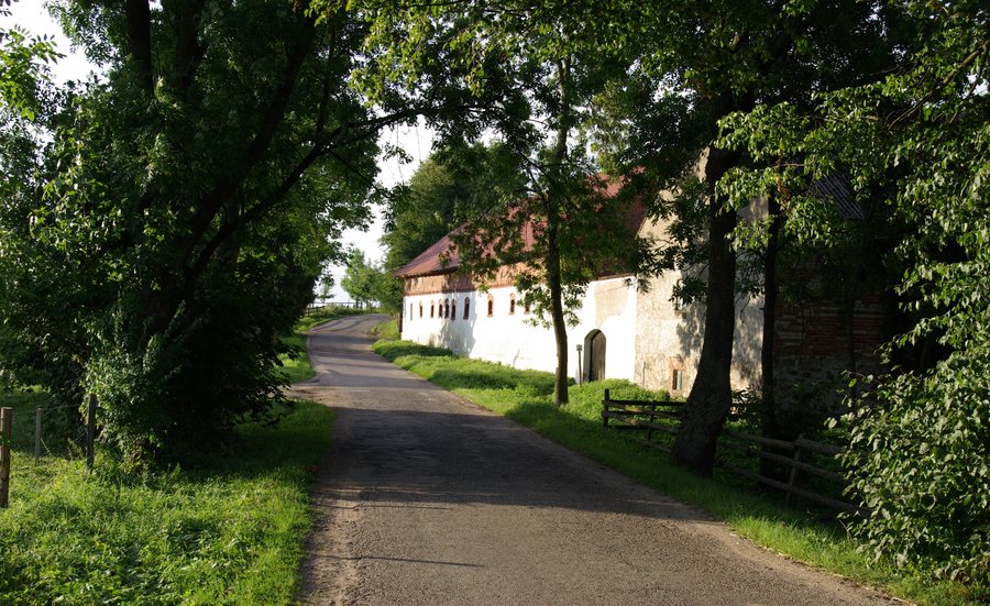
Stręgielek at a glance
- Location: on Lake Stręgielek, in the northern part of the Masurian Lake District.
- Orientation: 11 km southeast of Węgorzewo.
- Water: a beach and convenient access to the lake.
- Culture: pre-war farm buildings and a former Evangelical cemetery listed in the municipal register of historic monuments.
- Regional tour: “Wokół jeziora Stręgiel,” 28.4 km, 3 hours, rated as suitable for beginners.
What defines the lakeside location?
Lake Stręgielek is a clear reference point for the village’s location. The village also has a beach and convenient access to the lake. These add two water-related features to the geographical setting. For your travel plans, they offer a different point of interest from the village’s historic traces.
The surrounding area includes Stręgiel and the smaller lakes Białe koło Stręgielka, Romint, Piecek, Jagoczan, Głęboka Kuta, Brząs, and Dziaduszyn. These bodies of water lie near Stręgielek and extend the view beyond the immediate village area. This makes it possible to distinguish between the lake in the village and the waters in the surrounding area as separate geographical points of reference.
What historic traces define Stręgielek?
The pre-war farm buildings stand out in particular. They add an architectural aspect of the village’s history to its water-related features. Stręgielek is also home to a former Evangelical cemetery listed in the municipal register of historic monuments.
The farm buildings and former cemetery offer travelers interested in cultural history a different perspective on the place than the beach and lake access. When choosing a destination, you can weigh whether the lakeside setting or the village’s historic traces are especially important for your stay. The term “former” is part of how the cemetery is described.
How can you put the surrounding area in context for a trip?
Stręgielek lies 11 km southeast of Węgorzewo. This direction and distance help locate the village within the northern Masurian Lake District. The Green Velo excursion route “Wokół jeziora Stręgiel” also provides a regional point of reference: its route passes through Stręgielek, while its start and finish are in Węgorzewo.
The tour is 28.4 km long, takes 3 hours, and is rated as suitable for beginners. For your planning, it is useful to distinguish between a place along the route and its starting and finishing points: Stręgielek lies along the route, while Węgorzewo is both the start and finish. The tour details describe an excursion option in the wider area, while the beach, lake access, and historic traces are features of the village itself.
Discover more destinations: Budry, Harsz, Olszewo Węgorzewskie, Kolonia Rybacka, Kal, Kolonia Pozezdrze, Pozezdrze, Łabapa.
FAQ
Which lake is Stręgielek on?
Stręgielek lies on Lake Stręgielek. The village also has a beach and convenient access to the lake.
Which Green Velo tour passes through Stręgielek?
The “Wokół jeziora Stręgiel” tour passes through Stręgielek. It starts and ends in Węgorzewo, is 28.4 km long, and is listed as taking 3 hours and suitable for beginners.
What historic traces are there in the village?
The pre-war farm buildings stand out in particular. Stręgielek is also home to a former Evangelical cemetery listed in the municipal register of historic monuments.
For the broader travel overview: Węgorzewski.

