
Discover Drawsko Pomorskie
Accommodation in Drawsko Pomorskie
Drawsko Pomorskie combines a medieval town center with several cycling routes of different lengths and itineraries. When planning your trip, you can choose between town history and routes through the countryside.
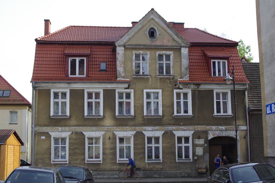 File:621 ratusz Drawsko Pomorskie ul.Ratuszowa 5 areekw02.JPG
Photo: Arkadiusz Wielemborek via Wikimedia Commons, CC BY-SA 3.0 pl
File:621 ratusz Drawsko Pomorskie ul.Ratuszowa 5 areekw02.JPG
Photo: Arkadiusz Wielemborek via Wikimedia Commons, CC BY-SA 3.0 pl
Drawsko Pomorskie at a glance
The Old Town retains its medieval layout, with the market square at its center. Beside the market square stands the late Gothic Church of the Resurrection of the Lord, one of the oldest surviving buildings in the town. Three cycling routes are described, with lengths of 27.2, 50 and 58 kilometers. A hiking trail also runs nearby through moraine hills and river valleys, and along a chain of lakes.
What does the Old Town tell you about Drawsko Pomorskie?
The medieval town layout gives the market square a central role. The Church of the Resurrection of the Lord stands right beside it. Built at the turn of the 14th and 15th centuries, it has a 75-meter-high tower. Its side portals feature distinctive bestiary depictions. These details make the church a notable subject for travelers interested in historic architecture and ornate architectural decoration.
The town’s fortification walls are also part of its history: construction began in the early 14th century. They had four defensive towers and were reinforced with bastions. Together with the surviving town layout and the market square at the center, these details illustrate different aspects of medieval urban development.
The Salt Storehouse offers another perspective on the town’s history. Since 2018, it has housed memorabilia relating to the history of Drawsko Pomorskie. The museum in the Salt Storehouse organizes workshops, meetings and conferences dedicated to protecting and promoting cultural heritage.
Which cycling routes can you compare?
The red “Wokół jeziora Lubie” cycling route is 50 kilometers long and starts and ends in Drawsko Pomorskie. The blue “Wzgórza Moreny Czołowej” circular cycling route covers 58 kilometers. It starts in Drawsko Pomorskie and passes through landscapes shaped by glacial terminal and ground moraines. The different route lengths can help you match your cycling trip to your planned distance, without implying a specific travel time.
The green “Parki Krajobrazowe” cycling route is 27.2 kilometers long and runs from Drawsko Pomorskie to Ińsko. Along the way, it connects Iński Landscape Park with Drawski Landscape Park. Unlike the red route, it has a named destination; the blue circular route is specified as starting in Drawsko Pomorskie. These specific itinerary details make it easier to compare the routes if you want to include a loop or a connection between two places in your plans.
What landscapes characterize the surrounding area?
The green “Jezior Drawskich” hiking trail runs around the town in the area near Drawsko Pomorskie. It passes through moraine hills and river valleys, as well as along a chain of lakes in the Drawskie Lake District. Alongside the cycling routes, this gives you the option of a hiking route through a landscape shaped by glacial features and bodies of water.
Within the town, Fryderyk Chopin City Park, established in 1875, offers another connection to the landscape. It stretches from a bend in the Drawa River. The park and hiking trail describe different places and experiences: a landscaped urban park on the one hand, and a route through hills and valleys and along the lake district on the other.
What should you know about road access?
National Road 20 passes through Drawsko Pomorskie, connecting Stargard and Szczecinek. If you are planning your arrival or onward travel by road, you can use this connection as a point of reference. The three cycling routes, by contrast, have specific distances and, depending on the route, a stated starting point, destination or circular itinerary.
More destination pages: Lubieszewo, Kalisz Pomorski, Łabędzie, Psie Głowy, Czaplinek, Bobrowo, Złocieniec and Wierzchowo.
FAQ
How long is the red “Wokół jeziora Lubie” cycling route?
The red cycling route is 50 kilometers long. It starts and ends in Drawsko Pomorskie.
Where does the blue “Wzgórza Moreny Czołowej” circular cycling route start?
The 58-kilometer circular cycling route starts in Drawsko Pomorskie and passes through landscapes shaped by glacial terminal and ground moraines.
What landscapes does the “Jezior Drawskich” hiking trail pass through?
The hiking trail runs around Drawsko Pomorskie through moraine hills and river valleys, as well as along a chain of lakes in the Drawskie Lake District.
For the broader travel overview: Dramburg.

