
Dramburg
Accommodation in Dramburg
Long hiking trails, a 39 km cycling route and Late Gothic architecture give you several specific starting points for planning your trip to Dramburg. The right accommodation also depends on whether you want to focus primarily on trails, the town’s history or transport connections.
Dramburg at a glance
- The black “Drawskich grodzisk wczesnośredniowiecznych” hiking trail is 67 km long and starts and ends in Drawsko Pomorskie.
- The blue “im. I Warszawskiej Dywizji Kawalerii” hiking trail runs for 52 km along the Wał Pomorski fortification line.
- The black “Rzeka Brzeźnicka Węgorza – wodospady” cycling route is 39 km long; its stated duration is 2–3 hours.
- National Road 20 and railway line 385 run through the town and municipality.
Which trails suit your travel plans?
The hiking trails differ not only in length, but also in their starting and ending points. The 67 km black trail to the early medieval hillforts starts and ends in Drawsko Pomorskie. By contrast, the blue “im. I Warszawskiej Dywizji Kawalerii” trail starts in Iłowiec and ends in Drawsko Pomorskie. Over 52 km, it follows the Wał Pomorski fortification line. This information can help you choose between a route with the same starting and ending point and one with different endpoints.
There is also a kayaking trail in the municipality: the “im. Ks. Kardynała Karola Wojtyły” trail is 47.5 km long within the municipality. The tourist information point in Drawsko Pomorskie provides information, among other things, about accommodation and cycling, horse-riding, hiking and walking trails.
What characterises the landscape and cycling routes?
The “Szlak Jezior Drawskich” hiking trail around Drawsko Pomorskie passes through moraine hills and river valleys, as well as along a continuous chain of lakes. The municipality’s landscape is also shaped by glacial channels with numerous lakes, rivers and streams. Valley meadows, wooded field margins and tree-lined avenues are other defining features. This gives you both the landscape and the different types of trails to consider when planning your trip.
The “Szlak Jezior Drawskich” can also be cycled. At inaccessible or difficult-to-access sections, use the detours suggested along the route. The black “Rzeka Brzeźnicka Węgorza – wodospady” cycling route is different: it starts and ends at Drawsko Pomorskie railway station, is 39 km long and takes 2–3 hours. You can factor its length and stated duration into your day’s plans without treating the two routes as equivalent.
What cultural history can you discover in Dramburg?
The Late Gothic Church of the Resurrection was built at the turn of the 14th and 15th centuries. Its tower is 75 metres high, and the pointed-arch side portals feature bestiary decorations. The building period, tower height and portal design offer different points of interest if you are interested in architecture and historical details.
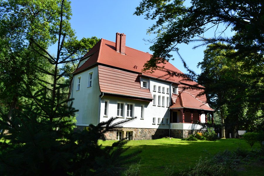
Since 2018, the salt granary has housed memorabilia relating to the history of Drawsko Pomorskie. The village of Jankowo in the municipality is also home to a granary designed by Walter Gropius. Built in 1906, it is the only building of the former manor complex to have survived unchanged. Fryderyka Chopina Town Park was laid out in 1875 at a right-hand bend in the Drawa River. The church, salt granary, granary and park offer different historical and cultural themes; they do not constitute a single route.
How is Dramburg connected, and where can you find other place pages?
National Road 20 and railway line 385 run through the town and municipality. Road 20 connects Stargard and Szczecinek; railway line 385 connects Runowo Pomorskie and Szczecinek. The tourist information point also provides information about tourist attractions, cultural and sporting events, and the rental of tourist equipment. Miód Drawski can be purchased from beekeepers in the municipality.
To compare other place pages within this topic, you can also find Warniłęg, Stare Kaleńsko, Bobrowo, Siemczyno, Psie Głowy, Łabędzie, Lubieszewo, Wierzchowo, Zabin, Drawsko Pomorskie, Złocieniec, Czaplinek, Borne, Ostrowice K Drawska Pomorskiego, Kalisz Pomorski and Broczyno.
FAQ
How long is the black hiking trail from Drawsko Pomorskie?
The “Drawskich grodzisk wczesnośredniowiecznych” trail is 67 km long and starts and ends in Drawsko Pomorskie.
Which route follows the Wał Pomorski fortification line?
The blue “im. I Warszawskiej Dywizji Kawalerii” hiking trail follows the fortification line for 52 km. It starts in Iłowiec and ends in Drawsko Pomorskie.
What information can you get at the tourist information point?
The point provides information, among other things, about accommodation, dining, attractions, various trails, events and the rental of tourist equipment.
For the broader travel overview: West Pomerania.

.jpg)