
Borino
Accommodation in Borino
Borino combines the mountain landscapes of the Rhodopes with gorges, caves and vibrant folklore. If you are looking for a hotel for your trip, the municipality offers a variety of themes to consider when planning excursions, from karst formations and waterfalls to archaeological traces and traditional festivals.
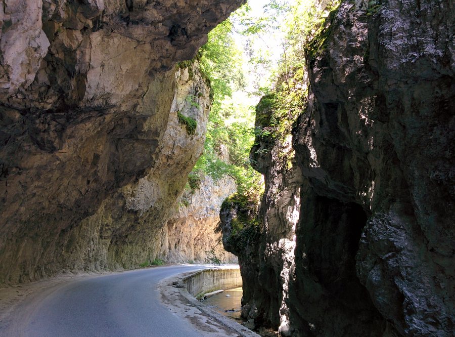 Smolyan Province - Borino Municipality - Village of Yagodina - Buynovsko Gorge (1)
Photo: Камен Ханджиев via Wikimedia Commons, CC BY-SA 4.0
Smolyan Province - Borino Municipality - Village of Yagodina - Buynovsko Gorge (1)
Photo: Камен Ханджиев via Wikimedia Commons, CC BY-SA 4.0
Borino at a glance
Borino Municipality is located in the Rila-Rhodope region, in the Veliyshko-Videnishki part of the Rhodopes and the Trigrad karst massif. Its mountainous, deeply dissected terrain includes high ridges, deep river valleys, gorges and tectonic basins. Owing to its rich biodiversity, the entire municipality is part of the Natura 2000 network. The Trigrad Gorge protected area lies partly within the territory of the village of Yagodina. It was designated on 6 December 1963, extended on 18 July 2007 and updated in area on 8 October 2015.
Which natural landmarks define the area?
One notable natural landmark is Buynovo Gorge, a protected area of 608.60 hectares established to preserve unique rock formations. It lies 6.5 kilometres northeast of Buynovo. The Buynovo River runs through the gorge, forming numerous waterfalls and pools. The scenery along the river therefore differs from the high, open ridges and deeply cut valleys that are also part of the municipality’s landscape.
The Kastrakli Biosphere Reserve is one of the municipality’s natural attractions and lies 6 kilometres from the village of Borino. Its characteristic black pine forest includes a small reservoir. The water surface covers 35 decares, and the reservoir is 18 metres deep; this artificial lake is fed by an underground spring. If you want to include forests and bodies of water in your trip planning, this offers a different natural setting from the rocky gorges.
Which routes and viewpoints can you include in your plans?
A marked and secured trail leads from Borino to the Devil’s Bridge; there are wooden shelters along the way where you can rest. The rock arch was formed over millions of years by the water of Chatak Dere. It is 18 metres high, its opening is 6 metres wide, and the rock layer is 3 to 4 metres thick. This connects the site’s geological features with a specific route option, without confusing the bridge itself with a simple viewpoint.
The Hidden Waterfalls can be reached from the trail at the Devil’s Bridge after a 15- to 20-minute walk. You can then continue to the confluence with the Buynovo River. The trail ends 2 to 2.5 kilometres downstream from Yagodina Cave. These details help you plan the waterfalls as a separate part of your day; no walking time is specified for the entire route.
Orlovo Oko is a panoramic viewing platform in the Western Rhodopes, near Yagodina Cave on Mount Sveti Iliya. It is at an altitude of 1,563 metres. From there, you can see Buynovo Gorge and the villages of Borino, Chala and Yagodina. In the distance, the view extends to parts of the Pirin and Rila Mountains, as well as mountain ranges in Greece. The viewpoint can therefore be a destination in its own right for travellers interested in mountain panoramas and getting their bearings in the surrounding landscape.
What do the cave and prehistoric past have to offer?
The section of Yagodina Cave developed for tourists is 1,100 metres long and passes through several halls. The karst formations described here include stalactites, stalagmites, stalactones, dendrites, cave pearls and draperies, as well as colourful facets reminiscent of leopard skin. The variety of formations makes a cave visit a different kind of nature experience from trails outdoors: here, the focus is on the structures inside the karst area.
A prehistoric dwelling is also located at the natural entrance to Yagodina Cave. A 270-metre paved path leads there from the asphalt road to Buynovo. Archaeological excavations from the 1970s reveal the way of life and material culture of the region’s prehistoric inhabitants. If you are interested in the history of human settlement as well as the landscape, you can add this site to your list of destinations.
What cultural insights does Borino offer?
Borino has two types of traditional folk costumes and woven textiles, which vary according to religious affiliation: Turkish and Bulgarian. Local folklore is preserved primarily through songs and dances. Two ensembles keep this tradition alive: the Authentic Folklore Group and the children’s dance folklore ensemble “Borinche”.
The folklore ensembles take part in the annual traditional festivals in Borino, Dospat, Grohotno, Gyovren, Buynovo, Yagodina and Chala. The village of Buynovo also holds a traditional village festival on 24 and 25 May. If you want to combine your trip with cultural interests, you can consider these folklore traditions alongside the natural and cave attractions; they are a distinct part of local life.
For comparisons with other places, you can also visit the pages for Kozhari, Madan, Nedelino and Zlatograd. When looking for a hotel in Borino, it helps to first consider whether gorges, caves, viewpoints or folklore are likely to be the main focus of your trip.
FAQ
How long is the section of Yagodina Cave developed for tourists?
The section developed for tourists is 1,100 metres long and passes through several halls with different karst formations.
How long does it take to walk to the Hidden Waterfalls?
The waterfalls can be reached from the trail at the Devil’s Bridge after a 15- to 20-minute walk.
What can you see from Orlovo Oko?
From the platform, you can see Buynovo Gorge and Borino, Chala and Yagodina. In the distance, the view extends to parts of the Pirin and Rila Mountains and to mountain ranges in Greece.
For the broader travel overview: Smolyan Province.

.jpg)