
Cesky Raj: Hotels and Accommodation
Accommodation in Cesky Raj
Ráj lies within the Kokořínsko Protected Landscape Area and is shaped by several paths as well as the Pšovka stream. The combination of protected landscape, regional folk architecture, and clearly defined routes makes this place in northern Bohemia easy to appreciate.
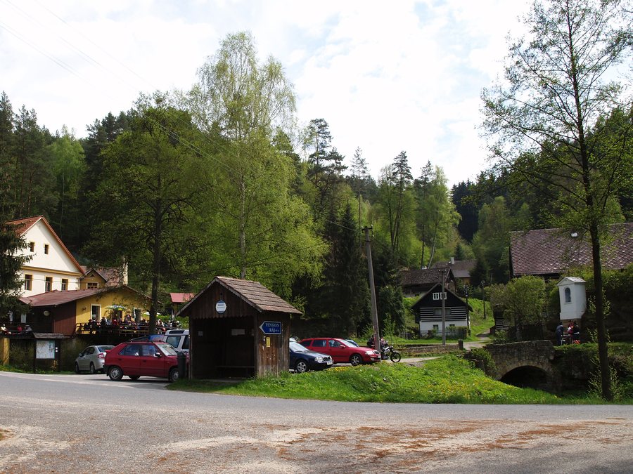 File:Ráj - pohled od křižovatky.jpg
Photo: Luděk Kovář – ludek@kovar.biz via Wikimedia Commons, CC BY-SA 3.0
File:Ráj - pohled od křižovatky.jpg
Photo: Luděk Kovář – ludek@kovar.biz via Wikimedia Commons, CC BY-SA 3.0
Nature
Within the Kokořínsko Protected Landscape Area lies the Kokořínský důl Nature Reserve, designated in 1953 and covering 2,097 hectares. The canyon-like valley of Kokořínský důl stretches for 14 km from the crossroads known as Ráj to the Lhotka u Mělníka railway stop.
The Pšovka stream flows from Konrádovský důl northwards to Ráj. In Ráj, the Pšovka flows beneath a road bridge and then continues through Kokořínský důl.
Routes
Hiking trail 6095 leads from Nad Studáneckou roklí via Ráj to Střezivojovice. Hiking trail 0004, the Máchova cesta, leads from Mělník via Lhotka, Harasov, and Ráj to Houska. In addition, cycle route 143 starts in Ráj and leads via Nosálov to Březovice.
Culture and Townscape
The Chapel of Our Lady in Ráj was rebuilt in 2006 after the original chapel collapsed in 1998. Ráj also has several recreational buildings featuring examples of traditional folk architecture.
The Památná lávka Memorial Footbridge crosses the Pšovka River in Ráj. On the hill above Ráj, near the hamlet of Na Víně, stands an old memorial beech tree. For a place to stop for refreshments after walks in the surrounding area, the “V Ráji” restaurant is a good option.
Other Places
Other places in the same higher-level directory: Zálezlice, Kralupy Nad Vltavou, Kly, Všestudy, Horní Počaply, Dolní Beřkovice, Stránka.
To the higher-level travel overview: Mělník District.
More about the destination
Relevant information for planning your trip:

