
Humpolec: Trails and History
Accommodation in Humpolec
Humpolec combines trail connections with small but distinctive traces of local history. The village lies 9 km south of Sušice; a cycling loop, hiking access points, a chapel, and a prehistoric fortified settlement offer different reasons to explore the destination.
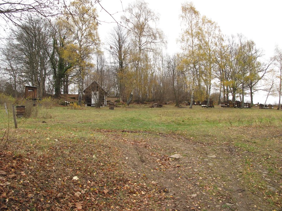
Humpolec at a glance
The regional administrative status as of 18 December 2023 lists Humpolec as a locality used exclusively for recreation. It lies 9 km south of Sušice. The 21 km “Pod keltské Sedlo” cycling loop continues along a road to Humpolec below the 902 m-high Sedlo.
The chapel in Humpolec dates from the second half of the 19th century. The nearby Sedlo Hillfort covers three hectares. A route description last updated in 2009 places the settlement away from marked hiking trails and mentions access via turnoffs from the red trail between Sedlo and Kašperk, as well as from the yellow trail.
What makes Humpolec a travel destination?
Its designation as a locality used exclusively for recreation sets it apart from a search for urban amenities. Specific points of interest include the cycling route, the described hiking access points, and the chapel. The location also helps you get your bearings: Humpolec lies south of Sušice, but is not part of Sušice. When looking for a hotel, you can first decide whether to focus your search on Humpolec or consider a wider area.
The sights mentioned appeal to different interests: the cycling loop is an option for a ride, while the chapel and hillfort offer connections to architectural and settlement history. You do not have to combine them into a single outing.
Which trail connections matter for your plans?
For cyclists, the loop’s length is clearly specified: 21 km. The “Pod keltské Sedlo” route continues along a road to Humpolec below the 902 m-high Sedlo. The distance gives you an indication of the route, but does not specify a travel time or difficulty level. This lets you consider the cycling route as a separate planning point without equating it with the hiking access points.
For hikers, the settlement’s location away from marked trails is important. The route description, last updated in 2009, mentions turnoffs from the red trail between Sedlo and Kašperk or from the yellow trail. Since this trail information is not dated recently, check the markings before setting out. These two access points are useful for orientation; they do not indicate that a continuously marked route leads all the way to the settlement.
What historical traces can you find in Humpolec and the surrounding area?
The chapel in Humpolec is a small, simple religious building resembling a small church. It was built in the second half of the 19th century and is a distinctive landmark in the village. It is also one of the few surviving original religious buildings in the Czech-German border region. A published hiking account describes a view of nearby Kašperk Castle from the chapel.
The Sedlo Hillfort is nearby. The three-hectare site was a prehistoric fortified settlement and was used as a place of refuge in later periods. Two different historical connections therefore stand side by side here: the chapel as a 19th-century religious building and the hillfort as evidence of a much earlier settlement history. Their distinct periods help you keep the sites separate in your mind.
How can you tailor your hotel search?
Before searching, decide what matters most for your stay: the cycling route, the hiking access points, or the chapel and prehistoric site. Compare hotel locations with your personal priorities. This connects your choice of destination with your choice of accommodation without turning different trails and cultural sights into a fixed itinerary.
FAQ
How long is the “Pod keltské Sedlo” cycling loop?
The loop is 21 km long. It continues along a road to Humpolec below the 902 m-high Sedlo.
Which hiking access points does the route description mention?
It mentions turnoffs from the red trail between Sedlo and Kašperk, as well as from the yellow trail. The description was last updated in 2009, so check the current markings before setting out.
What is the Sedlo Hillfort?
It is a nearby, three-hectare prehistoric fortified settlement that was used as a place of refuge in later periods.
For the broader travel overview: Susice.

