
Nyúl: Hiking, Cycling and Loess Landscape
Accommodation in Nyúl
Nyúl can be explored in a variety of ways: a circular trail leads to geological, biological and cultural sights, while there is also a religious Stations of the Cross route and a cycling tour through the hills. The village’s distinctive loess ravines also shape its landscape.
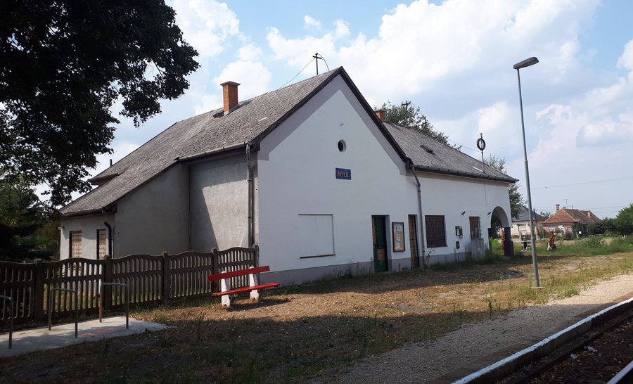
Nyúl at a glance
Nyúl lies in the heart of the Pannonhalma wine region, where wine has been produced for thousands of years. Its characteristic landscape features include the Szurdik, which is more than two kilometres long, and the 450-metre-long Vaskapu loess ravine. The distances are also useful when planning walks and trips: the Kökörcsin-körút is 12 kilometres long, while the Nyúli Keresztút is 13 kilometres long.
What trails and tours are there in Nyúl?
The 12-kilometre Kökörcsin-körút runs mostly through the hilly part of Nyúl. Along the way, it passes local sights relating to geology, biology, architecture, ethnography, history and literature. Viewpoints and rows of wine cellars are also on the route. The circular trail therefore offers a broad mix of nature and culture, rather than focusing on a single attraction.
The Nyúli Keresztút is a varied 13-kilometre hike with a religious focus. Its 14 stations recount the Passion of Christ. In a set order, the route also passes 14 of Nyúl’s 15 roadside crosses. Those interested in religious trail traditions will find both individual stations and a prescribed sequence along the crosses.
A cycling tour through the hills of Nyúl is listed as 12 kilometres and about two hours. Its brief description mentions viewpoints, wineries and a restaurant. The estimate of about two hours applies to this cycling tour; it should not be confused with the distances of the two hiking routes.
What makes the loess landscape distinctive?
The Szurdik is a long, gently sloping loess ravine in Nyúl. It is more than two kilometres long and 20 to 30 metres deep. These specific measurements describe a striking cut in the landscape. The ravine is therefore a different attraction from the longer themed route, which passes various geological and cultural sights.
Vaskapu is a typical cellar lane in Nyúl. Its 450-metre-long loess ravine is especially striking near the lower entrance and is a popular photo spot. When exploring the loess landscape, it is therefore worth considering Szurdik and Vaskapu as separate places, each with its own length and features.
What cultural sites and historical connections are there?
The Roman Catholic Church of All Saints (Mindenszentek) is a late Baroque building. It was built between 1774 and 1778 to designs by Fellner Jakab. The dates and architect provide a specific historical point of reference for travellers interested in Nyúl’s architectural history as well as its trails.
The Saint Donatus Chapel is located near the destination. It was built in the surrounding area in 1710 during a plague epidemic. Together with the church and the religious Stations of the Cross route, this historical connection shows that Nyúl’s culture can be explored not only through its buildings, but also through religious sites and trail stations. The Pannonhalma wine region provides another regional connection: wine has been produced there for thousands of years.
If you would like to include more places in your travel plans, you can also find Győrzámoly, Győr, Abda, Dunaszeg, Vámosszabadi, Pér, Kisbajcs and Öttevény here.
FAQ
How long is the Kökörcsin-körút?
The Kökörcsin-körút is 12 kilometres long and runs mostly through the hilly part of Nyúl.
What does the Nyúli Keresztút include?
The 13-kilometre hike has 14 stations depicting the Passion of Christ and passes, in a set order, 14 of Nyúl’s 15 roadside crosses.
What are the dimensions of the Szurdik?
The Szurdik is more than two kilometres long and 20 to 30 metres deep. It is a gently sloping loess ravine.
For the main travel overview: Győr.

