
Ságvár
Accommodation in Ságvár
Ságvár brings together a landscape shaped by hills, historic sites, and distinctive outdoor destinations.
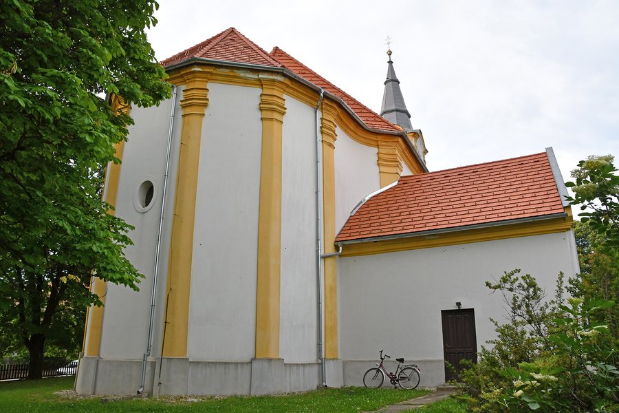 File:Ságvár, római katolikus templom 2024 03.jpg
Photo: Pasztilla aka Attila Terbócs via Wikimedia Commons, CC BY-SA 4.0
File:Ságvár, római katolikus templom 2024 03.jpg
Photo: Pasztilla aka Attila Terbócs via Wikimedia Commons, CC BY-SA 4.0
Ságvár at a glance
The Mezőföld and Somogyi-halomvidék landscape regions meet in Ságvár. The first hills of the Somogyi-halomvidék surround the village in a semicircle. Their slopes are home to vineyards, orchards, wine cellars, and weekend houses. The first hills offer panoramas of Lake Balaton, its northern shore, Ságvár, and the surrounding landscape.
The range of destinations includes Tricciana Park beside the Reformed Church, the Böre-vár hillfort, and the Bujó-lik Tunnel. Siófok-Kiliti Airport is also nearby. This makes Ságvár a suitable choice for a trip that appeals equally to those interested in landscape and culture.
What makes the landscape and excursions around Ságvár distinctive?
The hills, vineyards, and orchards give the surrounding area a rural character. The panoramas from the first hills take in Lake Balaton and its northern shore, as well as Ságvár itself and the surrounding landscape. If you are considering a stay in Ságvár, you can take this connection to the landscape into account as a reason in its own right for choosing the village, alongside its historic destinations.
The shady forests around Ságvár are also suitable for hunting and excursions. The Ságvárért Egyesület developed the Löszölő-Tökölő challenge hikes in response to the natural surroundings. The route leads to special and notable spots in Ságvár and the surrounding area. The Megalöszölő/Löszölő/Tökölő challenge hike has been held every July since 2007.
Which historic sites can you discover?
Ságvár’s present-day Reformed Church was built from 1811 to 1814 under the direction of Csicsvai Vasas András. The Reformed congregation funded the construction with money from the share of the harvest. Directly beside the church, Tricciana Park commemorates the Roman fortification. Archaeological research and excavations bring this historic period to life there.
Böre-vár is a hillfort within the boundaries of Ságvár. It lies five kilometers southwest of the village, on the south side of the Jaba Valley, and measures 150 × 57 meters. The hillfort gives a concrete sense of the size of the site and its location outside the village center. The two location details refer to different reference points: the boundaries of Ságvár and the distance southwest of the village.
What should you know about Bujó-lik and Képes-fa?
Bujó-lik, also known as Lyukas-domb, is a tunnel on Lándor-hegy. From the center of Ságvár, you can reach it by following the yellow trail markers for about 1.5 kilometers. As of 2013, the tunnel was 21.6 meters long, about 2 meters wide, and an average of 1.75 meters high. Its length and height gradually decrease over time. If you include the tunnel in your excursion plans, bear in mind both its dimensions and when they were recorded.
Képes-fa is an oak believed to be more than 300 years old, beside the road to Jaba puszta. It served as a resting place for pilgrims traveling on foot to the pilgrimage site in Andocs. The name Képes-fa comes from an image of Saint Vendel that pilgrims from Székesfehérvár placed on the tree in 1930. The site thus brings together its earlier role as a resting place and the origin of its name.
Which other destinations can you compare?
If you would like to compare Ságvár with other destinations while planning your trip, you can also find Balatonszéplak, Sosto, Balatonszabadi, Töreki, Zamárdi, Nagyberény, Siofok and Balatonendréd here.
Siófok-Kiliti Airport is located near Ságvár, between Siófok-Kiliti and Ságvár, parallel to Main Road 65. Sightseeing flights, skydiving, hang gliding, tandem jumps, and aerial photography were offered there. These offerings describe activities at the airport; they do not indicate scheduled flight connections.
FAQ
How do you get to Bujó-lik from the village center?
From the center of Ságvár, you can reach the tunnel by following the yellow trail markers for about 1.5 kilometers.
What are the dimensions of the Bujó-lik Tunnel?
As of 2013, it was 21.6 meters long, about 2 meters wide, and an average of 1.75 meters high. Its length and height gradually decrease over time.
Where is Böre-vár?
The hillfort lies within the boundaries of Ságvár, five kilometers southwest of the village, on the south side of the Jaba Valley. It measures 150 × 57 meters.
Why is the oak called Képes-fa?
The name comes from an image of Saint Vendel that pilgrims from Székesfehérvár placed on the tree in 1930.
For the overview of the wider area: Siófoki.

