
Discover Andrijevica: Hiking, Cycling and Culture
Accommodation in Andrijevica
Andrijevica combines mountain scenery with marked hiking and cycling trails, as well as special regulations for fly fishing. This lets you weigh up nature experiences, regional history and cuisine when choosing your destination.
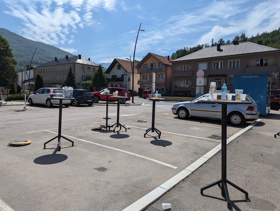 File:Andrijevica central square, morning after the city fest.jpg
Photo: Андрей Романенко via Wikimedia Commons, CC BY-SA 4.0
File:Andrijevica central square, morning after the city fest.jpg
Photo: Андрей Романенко via Wikimedia Commons, CC BY-SA 4.0
Andrijevica at a glance
Andrijevica lies at the confluence of the Zlorečica and Lim rivers. The municipality is surrounded by the Komovi, Bjelasica and Prokletije mountain ranges. There are more than 100 km of marked hiking trails, and more than 190 km of cycling routes run through Andrijevica. History and regional cuisine are also part of the area’s character: Knjaževac Memorial Park commemorates fighters and victims of various conflicts, and Andrijevica is associated with Vasojević cuisine.
What makes the landscape around Andrijevica distinctive?
The mountains give the municipality a clearly defined landscape. The highest peaks of the Komovi include Vasojevićki Kom at 2,461 m, Kučki Kom at 2,487 m and Ljevorečki Kom at 2,463 m. These elevations help convey the scale of the mountain massif, but do not, in themselves, indicate the difficulty or duration of a hike.
Part of the Komovi mountain massif within the municipality is protected as a natural asset of local importance and classified as a Category II protected area. If mountain scenery and nature conservation are a particular interest during your trip, this means you can explore a specific protected area as well as the trails.
What opportunities are there for hiking and cycling?
More than 100 km of marked hiking trails offer a range of options for planning a hike. The long-distance trail CT-1 also passes through Andrijevica. Trail markings and the long-distance route are two different navigation features: when planning a hike, you can first decide whether to look for local trails or the route of the CT-1.
Cyclists have more than 190 km of cycling routes to choose from. A high-quality wayfinding system is part of their signage.
What should you know about fly fishing?
Most of the Lim and its tributaries within Andrijevica municipality are reserved exclusively for catch-and-release fly fishing. This means that caught fish are released back into the water. To understand the precise area covered, it is important to note the designated fly-fishing zone: it includes the entire course of the Kuckaja and Zlorečica rivers, as well as 5 km of the Lim downstream from their confluence.
Andrijevica’s outdoor activities also include hiking, cycling, fishing, rafting and paragliding. These are different topics to consider when planning a trip; the specific river regulation concerns fly fishing, not all activities on the water in general.
What culture and history can you discover?
Knjaževac Memorial Park has monuments to fighters and victims of the Balkan Wars, the First and Second World Wars, and the conflicts of the 1990s. The park commemorates the fallen fighters of the regional Upper Vasojevići Brigade in the Balkan Wars and the First World War. The different historical references are thus associated with specific conflicts and groups.
The Church of the Holy Archangel Michael is also part of Andrijevica’s history: construction began in 1887, after Prince Nikola laid the cornerstone and donated money for the building. In Namastir, there are remains thought to belong to the oldest church in the Polimlje region. Archaeological excavations there uncovered pottery from the Bronze Age and Late Antiquity. The remains and the finds offer different ways to explore the area’s past.
What regional cuisine is associated with Andrijevica?
Vasojević cuisine includes lamb, kačamak, cheese and yoghurt, served with jardum. These regional foods add a culinary dimension to the nature and culture on offer. When comparing Andrijevica as a destination, you can also consider whether mountain scenery, outdoor activities and regional cuisine match your interests.
How is Andrijevica connected to the surrounding region?
Bus routes connect Andrijevica with all the towns in the surrounding region. If connections to other places are important for your plans, bear in mind that this information does not specify timetables or journey times.
For information on the subregions, see Andrijevica Andrijevica and Krajišta Krajišta. More destination pages: Budva Budva, Mojkovac Mojkovac, Cetinje Cetinje, Kolašin Kolašin, Žabljak Žabljak and Bijelo Polje Bijelo Polje.
FAQ
How many marked hiking trails are there in Andrijevica?
Andrijevica has more than 100 km of marked hiking trails. The long-distance trail CT-1 also passes through the area.
How long are the cycling routes?
Andrijevica has more than 190 km of cycling routes, signposted with a high-quality wayfinding system.
Where does the fly-fishing zone apply?
It includes the entire course of the Kuckaja and Zlorečica rivers, as well as 5 km of the Lim downstream from their confluence.
What foods are part of Vasojević cuisine?
It includes lamb, kačamak, cheese and yoghurt, served with jardum.
For the main travel overview: Montenegro.

