
Discover Samter: Culture, Nature and Trails
Accommodation in Samter
Samter combines cultural attractions with river, lake and hiking trails. When planning your trip, it is worth looking at the different experiences on offer: in Szamotuły, museums, the castle complex and religious architecture take centre stage; beyond the town, you can also find historic townscapes, landscape parks and designated trails.
Samter at a glance
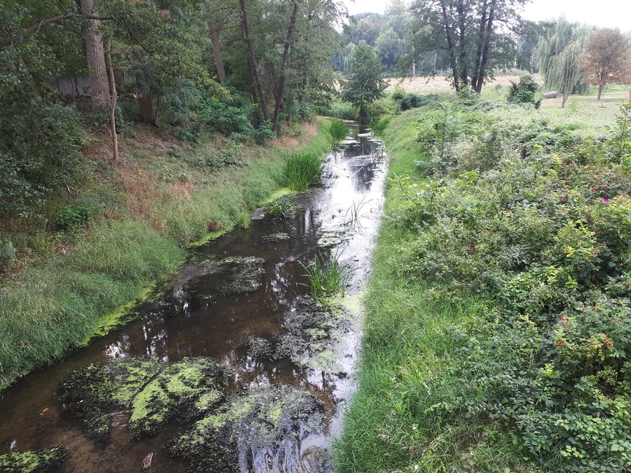
The Warta flows through Szamotuły County for 45 kilometres. The area’s waters can also be described with a specific figure: at 309 hectares, Lake Bytyńskie is the largest lake in Szamotuły County. There are both longer routes and a short trail in Pniewy Municipality for walks and hikes.
Cultural attractions range from the Zamek Górków Museum and the castle complex in Szamotuły to churches, a palace and a historic town layout. This lets you decide how to balance nature and culture during your stay, rather than viewing Samter from just one perspective.
Which natural and waterside attractions define the region?
The size of Lake Bytyńskie can be stated precisely: it covers 309 hectares. The Warta is another prominent river in the county. A kayaking route towards the Oder is designated for the river’s entire course. The route description indicates its designation; it does not specify a particular launch point or individual stages.
Another kayaking route, the Wełna Route, leads to the Warta. Together, the two river routes offer a point of reference for travellers who want to include waterways in their exploration of the region. Treat the Wełna Route and the Warta Route as separate listings: the destination given for one is the Warta, while the other runs towards the Oder and is designated for the river’s entire course.
Smaller natural attractions also have their own appeal. The Duszniczki Forest Reserve protects more than a dozen Polish larch trees that are over 100 years old. The Szlakiem Kani Rudej hiking trail runs along the edge of the “Las grądowy nad Mogilnicą” nature reserve. The reserve and trail provide a specific connection with nature for visitors interested in forests and landscapes.
Which routes are useful for planning your trip?
The E-11 long-distance hiking trail passes through Szamotuły County via Szamotuły, Szczuczyn, Grabówiec, Kobylniki, Słopanowo, Obrzycko and Klempicz. This sequence of places helps you get your bearings along the section through the county. Another long-distance route is the 200-kilometre Transwielkopolska Trasa Rowerowa. It passes through Pamiątkowo, Szamotuły, Kobylniki and Obrzycko, offering a different way to travel from the long-distance hiking trail.
For a shorter hike, Szlakiem Kani Rudej is a specific option: it is 2.2 kilometres long, with an approximate walking time of 45 minutes. These details make it easy to distinguish the route from longer trails when planning your day. The trail is in Pniewy Municipality and runs along the edge of the “Las grądowy nad Mogilnicą” nature reserve. Its description thus combines a manageable distance with a clearly identified natural setting, without conflating it with the E-11.
What culture and history can you discover?
The Zamek Górków Museum in Szamotuły has permanent regional and ethnographic exhibitions and owns the largest collection of icons in western Poland. Two different themes come together there: regional and ethnographic exhibits, and icons. The Halszki Tower is the best-preserved part of the Szamotuły castle complex.
Religious buildings include the Minor Basilica and the Collegiate Church of Our Lady of Consolation and Saint Stanislaus the Bishop. They are Szamotuły’s oldest monument and are among the important examples of religious architecture in Greater Poland. In Duszniki, meanwhile, the Gothic Church of Saint Martin has a Rococo interior. It includes a high altar, two side altars and a pulpit from the second half of the 18th century.
Historic sites beyond these two towns offer other points of interest. The palace in Kaźmierz-Nowa Wieś was built in the 19th century in the Neo-Renaissance style. Felicjan Niegolewski’s manor house in Bytyń dates from the 18th century and is surrounded by an 11.1-hectare landscape park. In Ostroróg, a historic town layout with a rectangular market square developed between the 14th and 19th centuries; a statue of Saint John of Nepomuk stands in the centre.
Pniewy is the seat of the Congregation of the Ursulines of the Agonizing Heart of Jesus and the place where Saint Ursula Ledóchowska is buried. If religious history is your main interest, you can add this place to your selection alongside the churches and historic architecture.
How can you assess the area’s transport connections?
Szamotuły County is an important transport hub, with a north–south railway connection and west–east road corridors. This layout gives you an initial point of reference when deciding which transport options and routes to look into further.
If you would like to compare other places in the area, you can find Nojewo Nojewo, Wronki Wronki, Szamotuły Szamotuły, Zajączkowo Zajączkowo, Sokolniki Wielkie Sokolniki Wielkie, Obrzycko Obrzycko, Chojno-Młyn Chojno-Młyn, Grzebienisko Grzebienisko, Chojno-Wieś Chojno-Wieś, Podrzewie Podrzewie and Niewierz Niewierz here.
FAQ
How long is the Szlakiem Kani Rudej hiking trail?
The trail in Pniewy Municipality is 2.2 kilometres long. The approximate walking time is 45 minutes.
Which places does the E-11 pass through in Szamotuły County?
The long-distance hiking trail passes through Szamotuły, Szczuczyn, Grabówiec, Kobylniki, Słopanowo, Obrzycko and Klempicz.
Which is the largest lake in Szamotuły County?
Lake Bytyńskie is the largest lake in the county and covers 309 hectares.
For the broader travel overview: Greater Poland.

