
Mikołajewo
Accommodation in Mikołajewo
Mikołajewo combines a specific cycling route with village history and a marked hiking trail. This makes both outdoor activities and the village’s development interesting points to consider when choosing where to go.
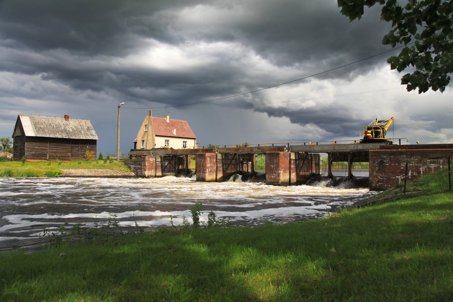 File:Stopień wodny Mikołajewo nr 17, na rzece Noteć1 LOF.jpg
Photo: Lofthy via Wikimedia Commons, CC BY-SA 3.0 pl
File:Stopień wodny Mikołajewo nr 17, na rzece Noteć1 LOF.jpg
Photo: Lofthy via Wikimedia Commons, CC BY-SA 3.0 pl
Mikołajewo at a glance
- A signposted cycling route in the Wągrowiec municipality passes through Mikołajewo and is listed as 35 km long.
- On a marked hiking trail, the edge of the village is at kilometer 102.9, between Lake Wiatrowskie and Pruśce.
- Mikołajewo was established on the right bank of the Wełna and became an independent village in 1921.
- A barbecue shelter, an outdoor grill, and picnic tables with benches were installed in the village center.
Which cycling and hiking trails pass through Mikołajewo?
The signposted cycling route in the Wągrowiec municipality runs from Wągrowiec through Bobrowniki, Rudnicze, Potulice, Runowo, Jakubowo, and Mikołajewo to Wiatrowiec, then back to Wągrowiec. Mikołajewo is therefore part of a route that takes in several places in the municipality. Its stated total length is 35 km.
Hiking also has a specific reference point: on a marked hiking trail, the edge of Mikołajewo is at kilometer 102.9, between Lake Wiatrowskie and Pruśce. Together, these offer two different ways to include Mikołajewo in a trip with outdoor activities. The Wągrowiec municipality also has signposted cycling routes that pass through areas of scenic, historical, and recreational interest.
What does the village’s history tell us?
Mikołajewo was established on the right bank of the Wełna. Another significant point in the village’s history is the year 1921, when Mikołajewo became an independent village. If you take a place’s history into account when planning a trip, as well as its routes, these provide two specific reference points: its location on the Wełna and its status as an independent village from 1921 onward.
What is in the village center, and which activities are mentioned?
A barbecue shelter, an outdoor grill, and picnic tables with benches were installed in the village center. A project helped create a place there for meetings and recreation, as well as for organizing outdoor events. These facilities and their intended purpose give the village center a community dimension alongside the route options. This sets them apart from activities that focus on a particular distance or marked trail.
Mikołajewo also has private fishing ponds. For travelers interested in fishing, the fact that they are private is important: these ponds should not be treated as a generally accessible facility. A school trip took students to Alpaki nad Stawem in Mikołajewo. Direct contact with the animals served as nature education; the trip also included alpaca therapy to reduce stress.
If you would like to compare other local pages, you can also find Skoki, Legowo, Gołaszewo, Kobylec, Wągrowiec, Przysieczyn, Grzybowo, and Sławica here.
FAQ
How long is the cycling route through Mikołajewo?
The signposted cycling route in the Wągrowiec municipality through Mikołajewo is listed as 35 km long and leads back to Wągrowiec.
Where is Mikołajewo on the marked hiking trail?
The edge of the village is at kilometer 102.9 on a marked hiking trail between Lake Wiatrowskie and Pruśce.
What is in the village center?
A barbecue shelter, an outdoor grill, and picnic tables with benches were installed there. A project helped create a place for meetings, recreation, and organizing outdoor events.
For the broader travel overview: Wongrowitz.

