
Discover Komarno
Accommodation in Komarno
Komarno brings together historical time periods and a hiking route with specific details on its length, elevation gain and estimated walking time. This makes it possible to explore the town through both its cultural history and a potential hike.
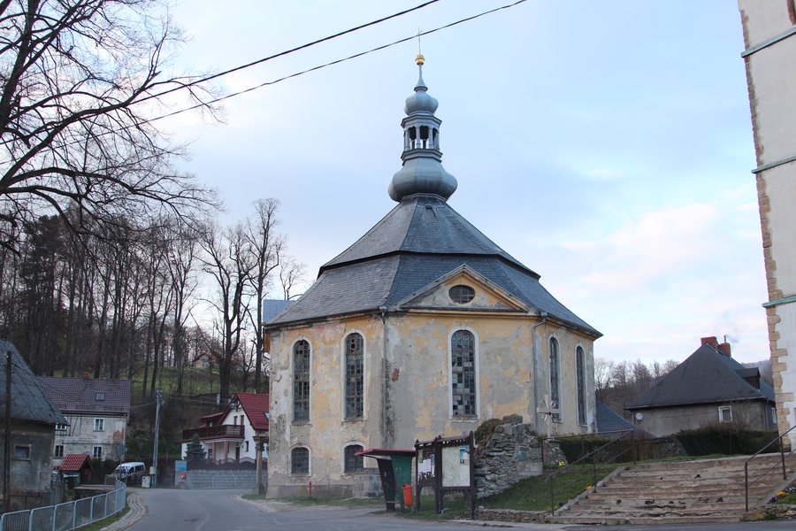
Komarno at a glance
- The branch church of St. John the Baptist fell into ruin after 1945 and was restored in the 1980s.
- The palace dates from the second half of the 17th century.
- The “Szlak z Komarna przez Baraniec do Janowic Wielkich” hiking trail is 15 km long, has 552 metres of elevation gain and an estimated walking time of 4 hours and 40 minutes. It runs through Komarno, over Przełęcz Komarnicka and Skopiec, and ends in Janowice Wielkie.
What periods of history do the church and palace tell us about?
The palace and branch church offer two different historical reference points. The palace is generally dated to the second half of the 17th century. For the branch church of St. John the Baptist, by contrast, two later changes are central: it fell into ruin after 1945 and was restored in the 1980s. This means Komarno can be viewed through different types of historical information: a date of origin on the one hand, and a sequence of deterioration and restoration on the other. If you weigh cultural themes when comparing destinations, this contrast helps explain the difference between the histories of the two sites.
What should you plan for the hiking route?
The hiking trail is called “Szlak z Komarna przez Baraniec do Janowic Wielkich”. It is 15 km long, has 552 metres of elevation gain and an estimated walking time of 4 hours and 40 minutes. It runs through Komarno, over Przełęcz Komarnicka and Skopiec, and ends in Janowice Wielkie. These details complement one another for planning: the distance indicates the length, the estimated time gives an idea of the duration, and the elevation gain is another measurable figure. Dividing the totals gives an average of just under 19 minutes per kilometre; this is an average based on the estimate, not an individual walking time. Check the route details again before planning your trip, before relying on the figures and time.
How can you assess Komarno based on your interests?
For an initial travel decision, you can consider the topics separately. If you are interested in historical development, the church and palace offer different historical reference points. If you are looking to include a hike in your plans, there is a specific combination of figures for distance, elevation gain and estimated duration. This distinction helps you assess the town according to your interests and weigh up the different aspects of your trip.
Discover more destinations: Dziwiszów, Jelenia Góra, Janowice Wielkie, Podgorzyn, Gruszków, Sosnówka K Jeleniej Góry, Jeżów Sudecki, Szklarska Poręba.
FAQ
What happened to the branch church of St. John the Baptist?
It fell into ruin after 1945 and was restored in the 1980s.
What period does the palace in Komarno date from?
The palace dates from the second half of the 17th century.
What details are available about the hiking route?
It is 15 km long, has 552 metres of elevation gain and an estimated walking time of 4 hours and 40 minutes. The route runs through Komarno, over Przełęcz Komarnicka and Skopiec, and ends in Janowice Wielkie.
For the main travel overview: Jeleniogórski.

