
Goworów: Village History, Architecture and Cycling Routes
Accommodation in Goworów
Goworów lies at the foot of the Śnieżnik Massif and combines a distinctive village layout with a history of architecture shaped by the region. For planning your trip, its built heritage, history as a summer resort and two cycling routes recommended for advanced cyclists provide useful starting points: the green route is one of the most difficult, while the blue route is considered difficult. This offers ways to understand the village through both cultural themes and the demands of a cycling tour.
Goworów at a glance
- The elevation ranges from 460 to 600 m.
- Goworów is a notable linear village along the Goworówka stream at the foot of the Śnieżnik Massif.
- The boundary of the Śnieżnicki Landscape Park runs through Goworów.
What defines the architecture in Goworów?
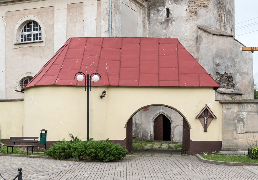
Goworów is the largest rural group of brick-built historic monuments in the Śnieżnik Massif area. Its features are characteristic of the Czech-Silesian border region. The term “group” draws attention to a cohesive architectural setting rather than just a single building. One specific example of ecclesiastical architecture is the Church of St Peter and St Paul in Goworów. It is an example of modern formal solutions in the architecture of rural churches in the Kłodzko region. The two descriptions therefore emphasize different aspects: the historic monument group represents a regional architectural setting, while the church showcases specific architectural forms.
What role did Goworów play as a summer resort?
In the second half of the 19th century, Goworów developed into a well-known summer resort. Inns were established during this period, and visitors walked to the Pątnik viewpoint. At the time, there was a cross and a gazebo there. The inns and the walk to a particular viewpoint illustrate the village’s importance as a tourist destination at the time: the history of its resort days encompasses both places to stop and a destination for excursions. This account refers to that historical period and adds a perspective on travel to Goworów to the architectural one.
How do the cycling routes through Goworów differ?
The green cycling route passes through Goworów, is 42.6 km long and is the longest cycling route in the Międzylesie municipality. Because of its elevation changes and terrain, it is one of the most difficult routes and is recommended for advanced cyclists. The 30 km blue cycling route also passes through Goworów and is recommended for advanced cyclists. It is considered difficult because of its elevation changes and terrain. In direct comparison, the green route is longer, while both descriptions point to challenging cycling for advanced riders. Check current route conditions before setting out.
What can you learn about local weaving?
The Izba Pamięci Tkactwa (Weaving Memorial Room) in Goworów presents the history of local weaving and collects related items, including historic spinning wheels. This topic differs from the built heritage: the focus here is on the history of weaving and associated objects, not the architectural styles of the historic monument group and church. Together, these offer different cultural and historical perspectives on Goworów, from the regional architectural setting to local crafts.
Discover more destinations: Bad Reinerz, Nowa Morawa, Kąty Bystrzyckie, Miedzygorze, Lewin Kłodzki, Raszków, Jodlow, Leśna.
FAQ
What is the elevation of Goworów?
The village lies between 460 and 600 m above sea level.
Which of the two cycling routes is longer?
The green cycling route is 42.6 km long, while the blue route is 30 km.
What is the Izba Pamięci Tkactwa about?
It presents the history of local weaving and collects related items, including historic spinning wheels.
Go to the main travel overview: Kłodzki.

