
Modliszów: Forest Valley, Church and Hiking Routes
Accommodation in Modliszów
Modliszów combines a deep valley covered in mixed forest with a Gothic church and hiking routes in the village and its surroundings. The landscape, architectural history and tour planning offer different perspectives if you are considering a trip or accommodation in Modliszów.
Key facts about Modliszów
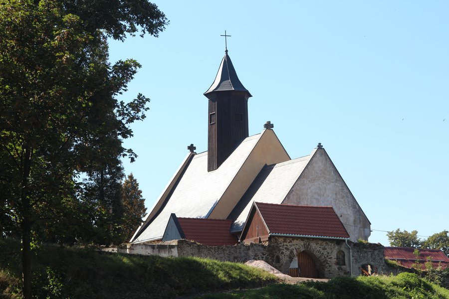
Modliszów lies in a deep valley covered in mixed forest. The Gothic Church of St. Bartholomew stands at the northern edge of the village and was built in the second half of the 14th century. The 12.5-kilometre “Wokół Modliszowa” hiking route starts in the village; a difficult section of Route 2b leads to Modliszów.
What shapes the landscape and village character?
The valley setting and mixed forest provide Modliszów with its landscape. There is also a specific cultural and historical feature: the Church of St. Bartholomew combines Gothic architecture with a construction date in the second half of the 14th century. It stands at the northern edge of the village. This gives you both a nature theme and a named historic building to consider when planning your trip.
Another church-related feature in Modliszów is a set of three stone penance crosses embedded in the gables of a church. This adds an architectural feature to the village’s history, distinct from the recorded style and construction date of St. Bartholomew’s.
Which hiking route suits your interests?
The two named hikes offer different points of reference. An older description of the difficult section of Route 2b leading to Modliszów highlights scenic views, especially in autumn. If you include this route in your plans, check the current route and conditions before setting out.
A tour report published in 2014 gives the length of “Wokół Modliszowa” as 12.5 kilometres and says it starts in Modliszów. Here too, check current trail markings and conditions before setting off. The details answer different planning questions: for Route 2b, the focus is on the difficult section and the views highlighted especially in autumn; for “Wokół Modliszowa,” it is the length and starting point.
What is there to discover nearby?
An older description of the main route in the surrounding area describes a steep descent towards Złoty Las. From there, the trail goes through the forest to a reservoir in Złoty Las. This route is another landscape feature to consider when planning your trip; if you are hiking today, it is advisable to check the current route.
There is also a glacial erratic near Modliszów measuring 7 × 8 × 10 metres. It is described as the largest in Silesia. This size offers a different perspective on the area from the hiking trails or church architecture described above. For the return journey from Modliszów to Świdnica, an older route description gives the Wałbrzych–Świdnica road. Check the current route before following it.
How do you choose accommodation for your trip?
If you are looking for a hotel in Modliszów, first consider whether the landscape, architectural history or hiking is the main focus of your trip. The forest valley, church features and different route details provide specific points of reference. You can then compare the information about each hotel and its location with your travel plans.
Discover more destinations: Bystrzyca Górna, Jugowa, Jawor, Groß Merzdorf, Striegau, Żarów, Zebrzydów, Boleścin.
FAQ
How long is “Wokół Modliszowa” and where does the route start?
A tour report published in 2014 gives the length as 12.5 kilometres and Modliszów as the starting point. Check current trail markings and conditions before setting off.
When are the views on Route 2b especially highlighted?
An older route description particularly highlights the views on the difficult section leading to Modliszów in autumn.
Which road is named as the return route to Świdnica?
An older route description names the Wałbrzych–Świdnica road. Check the current route before travelling.
To the main travel overview: Świdnicki.

