
Szczycieński: Lakes, Forests and Trails
Accommodation in Szczycieński
Lakes in the center of Szczytno, forest landscapes and routes with very different characteristics give you several clear starting points for planning your trip to Szczycieński County.
Szczycieński at a glance
- The lakes Domowe Duże and Domowe Małe lie in the center of Szczytno.
- Domowe Duże, also called Długie, covers 51 hectares and is connected to Domowe Małe.
- Sasek Wielki is the largest lake in Szczycieński County and is surrounded by wooded hills.
- The Szczytno–Dźwierzuty–Biskupiec cycling route section is about 42 kilometers long and paved.
- The kayaking route on the Sawica is considered difficult because of obstacles, stronger currents and numerous bends.
What can you expect at the lakes and in Szczytno?
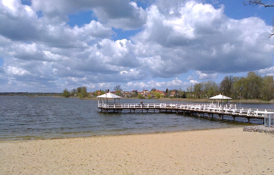
The lakes Domowe Duże and Domowe Małe lie in the center of Szczytno. Domowe Duże is also known as Długie; it covers 51 hectares. The two lakes are connected. A walking and cycling path runs around one of the lakes. This lets you include the town and the lakeshore in your plans without needing to identify which of the two lakes the path goes around.
The town beach is on the larger of the two central lakes. At the eastern end of the lakeshore, there is also an illuminated pier with benches and tables, as well as a landing stage at the beach. Check the current condition of the facilities before visiting. A watersports center on the lake has offered pedal boat, kayak and sailboat rentals seasonally. If you plan to rent equipment, ask locally about what is currently available.
The permanent ruins of the Teutonic Order castle are also part of Szczytno’s townscape. There are multimedia devices there that visitors can operate themselves. They provide information about the town, the castle and the region, which visitors can explore individually. This means you can choose between different areas of focus, including the lakes, local culture and regional topics.
What landscapes and seasons shape the county?
Sasek Wielki, the largest lake in Szczycieński County, is long and narrow, and is surrounded by wooded hills. A different waterscape can be found along the Krutynia: its first, calm stretches wind along the county’s eastern edge, including around Spychowo. These descriptions give an impression of different types of landscape without specifying a particular starting point or visitor access to a lakeshore.
The forests also change character over the course of the year. In summer, they offer shady areas and access to forest waters. In autumn, they attract mushroom pickers from across the country; in winter, they become cross-country skiing routes. This seasonal change is a useful distinction when choosing when to travel: different activities take center stage depending on the season.
Hikers will find forest nature trails in the Szczytno, Korpele, Jedwabno and Spychowo forest districts; check locally to see whether they are available. There are also hundreds of kilometers of prepared trails in the forests. As routes can change, it is worth checking the specific route before making firm plans.
What cycling and kayaking routes are there in the county?
For cycling plans, the Szczytno–Dźwierzuty–Biskupiec section, about 42 kilometers long and paved, is a concrete point of reference. The route extends beyond Szczycieński County. If you plan to ride this section, check the route details and conditions before setting off. Another option is the “Rowerem po kolei” cycling route, which follows the former railway line No. 262 through the county.
The kayaking routes differ in their courses and known challenges. The route on the Omulew starts at Lake Omulew in Nidzica County, passes through Jedwabno Municipality and then crosses the border into Wielbark Municipality. Its starting point is therefore outside Szczycieński County. On the Sawica, numerous obstacles in the river, especially fallen trees, stronger currents and many bends, are considered reasons why the route is difficult. Water conditions can vary.
Your choice depends on different planning considerations: the cycling route has a stated length and paved surface; the Omulew’s course through several municipalities helps put it in geographic context; and obstacles and currents are the main considerations on the Sawica. These details describe different characteristics and are not a common measure of the effort required for all routes.
Discover more destinations
Discover more destinations: Bialy Grunt, Jerutki, Kobylocha, Marksewo, Orzyny, Pasym, Piasutno, Pidun, Powalczyn, Rudka, Saplaty, Warchaly, Spychowo, Racibórz, Malszewo, Szczytno, Dzwierzuty, Rumy, Świętajno, Trelkówko, Lipowa Góra Wschodnia, Narty, Niedźwiedzie, Zabiele, Lipowiec, Sedansk, Jedwabno, Piece, Występ, Rudziska Pasymskie, Rańsk, Wielbark, Krzywonoga, Dybowo, Rozogi.
FAQ
Which lakes are in the center of Szczytno?
Domowe Duże and Domowe Małe are in the center. Domowe Duże is also called Długie and is connected to Domowe Małe.
Which cycling route is about 42 kilometers long?
The paved Szczytno–Dźwierzuty–Biskupiec section is about 42 kilometers long and extends beyond Szczycieński County.
Why is the Sawica considered a difficult kayaking route?
The reasons include numerous obstacles, especially fallen trees, stronger currents and many bends. Water conditions can vary.
For the broader travel overview: Warmia-Masuria.

