
Neustettin: Lakes, Peat Bogs and Culture
Accommodation in Neustettin
Neustettin brings together natural attractions and marked routes in the Gmina Szczecinek, as well as historic churches and a preserved mural. When planning your trip, consider whether you would rather explore landscapes, hike and cycle, or visit cultural sites.
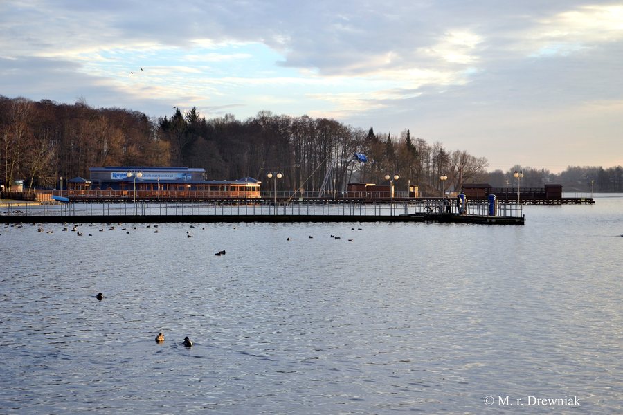 File:Szczecinek j Trzesiecko wyciag nart wodnych.jpg
Photo: Maciek r. drewniak via Wikimedia Commons, CC BY-SA 4.0
File:Szczecinek j Trzesiecko wyciag nart wodnych.jpg
Photo: Maciek r. drewniak via Wikimedia Commons, CC BY-SA 4.0
Neustettin at a glance
The Gmina Szczecinek lies in the Drawskie Lake District. Its listed landscape attractions include the “Jeziora Szczecineckie” protected landscape area, the Bagno Kusowo peat bog, and the “Jezioro Kiełpino” water and flora reserve. A 161 km red-marked hiking trail runs through the gmina; the red-marked “Szczecineckie Jeziora” cycling route is 65.1 km long.
Which natural attractions define the Gmina Szczecinek?
“Jeziora Szczecineckie” is a protected landscape area within the Gmina Szczecinek. Bagno Kusowo is considered one of Poland’s largest and best-preserved Baltic raised bogs. It covers about 300 ha. Those interested in peat bog landscapes will find a different focus here than by the water: the 49.4 ha “Jezioro Kiełpino” water and flora reserve protects relict aquatic plants.
Lake Wielimie is another defining body of water in the area. It covers 17.9 km² and lies partly within the Gmina Szczecinek.
What hiking and cycling routes are available?
The red-marked “Szlak Wzniesień Moreny Czołowej” hiking trail runs through the Gmina Szczecinek and is 161 km long. This is the length of the entire trail, not a single stage. If hiking is a priority on your trip, this information can help you choose your route.
The “Szczecineckie Jeziora” cycling route is also marked red and covers 65.1 km. It passes through the villages of Spore, Stare Wierzchowo, Wierzchowo, Trzebiechowo, Kusowo, and Dalęcino in the Gmina Szczecinek. If you would like to explore the area by bicycle, you can take the listed villages and route length into account when planning your ride. The hiking trail and cycling route are separate options; their shared red marking does not mean that they follow the same route.
Another way to experience nature is the “Wielkie Błoto” nature and forest education trail on the southern shore of Lake Wierzchowo, southeast of Wierzchowo. Its facilities include five information boards, a wooden boardwalk over the peat bog, and an observation tower. The trail therefore combines information along the route with these three specific facilities.
Which cultural sites and historic landmarks are there?
In Trzebiechowo, the palace complex includes buildings from the second half of the 19th century. The same village is home to a church dedicated to Our Lady of Częstochowa, dating from the third quarter of the 19th century. Both sites offer different points of interest for travelers interested in architectural history.
Other churches reflect different periods: the Church of the Assumption of Mary in Wierzchowo dates from the 18th century. The Holy Family Church in Spore was built between 1859 and 1865, while the All Saints’ Church in Wilcze Laski dates from 1894. Wierzchowo is also home to the mural “Przewodzi Partia,” created in 1975 and still visible today. It adds a 20th-century mural to the area’s historic sites.
For more information about the area, visit the pages for Sitno, Szczecinek, Rakowo, Lubowo, Krągi, Sępolno Wielkie, Drezno, Borne Sulinowo, Silnowo, Spore, Stare Wierzchowo, and Pilawa.
What should you know about activities and events?
The air show picnic in Wilcze Laski takes place every year during the summer holidays. For recreational fishing on Lake Wierzchowo in the Gmina Szczecinek, a new order from the village head has been in effect since February 24, 2026: fishing is permitted only from the shore. Keep this restriction in mind if you plan to fish.
FAQ
Where is the Gmina Szczecinek located?
The Gmina Szczecinek lies in the Drawskie Lake District.
What does the “Wielkie Błoto” education trail offer?
The nature and forest education trail on the southern shore of Lake Wierzchowo has five information boards, a wooden boardwalk over the peat bog, and an observation tower.
How long are the routes described?
The red-marked “Szlak Wzniesień Moreny Czołowej” hiking trail is 161 km long. The red-marked “Szczecineckie Jeziora” cycling route covers 65.1 km.
Where is fishing permitted on Lake Wierzchowo?
Since February 24, 2026, recreational fishing on Lake Wierzchowo in the Gmina Szczecinek has been permitted only from the shore.
For the broader travel guide: West Pomerania.

