
Silnowo
Accommodation in Silnowo
Silnowo lies north of Lake Pile and is part of the „Pojezierze Drawskie“ Protected Landscape Area. Lakes and several trails shape the ways to explore the area: you can follow a cycling route, a longer hiking trail or an unsigned circular route. A historic cemetery and the railway station building also offer points of interest of their own.
Silnowo at a glance
Silnowo lies north of Lake Pile in the „Pojezierze Drawskie“ Protected Landscape Area. The „Kraina małych jezior“ cycling route and the red-marked „Szlak Wzniesień Moreny Czołowej“ hiking trail pass through the village. An unsigned circular route around Lake Pile is more than 30 kilometres long. Nearby, Lake Łączno lies about 500 metres east of Silnowo.
What defines the lake landscape around Silnowo?
Lake Pile is an important landmark for orientation: Silnowo lies to its north, and the lake reaches a maximum depth of 43.9 metres near Nieder-Silnowo. If you would like to compare bodies of water, Lake Łączno lies about 500 metres east of the village. It covers an area of 50.78 hectares.
The route of the „Kraina małych jezior“ cycling trail is also useful for understanding the landscape. It passes through Silnowo and along the shores of Lakes Komorze and Pile. The „Pojezierze Drawskie“ Protected Landscape Area provides another geographic context for Silnowo.
Which cycling and hiking trails are available?
For a cycling tour, „Kraina małych jezior“ is a specific option: the cycling route passes through Silnowo and along the shores of Lakes Komorze and Pile. If you would rather plan a loop around Lake Pile, bear in mind that this route is unsigned and more than 30 kilometres long. These details clearly distinguish it from a marked hiking trail and are worth considering when planning your own route.
The red-marked „Szlak Wzniesień Moreny Czołowej“ also passes through Silnowo. Its total length is 161 kilometres; this refers to the entire hiking trail, not just the section in the village. This means there are different types of route to choose from: a cycling route, an unsigned loop around Lake Pile and a marked long-distance hiking trail. Which one suits your trip depends on whether you would like to focus on cycling or hiking.
What local sights and amenities are there?
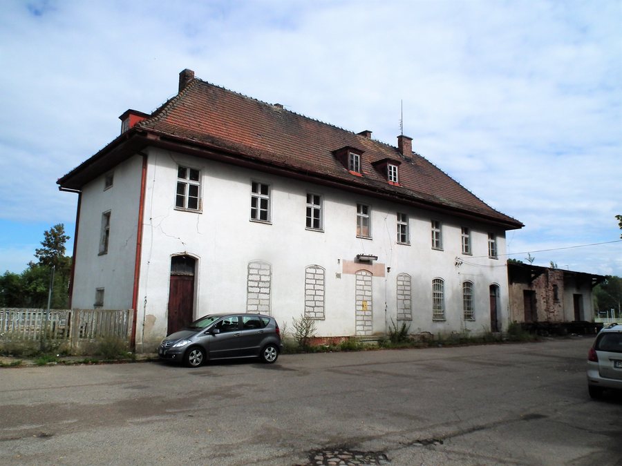
Silnowo has a Protestant cemetery dating from around the turn of the 20th century. The railway station building dates from 1935. These two sites add specific historical points of interest to the information about nature and trails; they represent different aspects of the village’s history.
There are grass volleyball courts in a recreational area in the centre. Next to the volleyball court is a small playground with four pieces of equipment. Dom Nad Jeziorem is listed as an agritourism accommodation at Silnowo 65, 78-446 Silnowo.
If you would like to include other destination pages in your trip planning, you can also find Krągi, Sitno, Spore, Lubowo, Rakowo, Sępolno Wielkie, Borne Sulinowo and Drezno.
FAQ
Where is Silnowo in relation to Lake Pile?
Silnowo lies north of Lake Pile. Lake Łączno is about 500 metres east of the village.
How long is the circular route around Lake Pile?
The unsigned circular route around Lake Pile is more than 30 kilometres long.
Which marked trails pass through Silnowo?
The „Kraina małych jezior“ cycling route and the red-marked „Szlak Wzniesień Moreny Czołowej“ hiking trail, which is 161 kilometres long in total, pass through Silnowo.
Which historic sites are mentioned in Silnowo?
Silnowo has a Protestant cemetery dating from around the turn of the 20th century. The railway station building dates from 1935.
For the broader travel overview: Neustettin.

.jpg)