
Borne Sulinowo: Lake District and Military History
Accommodation in Borne Sulinowo
Borne Sulinowo combines a lake and forest landscape shaped by the Ice Age with the town’s military history. This gives you different aspects to consider when planning your trip and accommodation: a nature trail, two cycling routes, a protected nature area and the town’s former role as a base and barracks. You can choose which themes will shape your stay.
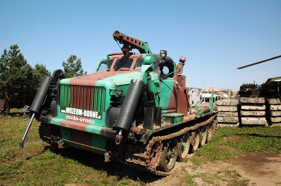 File:Borne Sulinowo - Muzeum Militarnej Historii - BAT - 14.08.2025 12-24-35.jpg
Photo: Photographs by Radosław Drożdżewski (User:Zwiadowca21) via Source, CC BY-SA 4.0
Borne Sulinowo: Key Facts
- The “Diabelskie Pustacie” nature reserve covers 932.04 hectares and is located within the Natura 2000 protected area of the same name.
- An approximately 9.1-kilometre nature trail leads from the vicinity of a former Soviet cemetery to a vehicle rest area by Lake Rymierzewo; it can be explored on foot or by bicycle.
- The middle section of the blue cycling route passes through two glacial valleys containing five lakes; the black cycling route runs through pine forest and past small glacial lakes.
- Borne Sulinowo developed as a rear base and barracks for the military training area and was home to the Wehrmacht artillery school.
What natural landscape defines Borne Sulinowo?
“Diabelskie Pustacie” covers 932.04 hectares. Within the Borne Sulinowo administrative district, 637.63 hectares belong to the Nadleśnictwo Borne Sulinowo Forest District. The nature reserve is located within the “Diabelskie Pustacie” Natura 2000 protected area.
The routes highlight different features from those described for the protected area: here, the focus is on landforms and bodies of water along specific routes. The middle section of the blue “Kraina Odwróconego Krzyża” cycling route passes through two glacial valleys that meet at right angles. The valleys contain five lakes and together form the shape of an inverted cross. This makes the section especially illustrative for travellers interested in glacial landscapes.
How do the nature trail and cycling routes differ?
The approximately 9.1-kilometre nature trail begins near the former Soviet cemetery in Borne Sulinowo and leads to a vehicle rest area by Lake Rymierzewo. You can explore it on foot or by bicycle. Its approximate length and stated endpoints give you a specific reference point for planning, without specifying a walking or cycling time.
The blue “Kraina Odwróconego Krzyża” cycling route also starts and ends at a crossroads in Borne Sulinowo. The black “Kraina małych jezior” cycling route also starts and ends at a crossroads in Borne Sulinowo, but passes through a pine forest landscape with small glacial lakes and runs between Rakowo, Komorze, Okole, Uniemino and Strzeszyn. The blue route focuses on valley landforms and five lakes, while the black route features pine forest, smaller lakes and the villages listed above. When choosing between the routes, you can use these different landscapes as a guide.
What historical and seasonal connections are there?
Borne Sulinowo developed as a rear base and barracks for the military training area and was home to the Wehrmacht artillery school. This military role offers a distinct perspective on the town’s history, alongside its natural and scenic attractions. If you are particularly interested in the town’s development, this past provides a specific historical reference point.
The annual Piknik Lotniczy takes place at the sports airfield during the first few days of May. If you want to plan your trip around it, check the specific event dates in advance.
What experiences are described in the municipality and nearby area?
The Piława is the largest river in the municipality of Borne Sulinowo and a popular canoeing route. This nature and activity-related feature applies to the municipality; it should not be mistaken for a route through the town. In the destination’s surrounding area, alongside an island near the town, there is the “sunken forest”, a popular diving spot. Canoeing and diving thus add two different nature-based activities to the cycling and walking routes.
Discover more destinations: Rakowo, Drezno, Krągi, Sępolno Wielkie, Spore, Sitno, Silnowo, Stare Wierzchowo.
FAQ
How long is the nature trail?
The nature trail is approximately 9.1 kilometres long. It leads from near the former Soviet cemetery to a vehicle rest area by Lake Rymierzewo and can be explored on foot or by bicycle.
What is the difference between the two cycling routes?
The blue route passes through two glacial valleys with five lakes that together form an inverted cross. The black route runs through pine forest and past small glacial lakes, as well as between five named villages.
When does the Piknik Lotniczy take place?
The Piknik Lotniczy takes place annually at the sports airfield during the first few days of May. Check the specific dates before planning your trip.
To the main travel overview: Szczecinek.

