
Zagra – Roman Remains, Wooden Church and Țibleș Landscape
Accommodation in Zagra
Around 800 metres southeast of Zagra, in the forest on Măgura Lupului, stands the Roman watchtower “Turnul de epocă romană de la Zagra – Dealul Lupului”. It is located on the western bank of the Valea Lupului stream.
Culture
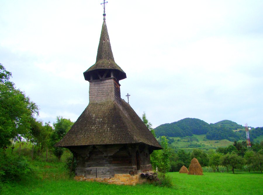
Another historical trace leads to the “Biserica de pe Pod”: it was originally built in Perișor, brought to Zagra in 1936 and rebuilt there. The Roman watchtower near Zagra at Vârful Zgăului stood in a dominant position and offered an excellent view over the Țibleș Valley and northwards, almost as far as the foothills of the Țibleș Mountains. In the vicinity of Zagra, the Roman watchtower near Perișor, at the highest point of the Vârful Colnicului plateau, offered an excellent view eastwards across the Țibleș Valley.
The “Cuvioasa Paraschiva” wooden church in Zagra has a pentagonal polygonal narthex and a pentagonal polygonal altar apse; its tower roof is octagonal. Preserved but damaged paintings can be found in both the narthex and the nave. Zagra was formerly known for the artistic processing of Cergi and Pănuri. In Zagra, singing Christmas and New Year’s songs is part of the local customs. The folkloric heritage of Valea Zăgrii includes the traditional forms “Cununa grîului” and “Sâmbra oilor”. A “Hora țărănească” is listed for July in Zagra.
Nature
In the regional surroundings of Zagra, the Țibleș Mountains, with the peaks Țibleș, Bran and Arcer, are part of the landscape; the highest peak is Țibleș at 1,839 metres. The ridges of the Țibleș Mountains are largely covered with beech and coniferous forests; alpine meadows stretch above them.
The landscape therefore combines forested ridges with the alpine meadows above them. The named peaks Țibleș, Bran and Arcer belong to the regional surroundings of Zagra, with the elevation of 1,839 metres referring to Țibleș.
Lacul Zagra is a natural reservoir that formed after a landslide displaced sedimentary rocks on the southern slope of Dealul Comoara and blocked springs in the area. Dealul Comoara lies east of the municipality of Zagra. In the vicinity of Zagra lies Lacul Zagra, also called “Tăul lui Alac”; it is a botanical nature reserve about 500 metres from the village. The name “Tăul lui Alac” refers to the same lake, which is designated as a botanical nature reserve. The European pond turtle and the European stripe-necked terrapin are found in Lacul Zagra; both species are considered legally protected. A footpath to Lacul Zagra branches off from the last road bend before the entrance to Zagra.
Routes
Access to the Țibleș Mountains from Mocod leads along the county road through Zagra, Poienile Zagrei and Suplai. A described mountain route to Suplai and into the Țibleș Mountains runs via Mocod and Zagra and continues along gravel and forest roads. The county road and the subsequent gravel and forest roads are therefore parts of the described connection towards Suplai and the Țibleș Mountains.
More destinations
More destinations: Romuli, Sebiş, Sângeorz-Băi, Valea Borcutului, Poiana Ilvei, Uriu, Crainimăt, Piatra Fântânele
To the main travel overview: Bistrita-Nasaud.

