
Măneciu-Ungureni – Hiking Routes, Mountain Landscapes and Culture
Accommodation in Măneciu-Ungureni
Măneciu-Ungureni lies at an altitude of around 620 metres in a natural amphitheatre with broad terraces that merge into the area along the right bank of the Teleajen.
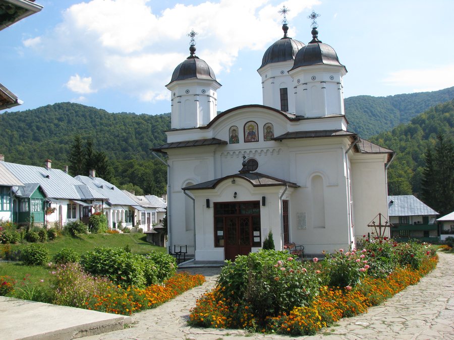 File:Manastirea Suzana - comuna Maneciu Ungureni.JPG
Photo: Andreescu N. Stefan via Wikimedia Commons, CC BY-SA 3.0 ro
File:Manastirea Suzana - comuna Maneciu Ungureni.JPG
Photo: Andreescu N. Stefan via Wikimedia Commons, CC BY-SA 3.0 ro
Nature and Routes
A marked hiking route leads from Măneciu-Ungureni via Muntele Poiana Mare, Muntele Stâna and Muntele Nebunu Mare to Vârful Ulita. The route is 18 km long, takes 6 to 7 hours, has an elevation gain of 1,488 metres and is rated as moderate.
Route 25 CA connects the dam of the Măneciu Reservoir with Pasul Tabla Buții, the saddle between Ciucaș and the Culmea Tătaru Mare ridge.
The nearby surroundings of Măneciu-Ungureni include Pietri Peak, Măgura Ceraşul Mountain, Magura Maneciu Peak and Plaiului Ursului Peak.
The Măneciu-Ungureni–Pasul Boncuța–Măneciu-Ungureni cycling route starts in Măneciu-Ungureni, crosses the dam of the Măneciu Reservoir and continues uphill towards Pasul Tabla Buții. It is 51.70 km long and rated from moderate to difficult.
The different route lengths and ratings provide an objective basis for organising day plans according to scope and level of challenge. The hiking route and cycling route represent different forms of activity, while the peaks and mountain landmarks mentioned preserve additional names of the nearby landscape.
When choosing a hotel for Măneciu-Ungureni, the respective offer page provides travel dates, room category and cancellation conditions for comparison. The route lengths and cultural destinations in the wider regional area can be considered separately in your personal travel planning. For an objective comparison, you can view the stated characteristics of each route side by side, such as length, duration, elevation gain, difficulty level and type of activity. Sporting routes and cultural topics thus remain recognisable as different planning priorities. For day planning, you can read the various details side by side according to scope and level of challenge.
History and Culture
Măneciu-Ungureni emerged in the 18th and 19th centuries through the immigration of Romanians from Transylvania, including from the Săcele area and the Székely regions.
Traditional activities in the hilly and mountainous surroundings of Măneciu-Ungureni include wood processing, livestock farming, fruit growing and beekeeping.
At Tabla Buții, trenches, shelters and shell craters from the battles of the First World War, as well as the purpose-built Heroes’ Cemetery, Cimitirul Eroilor, bear witness to the history of the war.
The ruins of the medieval Tabla Buții fortress lie along a historic trade route that connected the centre of Wallachia with Transylvania.
The wider regional area around Măneciu-Ungureni includes Cheia Monastery, Biserica Sfinţii Arhangheli Church, Biserica Ortodoxă Bordenii Mici Orthodox Church and Biserica Sfinţii Voievozi Church.
In Măneciu-Ungureni, the Sf. Nicolae Church was first consecrated in 1866.
The ethnographic museum of the Măneciu municipality is located in the building of the Măneciu-Ungureni Cultural Centre and was established by Prof. Alexandru Barbu.
Other Locality Pages
Bărcănești, Negrasu, Strejnicu, Valea Doftanei, Blejoi, Ceraşu, Surani, Bughea De Jos
For the higher-level travel overview: Prahova.

