
Vrbatův Kostelec: Educational Trails, Geopark and Culture
Accommodation in Vrbatův Kostelec
Geology and the Valley Landscape
Vrbatův Kostelec combines a geologically significant site with a clearly defined valley landscape. The locality lies in the eastern part of the Železné hory National Geopark and approximately halfway along the Žejbra Valley. This valley begins below the slope of Kostelecká hůra and ends in Podskála. The landscape therefore includes both the geopark as a broader spatial context and the valley with its beginning and end. The geopark, valley and sandstone outcrop thus represent different landscape features around Vrbatův Kostelec.
At the sandstone outcrop on the northern edge of Vrbatův Kostelec, near the road from Vrbatův Kostelec to Skála, there are two information panels. They complement the geological setting with a visible information point on the edge of the village.
Church of St. Gallus
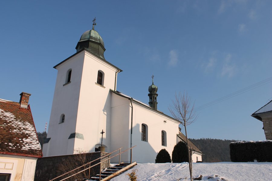
Vrbatův Kostelec is home to the parish church of St. Gallus the Abbot. The church has been protected since November 3, 2023. Alongside its connection with the geopark, the village therefore has an independent cultural landmark. The village church and the educational trails lead to different subjects: here, the building is the focus, while there, the landscape or the history of Ležáky takes center stage.
Educational Trail on the History of Ležáky
The “Stopy Ležácké tragédie” educational trail begins in Vrbatův Kostelec and follows the green-marked hiking trail via Louka and Habroveč to Ležáky. It is 13 km long and has eight information panels. In terms of content, the trail addresses the events connected with the destruction of the village of Ležáky on June 24, 1942. For planning this route, the 13 kilometers and eight panels provide two specific reference points: the route connects the start in Vrbatův Kostelec with the destination of Ležáky, while the panels accompany the historical theme along the way.
The established route, its length and the number of panels give this trail a clearly defined character. The route leads from the starting point in Vrbatův Kostelec via Louka and Habroveč to Ležáky. As a result, the named places are part of the route just as the historical subject is part of the educational trail.
Chrastecka Educational Trail
Another route is the Chrastecka educational trail. It runs from the railway station in Chrast u Chrudimi to Vrbatův Kostelec railway station and has 13 stations. The beginning and end are therefore each associated with a railway station. The fixed number of stations further structures the route and distinguishes this educational trail from the “Stopy Ležácké tragédie” route, which leads via Louka and Habroveč to Ležáky. The two railway stations mark the connection between Chrast u Chrudimi and Vrbatův Kostelec, while the 13 stations divide the route into individual points.
Signposted Cycling Routes
Several signposted local cycling routes run through Vrbatův Kostelec. They complement the two educational trails with another marked route through the village area. The cycling routes remain a separate focus alongside the walking trails, while the Church of St. Gallus and the sandstone outcrop represent two location-specific destinations. The signposted cycling routes complement this network of paths with an independent means of getting around the village area.
Other travel destinations: Kamenicky, Dolívka, Dědová, Hlinsko V Cechách, Krouna, Úherčice, Trojovice, Stolany
For the broader travel overview: Okres Chrudim.

.jpg)