
Kyjov: Hotels and Accommodation
Accommodation in Kyjov
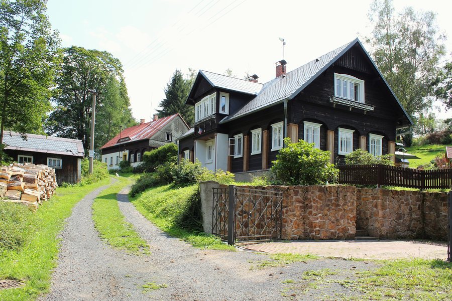
Kyjov is a small village with traditional wooden houses near Krásná Lípa. The Kyjovské údolí valley, which belongs to České Švýcarsko National Park, is located in the vicinity of Kyjov. A paved path leads through the valley, with numerous hiking and cycling trails as well as natural paths branching off into the rocks.
Nature
Walks through the Kyjovské údolí offer views of sandstone formations, rock walls and rock towers, as well as picturesque viewpoints and romantic natural areas. Klenotnice was formed by the collapse of masses of rock that created tunnels and chambers, rather than by the action of water as in classic karst caves.
Trails
For the area of the adventure trail, tourist bus 434 from Krásná Lípa or from the direction of Děčín is recommended. Kyjovský hrádek can be reached from Krásná Lípa via a yellow-marked trail that connects to the Köglerova naučná stezka. The access route includes several stone stairways, narrow paths and ladders and is relatively demanding. Klenotnice can be easily reached via a red-marked trail from the Pod praporkem signpost in the Kyjovské údolí.
The Kyjovské údolí is part of the Köglerova naučná stezka, the oldest nature trail in Bohemia, established in 1941. The trail is 23 kilometres long and has 39 stations with Czech-German explanations. The 4-kilometre route “Údolím říčky Křinice všemi smysly” runs between Restaurace U Fakulty, the Kyjovské údolí and Turistický most, as well as through the Kyjovské údolí near Krásná Lípa; it was designated as accessible and suitable for families with children and pushchairs.
The Kyjovská skalní stezka forms a circular route of approximately 2.5 kilometres starting in Kyjov, for which around 1.5 hours is estimated. It leads through rocky terrain with numerous stairs and ladders and offers views of various rock formations.
History
Kyjovský hrádek is located on a sandstone spur whose walls descend vertically into the canyon of the Křinice. Archaeological investigations there uncovered a furnace, remnants of melted basalt and small metal vessels. In 1884, the mountain association for the Kyjovské údolí began developing the valley, making the most interesting rock formations accessible. Memorial plaques for MUDr. Johann Hille and for the brothers Eduard and František Bienert are set into the rock.
Water
Kyjovská přehrada is located approximately 1 kilometre northeast of Kyjov. It has a sandy bottom, a gently sloping entry into the water, a sunbathing lawn, seating and parking nearby. The reservoir is a natural swimming area near Kyjov.
Routes
The “Divokým údolím Křinice” route leads from Kyjov through the Kyjovské údolí to Dolní mlýn and onwards to Zadní Jetřichovice. It crosses the national border because part of it runs through German territory. Marked cycling trails lead through the Kyjovské údolí to the German border; the return journey is possible via Česká silnice or via Vlčí Hora and Sněžná to Kyjov or Krásná Lípa.
A hiking route runs from Krásná Lípa via Kamenná Horka, Kyjov, Kyjovský hrad, the Kyjovské údolí and Turistický most onwards to Brtnický hrádek and Brtníky.
Other Places
Other places: Kunratice, Rybniště, Chřibská, Krasne Pole, Františkov Nad Ploučnicí, Janská, Šluknov, Růžová
To the higher-level travel overview: Děčín District.

