
Horní Radslavice between Strážnice and Svatoslavský potok
Accommodation in Horní Radslavice
Landscape along Svatoslavský potok
The southern and eastern part of the Horní Radslavice area is shaped primarily by the valley of Svatoslavský potok, with floodplain areas and steep, predominantly wooded slopes. Svatoslavský potok separates Horní Radslavice from Strážnice Mountain. For a stay focused on landscape and water, this part of the area provides a natural thematic setting.
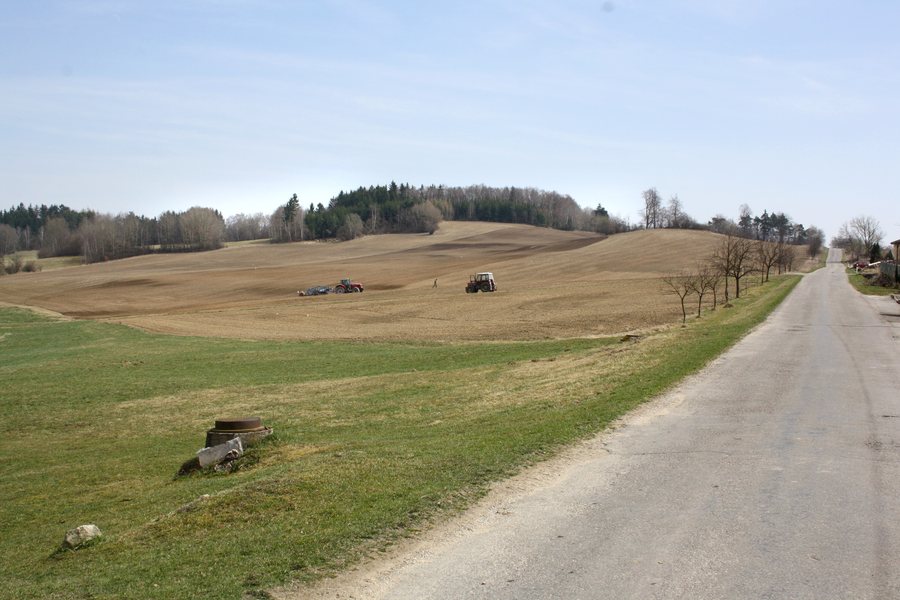 File:Pavlínov, road to Horní Radslavice.jpg
Photo: Pavel Hrdlička (Czech Wikipedia user Packa ) via Wikimedia Commons, CC BY-SA 3.0
File:Pavlínov, road to Horní Radslavice.jpg
Photo: Pavel Hrdlička (Czech Wikipedia user Packa ) via Wikimedia Commons, CC BY-SA 3.0
Strážnice and the hiking trail
Located east of Horní Radslavice, Strážnice Mountain reaches an elevation of 564 metres. Strážnice offers views of the surrounding landscape. A blue-marked hiking trail also passes through the cadastral territory of Horní Radslavice. The mountain represents views across the landscape, while the blue-marked trail represents travelling on foot. Those who do not want to structure their day around a single destination can consider these two forms of exploring the landscape separately.
Water and the southern surroundings
A tributary of Svatoslavský potok rises in a wooded area west of Horní Radslavice below Posekaný Mountain and flows into Svatoslavský potok below the settlement. To the south, the Horní Radslavice area borders Přírodní park Třebíčsko; Svatoslavský potok forms the boundary. Luční Pond lies west of Horní Radslavice and offers opportunities for swimming and fishing. Those who choose water as their focus can distinguish between these two activities at the pond.
History of the village
The first written mention of Horní Radslavice dates from 1377. In 1409, Ladislav z Kravař na Meziříčí sold Horní Radslavice, with the consent of Anežka, the daughter of the late Jan of Meziříčí, to Janko, Štědroň and Mikuláš from Bochovice. The history of the village therefore includes both an early written mention and a specifically dated sale involving several people.
Historical traces in the villagescape
In 1436, a dispute arose over Raclavice, the historical name of Horní Radslavice, because of the inheritance of Bochovice. An agreement was reached between the parties in 1437. A bell tower stands on the village square in Horní Radslavice. Several historic crosses also stand in Horní Radslavice and its surroundings. The villagescape thus brings together dated history, a bell tower on the village square, and small religious monuments in the village and surrounding area.
Location for choosing your base
Horní Radslavice lies on Road II/349 between Bochovice and Pohořílky, a district of Otín. The road location therefore provides two specific geographical reference points for situating the village. When choosing accommodation, this road route can serve as an objective framework for planning your stay.
Other places in the same higher-level area: Bolesín, Skrdlovice, Netín, Radňovice, Chlum-Korouhvice, Věstín, Bobrová, Světnov
To the higher-level travel overview: Okres Žďár Nad Sázavou.

