
Štěpkov: Rotunda, Fortress History and Cycling Route
Accommodation in Štěpkov
Culture and Townscape
The Chapel–Rotunda of Saint Wenceslas is designated as a prominent architectural landmark in Štěpkov. At the same time, the rotunda is protected as a cultural monument; its register number is 35731/7-3080. The group of houses around the rotunda is also designated as a valuable urban ensemble.
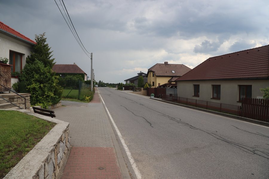 File:Overview of road II 151 in Štěpkov, Třebíč District.jpg
Photo: Jiří Sedláček via Wikimedia Commons, CC BY-SA 4.0
File:Overview of road II 151 in Štěpkov, Třebíč District.jpg
Photo: Jiří Sedláček via Wikimedia Commons, CC BY-SA 4.0
History and Architecture
The rotunda in Štěpkov was built from rubble stone in the 12th century and later received a Baroque brick dome. It also served as a fortified place of refuge. The history of the locality includes Štěpkov Fortress: it is mentioned in written sources for the years 1582 to 1629, while in 1589 it is described as deserted. It stood on the site of today’s ZD; a one-storey building in the ZD complex is regarded as its successor. The fortress grounds are recorded as an archaeological area in category ÚAN I.
The architectural details thus combine an early period of origin with a later Baroque alteration; the traditional function as a fortified place of refuge is also part of the description of the rotunda. The fortress history includes the period mentioned from 1582 to 1629, its designation as deserted in 1589, its connection to the site of today’s ZD, and the archaeological registration of the grounds.
The combination of the building, townscape and history offers different ways of viewing the locality. You can consider these topics individually rather than combining them into a single activity.
Landscape and Surroundings
Špičák, which is classified as a mountain, is located in the immediate vicinity of Štěpkov. Modrácký kopec, Rudný and Srnčí vrch are located in the surrounding area; all three are classified as mountains. Svatá Markéta, U Svaté Magdalena and U Svatého Křiže are also located in the surrounding area, each classified as a church. In the wider regional surroundings is Schloßberg, which is classified as a ruin.
The spatial range of the destinations extends from the immediate vicinity through the surrounding area to the wider regional surroundings. For planning purposes, you can consider these levels separately and distinguish between cultural, landscape, religious and historical sites.
The landscape destinations and the historical or religious sites therefore form separate groups: mountains stand alongside churches and a ruin, while the rotunda and the fortress history thematically complement the town centre.
Other Places
Other places at the same regional level include Ocmanice, Jinošov, Petrovice U Třebíče, Rokytnice Nad Rokytnou, Moravské Budějovice, Lesní Jakubov, Budišov and Babice U Lesonic.
Cycling Route and Location
A marked cycling route complements the local and surrounding-area themes: Route 5104 Třebíč–Jemnice runs through the Štěpkov planning area. Road II/151 runs from west to east through the central part of Štěpkov and directly serves the adjacent built-up area. Bus stops are located in the central part of Štěpkov. Different routes and destinations can be weighed alongside one another when planning your own trip, without mixing the historical and landscape points of interest.
The transport details add a local structure to the thematic destinations: the road crosses the central part, while the bus stops are also located there; the cycling route, by contrast, is defined spatially through the planning area. The transport situation and excursion destinations remain separate pieces of information.
For the broader travel overview: Třebíč District.

