
Discover Irota
Accommodation in Irota
Marked trails of varying lengths and a rich church history give Irota a distinctive character. Here you can find information about local features and other topics in the wider Borsod-Abaúj-Zemplén destination.
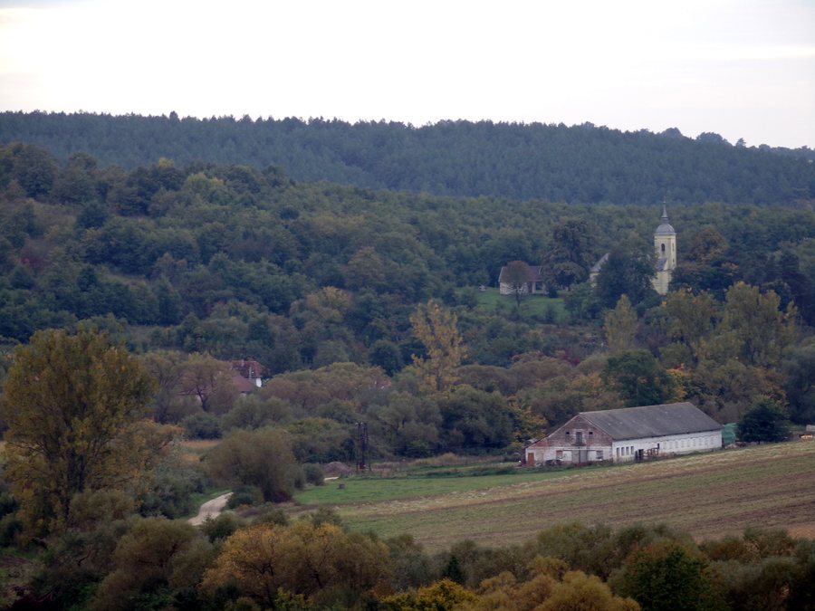
Irota at a glance
- Marked hiking trails of varying lengths run around the village.
- The Greek Catholic church stands on a hill above Irota.
- The ruins of an earlier church are still visible on a hill south of the present-day church.
- Before the stone church was completed in 1846, Irota had a wooden church.
What hiking trails are there around Irota?
The marked hiking trails around Irota vary in length. This gives you an initial point of reference if you would like to include hikes in your travel plans: there is no single standard trail length, but both shorter and longer options.
Hiking is a distinct topic here, alongside the village’s historical sights. If you organize your trip by interests, you can consider these two aspects separately: the trails around Irota and the history of its churches. This keeps your choice of location focused on the features that matter to you, rather than combining different experiences into a single route.
What do the churches tell us about Irota?
The Greek Catholic church, dedicated to the veneration of the Mother of God, stands on a hill above the village. Its location is a striking part of its description. The village’s history also refers to an earlier church building: the ruins of an older church on a hill south of the present-day church are still visible. The surviving remains and the existing church building are two distinct places, each with its own history.
The building’s history goes back further than the stone church. Before the stone church was completed for the Greek Catholic faithful in 1846, Irota had a wooden church. Together, the former wooden church, the ruins on the southern hill, and the present-day church provide several historical points of reference.
What nature experiences does the wider Borsod-Abaúj-Zemplén destination offer?
The wider Borsod-Abaúj-Zemplén destination offers other nature-related attractions as well. At Gergés-lápa, about 1.5 kilometres north of Jósvafő, the Hucul herd can be viewed in the pastures year-round. This is a different focus from the marked hiking trails around Irota: here, the emphasis is on observing the herd.
The Baradla-Domica cave system is also part of the UNESCO World Heritage-listed Caves of the Aggtelek Karst and Slovak Karst. A short Aggtelek cave tour is one kilometre long, takes 60 minutes, and is rated easy. This is separate from the educational trail that connects the Aggtelek and Jósvafő entrances to Baradla Cave and presents natural and cultural-historical values. The UNESCO World Heritage site, cave tour, and educational trail thus offer different ways to explore the subject of caves.
What cultural contrasts are there in Borsod-Abaúj-Zemplén?
The cultural range in the wider Borsod-Abaúj-Zemplén destination extends from castle history to the performing arts. Diósgyőr Castle reached its heyday under King Louis the Great in the 14th century. Later, it served as a residence and as a wedding gift for six queens. The National Theatre of Miskolc offers a different focus: it is a performing arts complex with five stages.
Sárospatak is another source of cultural experiences in the wider Borsod-Abaúj-Zemplén destination. The Reformed College preserves treasures of Hungarian Protestant culture. St. Elizabeth’s Basilica and the St. Elizabeth House bring the medieval world to life. These examples appeal to different historical and cultural interests and should be understood as attractions in the wider destination.
How can you choose a location for your trip?
When looking for accommodation, it helps to first decide on the geographical area you have in mind: should your plans focus mainly on Irota and its local features, or would you also like to explore other topics in the wider Borsod-Abaúj-Zemplén destination? The hiking trails and church history relate to Irota; the other nature and cultural topics are examples from the wider Borsod-Abaúj-Zemplén destination. Rather, they show how your research can focus on hiking and church history, or on caves, culture, and other nature-related attractions, depending on your interests.
If you would like to discover more local profiles, you can also find information about Szakácsi, Szögliget, Komjáti, Szuhogy, Ziliz, Jósvafő, Damak and Tornaszentandrás.
FAQ
Are there marked hiking trails around Irota?
Yes. Marked hiking trails of varying lengths run around Irota.
Where is the Greek Catholic church located?
It stands on a hill above Irota and is dedicated to the veneration of the Mother of God.
What is known about the former church?
Before the stone church was completed in 1846, Irota had a wooden church. The ruins of an earlier church are still visible on a hill south of the present-day church.
How long does the short Aggtelek cave tour take?
The tour is one kilometre long and takes 60 minutes. It is rated easy and is part of the wider Borsod-Abaúj-Zemplén destination.
To the wider travel overview: Edelényi.

