
Kemence
Accommodation in Kemence
Marked hiking trails and the history of the narrow-gauge railway give Kemence two distinct sides. Which of these matters more to your travel plans depends on whether you want to get to know trails through the Börzsöny landscape or learn more about railway and forestry history.
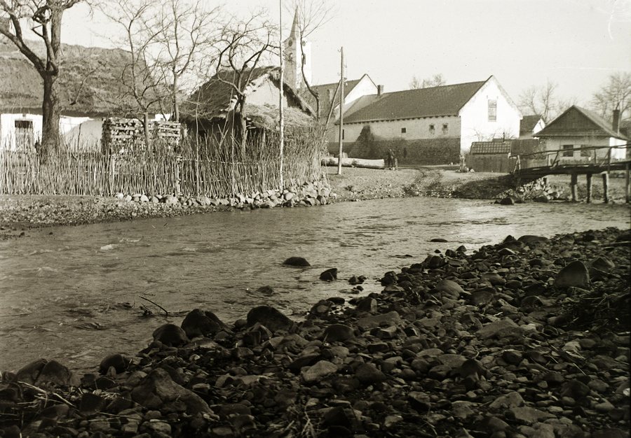 Kemence stream with the Roman Catholic Church of the Nativity of Mary in the background
Photo: Photo: FOTO:Fortepan — ID 95550 : Adományozó/Donor: Schermann Ákos. archive copy at the Wayback Machine
Kemence stream with the Roman Catholic Church of the Nativity of Mary in the background
Photo: Photo: FOTO:Fortepan — ID 95550 : Adományozó/Donor: Schermann Ákos. archive copy at the Wayback Machine
Kemence at a glance
A yellow-marked hiking trail starts in the center and leads via Tótok útja, Kámor-hegy, and Závoz-tető to Diósjenő. The route is listed as 20 kilometers long, with a duration of 5.5 hours. Other marked trails start from the Vilati-Feketevölgy-Panzió and head toward various named points. The Kemencei Erdei Múzeumvasút runs for about 4 kilometers through varied landscapes; its exhibition covers the Börzsöny narrow-gauge railway and forestry history.
Which hiking trails can you plan in Kemence?
The yellow-marked route from the center to Diósjenő is clearly described, passing via Tótok útja, Kámor-hegy, and Závoz-tető. At 20 kilometers, with a stated duration of 5.5 hours, both the distance and a time estimate are part of the planning information. The named waypoints give the route a specific sequence: from the center of Kemence, through the three named locations, to Diósjenő. If you are interested in this hike, you can consider these details together as a description of the route.
Another route is marked blue and green-plus. It leads from the Vilati-Feketevölgy-Panzió via Drinó-patak, Dosnya-nyereg, and Nagy-Oros-bérc toward Mathias Panzió in Királyháza; its length is listed as 15 kilometers. The destination is named as a direction, not as a confirmed endpoint. This distinguishes the route description from the yellow-marked trail: it names different markings, other landscape features, and a different stated distance.
Blue- and blue-plus-marked hiking trails also lead from the Vilati-Feketevölgy-Panzió toward Hamuház, Hangyás-bérc, and Nagy-Hideghegyi turistaház. These names help distinguish the routes described. Together with the 15-kilometer route, they make the panzió the starting point for several route descriptions, without implying that they form a single trail. When choosing a route, you can therefore pay attention to its marking and the named waypoints.
What can you learn about the narrow-gauge railway?
The Kemencei Erdei Múzeumvasút opened in 2000 on the northern part of the former sawmill site in Csarna-völgy. Its exhibition is devoted to the Börzsöny narrow-gauge railway and forestry history. This puts a cultural and historical topic alongside the hiking trails: the exhibition brings railway and forest history together.
The railway runs for about 4 kilometers through varied landscapes and operates from early spring to late autumn. The approximate route length and this seasonal period describe the museum railway, not the hiking trails. If you are considering both, you can treat the stated railway route and the specifically described hikes as distinct travel interests.
How can you choose the focus of your stay?
For hiking enthusiasts, the trail markings, names, and stated distances provide specific points of reference. Those interested in the region’s history will find a different focus in the exhibition. The information provided does not describe the features of individual hotels, so when choosing a hotel, you can first decide which of these topics matters more to your trip.
If you would like to compare other places, you can also find information about Bernecebaráti, Kóspallag, Nagybörzsöny, Zebegény, Ipolytölgyes and Vámosmikola.
FAQ
How long is the yellow-marked hiking trail from Kemence?
The trail starts in the center and is listed as 20 kilometers long, with a duration of 5.5 hours. It leads via Tótok útja, Kámor-hegy, and Závoz-tető to Diósjenő.
How long is the route from the Vilati-Feketevölgy-Panzió toward Királyháza?
The blue- and green-plus-marked route via Drinó-patak, Dosnya-nyereg, and Nagy-Oros-bérc is listed as 15 kilometers long and leads toward Mathias Panzió in Királyháza.
What topics does the Kemencei Erdei Múzeumvasút exhibition cover?
The exhibition covers the Börzsöny narrow-gauge railway and forestry history. It opened in 2000 on the northern part of the former sawmill site in Csarna-völgy.
What route does the Kemencei Erdei Múzeumvasút run along?
The museum railway runs for about 4 kilometers through varied landscapes and operates from early spring to late autumn.
For the broader travel overview: Szob.
