
Rusnė: Island Landscape and Cultural History
Accommodation in Rusnė
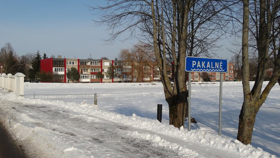
Rusnė is located on an island in the Nemunas Delta between the Atmata and Skirvytė rivers; the Pakalnė runs through the middle of the island. This can help you decide whether the landscape, old wooden architecture or historical landmarks should shape your stay.
Key facts about Rusnė
- Rusnė lies between the Atmata and Skirvytė rivers; the Pakalnė runs through the middle of the island.
- The first written mention of the Evangelical Lutheran church dates from 1544.
- A monument to Mahatma Gandhi and Hermann Kallenbach was unveiled on the banks of the Atmata in 2015.
What cultural history shapes Rusnė?
Rusnė is known for its preserved old wooden architecture. Another architectural landmark is the old post office building at the entrance to Peters Bridge, an example of German national architecture. These two buildings offer different points of reference if you are interested in the town’s built history.
It is also worth distinguishing between written records and the surviving building fabric of the Evangelical Lutheran church. Its first written mention, from 1544, records services held in Lithuanian and German. The present masonry dates from the 19th century. The details therefore tell of different historical layers: the early mention of religious life and the building’s later form.
A monument unveiled on the banks of the Atmata in 2015 commemorates Mahatma Gandhi and Hermann Kallenbach. Kallenbach was from Rusnė. The monument’s location and Kallenbach’s origins connect the memorial to the town in a concrete way.
The history of the island’s name also offers its own point of reference in time: the name of Lithuania’s largest island was first mentioned in written sources in 1366. This date refers to the island’s name, not to the founding of Rusnė.
Which cultural heritage sites are nearby?
The village of Skirvytėlė is nearby and is recognized as a nationally significant architectural heritage site. It is listed as a village within the administrative area of Rusnė Eldership, not as part of the town. This distinction can help you interpret place references when separating sights in Rusnė itself from those in the surrounding area.
A lighthouse stands in the nearby village of Uostadvaris and is considered a technical heritage monument. It is no longer used for navigation; instead, it serves as an observation tower with views of the areas around Rusnė and Minija. This adds a different kind of viewpoint in the surrounding area to the architectural and cultural landmarks in Rusnė itself.
How should you choose Rusnė as a destination when looking for accommodation?
First, consider which aspects of the trip matter to you: the island landscape between the rivers, the preserved wooden architecture, or the history of the church, post office building and monument. If you also want to explore places nearby, distinguish them in your plans from the sights in the town.
Discover more destinations: Dauparai, Dituva, Juodkrantė, Žemaičių Naumiesčio Seniūnija, Kretingalė, Dreverna, Pervalka, Gargždai.
FAQ
Which rivers shape Rusnė’s location?
Rusnė is located on an island in the Nemunas Delta between the Atmata and Skirvytė rivers. The Pakalnė runs through the middle of the island.
What is known about the church’s history?
The first written mention of the Evangelical Lutheran church dates from 1544 and records services held in Lithuanian and German. The present masonry dates from the 19th century.
Which cultural heritage sites are nearby?
The village of Skirvytėlė has a recognized nationally significant architectural heritage site. Uostadvaris is home to a technical heritage monument: the lighthouse, which serves as an observation tower with views of the areas around Rusnė and Minija.
For the broader travel overview: Klaipėda County.

