
Białawoda on the slopes of Białowodzka Góra
Accommodation in Białawoda
When planning your trip, it is worth looking at two scales: Białawoda lies on the slopes of Białowodzka Góra. Hiking trails, forest habitats and historic remains at Zamczysko provide other, distinct points of interest in the surrounding area. This lets you place the town in the context of its mountain landscape and compare routes by destination and stated walking time.
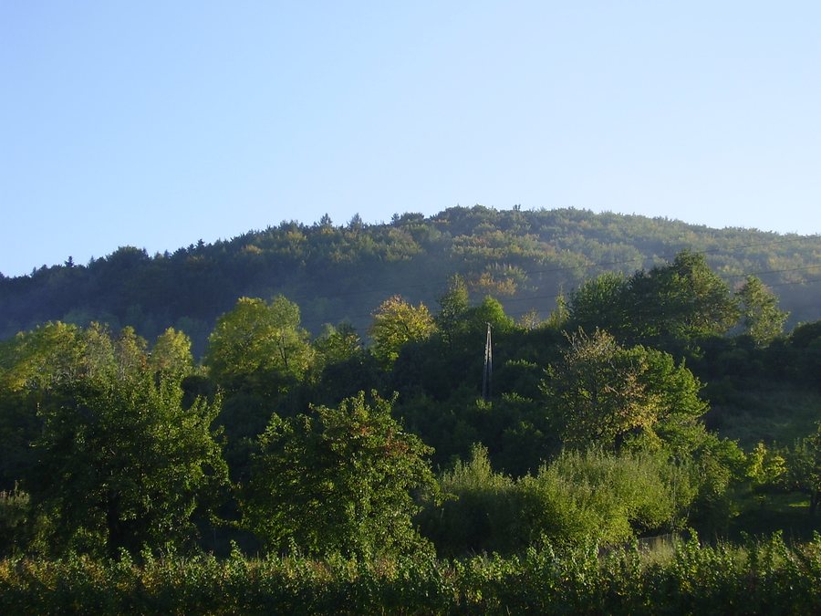 File:Białawoda (woj małopolskie)-las.jpg
Photo: Mf Greg at Polish Wikipedia via Wikimedia Commons, Public domain
File:Białawoda (woj małopolskie)-las.jpg
Photo: Mf Greg at Polish Wikipedia via Wikimedia Commons, Public domain
Białawoda at a glance
- Białawoda lies on the slopes of Białowodzka Góra, which is 616 metres high.
- The elevations include Zamczysko at 608 metres and Rozdziele at 616 metres.
- A green hiking trail from Tęgoborze to Rozdziele is listed as taking about 1 hour and 30 minutes.
- The yellow hiking trail from Marcinkowice via Białowodzka Góra to Zawadka and Rojówka is listed as taking three hours.
- The nearby Białowodzka Góra nad Dunajcem Nature Reserve covers 67.74 hectares.
What is the landscape around Białawoda like?
Its location on the mountain slopes provides the geographical context: Białowodzka Góra reaches 616 metres and forms the easternmost section of the Pasmo Łososińskiego. Zamczysko (608 metres) and Rozdziele (616 metres) are among this mountain’s elevations. The names refer to different points in the landscape: Rozdziele is the destination of the green hiking trail, while Zamczysko is associated with an old rampart and the remains of a former defensive structure.
The nearby Białowodzka Góra nad Dunajcem Nature Reserve is part of the area’s natural landscape. On the eastern side of Zamczysko, a nutrient-rich oak-hornbeam forest gradually gives way to a Carpathian beech forest. Flowering ivy also grows high in the fir tree canopies there.
Which hike fits your plans?
The two trails mentioned differ mainly in their stated walking times and the places along their routes. The green hiking trail from Tęgoborze to Rozdziele is listed as taking about 1 hour and 30 minutes. It ends around 500 metres before the summit of Białowodzka Góra. The time given therefore applies to the route to Rozdziele, not to a walk to the summit.
The yellow hiking trail runs from Marcinkowice via Białowodzka Góra to Zawadka and Rojówka; it is listed as taking three hours. This makes it the longer of the two suggested itineraries and the one that names more stops along the route. So when choosing, duration is not the only factor: Rozdziele is the destination on the green trail, while the yellow trail continues over the mountain to Zawadka and Rojówka. The approximate walking times are a guide; check local route conditions before setting out.
What can you find at Zamczysko?
The remains of a former defensive structure are located on Zamczysko, on Białowodzka Góra. From the edge of the old rampart, views of a steep rock face, the Dunajec winding below, the surrounding mountains and villages form part of the landscape. Archaeological traces and wide-ranging views of the area come together here. This distinguishes the site from Rozdziele, named as the destination of the green hiking trail, and from the forest habitats on the eastern slope of Zamczysko.
Discover more destinations: Binczarowa, Wierchomla Wielka, Grybow, Kąclowa, Żegiestów, Krzyżówka, Berest, Nowy Sącz.
FAQ
Does the green hiking trail reach the summit of Białowodzka Góra?
No. The trail from Tęgoborze to Rozdziele ends about 500 metres before the summit. The stated walking time is around 1 hour and 30 minutes.
Which places does the yellow hiking trail connect?
It runs from Marcinkowice via Białowodzka Góra to Zawadka and Rojówka. The stated walking time is three hours.
What is there at Zamczysko?
The remains of a former defensive structure are located there. Views of the Dunajec, a steep rock face, mountains and villages can be enjoyed from the old rampart.
Go to the main travel overview: Nowy Sącz.

-las.jpg)