
Zatwarnica: Nature and History
Accommodation in Zatwarnica
Zatwarnica combines distinctive traces in the landscape with insights into the area's history. The waterfall, former mills, and Hylaty Nature and History Trail give you different points of reference to decide which topics are of particular interest to you on your trip.
Zatwarnica at a glance
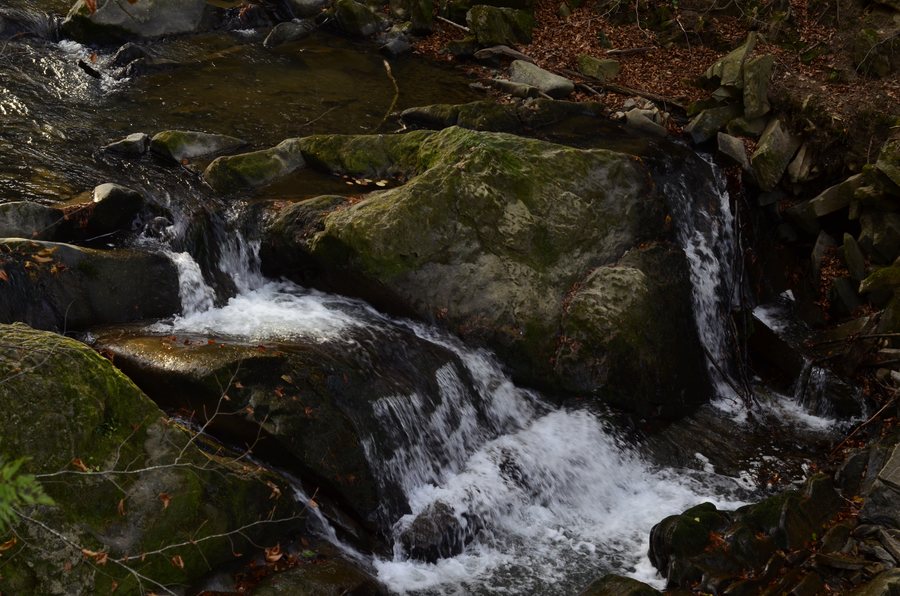
Clearly visible remains of former mills have been preserved at several stretches of the Głęboki stream. Above the confluence of Hylaty and Ryka, a small waterfall lies in the bed of a former mill race. The Hylaty Nature and History Trail is 12 kilometers long, marked in green, and runs from Zatwarnica to the 1,004-meter-high summit of Dwernik Kamień. It is the main element of the “W Krainie Bojków” Ecomuseum.
What traces in the landscape can you discover?
Water and former mill use shape several of the places described, but in different ways. Mill remains can be found along various stretches of the Głęboki. The small waterfall, by contrast, lies in the bed of a former mill race, above the confluence of Hylaty and Ryka. These details give you specific points of reference if you are interested in the landscape and its historical traces.
You will encounter another mill relic on the Hylaty Trail: the route passes the remains of a former mill in Zatwarnica. This site is distinct from the mill remains preserved along various stretches of the Głęboki. This allows you to distinguish between the different clues to the former use of the waterways, both on the map and when learning about the area.
What insights does the history of the village offer?
Several generations of Boyko villagers, as well as Polish militiamen who died in 1946, rest in the former village cemetery. A simple monument commemorates their graves. The cemetery thus points to different chapters in the area's history and is a different point of reference from the built traces of former mills.
The regional history room in Zatwarnica covers the history and events of the area, legends passed down from generation to generation, and the surrounding nature. Its oldest exhibits are several hundred years old. For choosing what interests you, this offers a contrast between traces in the landscape and the topics presented in the room.
What should you know about the Hylaty Trail?
The Hylaty Nature and History Trail runs from Zatwarnica to the 1,004-meter-high summit of Dwernik Kamień. Its stated length is 12 kilometers, and it is marked in green. These three specific details help you assess the route by its length, marking, and destination, rather than reducing the trip to a mere attraction in the village.
The trail is the main element of the “W Krainie Bojków” Ecomuseum. Its first point is the “Chata Bojkowska”: a reconstruction of a dwelling traditionally found in this part of the Carpathians, adapted as a local education and cultural center. The trail and the Chata thus represent different aspects of the Ecomuseum: a route through nature and history topics, and a reconstructed type of home with an educational and cultural role.
Which topics suit your travel interests?
If you are more interested in local history, the cemetery and regional history room offer different points of connection. The waterfall and mill remains, in turn, combine impressions of the landscape with the former use of water. These different points of focus can help you explore Zatwarnica according to your own interests, rather than reducing all the places to a single kind of excursion.
Discover more destinations: Teleśnica Oszwarowa, Ustrzyki Dolne, Muczne, Smolnik, Procisne, Tworylne, Ropienka and Dwernik.
FAQ
How long is the Hylaty Nature and History Trail?
The trail is 12 kilometers long and marked in green.
Where does the Hylaty Trail lead?
It runs from Zatwarnica to the 1,004-meter-high summit of Dwernik Kamień.
What historical traces can be found along the Głęboki stream?
Clearly visible remains of former mills have been preserved along various stretches of the stream.
To the main travel overview: Bieszczady.

