
Odrzykoń: Chapel Trail and Landscape
Accommodation in Odrzykoń
Odrzykoń lies on the border between the Doły Jasielsko-Sanockie and the Pogórze Dynowskie. For visitors, the walking and cycling trail “Śladami krzyży i kapliczek w Odrzykoniu” offers a way to explore the history of roadside crosses and chapels. Two options start at the same place and differ in length and number of chapels.
Odrzykoń at a glance
- The trail was established in 2008 at the initiative of the Stowarzyszenie Odrzykoniaków to introduce residents and visitors to the history of roadside crosses and chapels.
- The shorter, blue option passes 11 roadside chapels.
- The longer, yellow option is about 17 km long and passes 22 roadside chapels.
- Both options start at the Muzeum Wsi in Odrzykoń. There is an information board there with a trail map and descriptions of the chapels.
What makes the Chapel Trail interesting?
This trail focuses on roadside crosses and chapels as historical subjects. Established in 2008, it was intended to bring their history closer not only to residents but also to visitors. This gives the trail a specific cultural focus: it is about the stories of the small monuments along the route, not just choosing a path.
Information boards at the roadside chapels tell visitors about their history. At the starting point, another information board provides an overview with a map of the trail and descriptions of the chapels. This means there are two kinds of information: an overview at the beginning and details at the individual roadside chapels. For planning, you can use the shared starting point first and then choose between the two options.
Which option suits your plans?
The blue option is shorter and passes 11 chapels. The yellow option covers about 17 km and 22 chapels. The routes therefore differ both in their stated length and in the number of roadside chapels. Comparing the two options on this basis, the blue route is shorter, while the yellow route includes more chapels and a greater stated distance.
The yellow option also includes chapels in more distant parts of the village, in the Czarnorzecko-Strzyżowski Park Krajobrazowy, and in Podbratkówka. These details describe its wider reach; they do not mean that all the stops are in the village. Check local conditions before setting out, especially if you are planning the longer option.
Where does the trail start, and how can you find your way?
Both options start at the Muzeum Wsi in Odrzykoń. The information board there provides a trail map and descriptions of the chapels. The starting point is the same for both options, while the choice depends mainly on the trail length and the number of chapels.
The nearest PKS bus stop is at the Dom Kultury in Odrzykoń, 50 metres from the trail entrance. If you plan to arrive by bus, check the current timetable in advance. The bus stop information is a landmark for locating the trail entrance, not confirmation of current departure times.
How can you get a sense of the surrounding area?
Odrzykoń’s location on the border between the Doły Jasielsko-Sanockie and Pogórze Dynowskie provides its geographical setting. The Królewska and Sucha Góra massifs shape the surrounding landscape. This places the village within two named landscape regions and among the surrounding massifs, while the Chapel Trail offers its own historical focus.
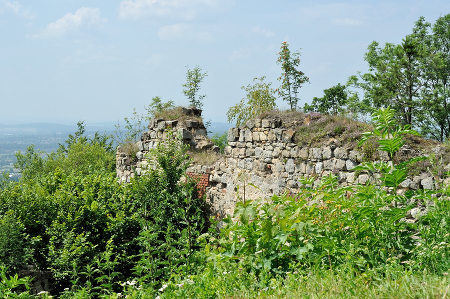
Nearby is Zamek Kamieniec, close to the Prządki Nature Reserve. The relationship between the castle and the protected area provides another point of reference for exploring the region. It complements information about the village and route with a view of the wider surroundings.
Discover more destinations: Moderówka, Węglówka, Wisłoczek, Trzciana, Jedlicze, Krasna, Iwonicz-Zdrój and Dukla.
FAQ
How do the two options differ?
The shorter, blue option passes 11 roadside chapels. The yellow option is about 17 km long, includes 22 chapels, and also covers more distant parts of the village, the Czarnorzecko-Strzyżowski Park Krajobrazowy, and Podbratkówka.
Where do the Chapel Trail options start?
Both start at the Muzeum Wsi in Odrzykoń. There is an information board there with a trail map and descriptions of the chapels.
Where is the nearest PKS bus stop?
The nearest stop is at the Dom Kultury in Odrzykoń, 50 metres from the trail entrance. Check the current timetable before travelling.
Back to the main travel overview: Krośnieński.

