
Discover Bukowsko
Accommodation in Bukowsko
Bukowsko brings together a distinctive landscape, murals, local history and several described trails. When planning your trip, it is useful to consider these topics separately: each shows a different side of the village and its municipality.
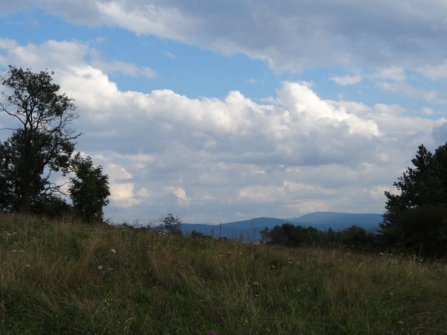 File:Gmina Bukowsko, Poland - panoramio (109).jpg
Photo: Wojciech Zabolotny via Wikimedia Commons, CC BY-SA 3.0
File:Gmina Bukowsko, Poland - panoramio (109).jpg
Photo: Wojciech Zabolotny via Wikimedia Commons, CC BY-SA 3.0
Bukowsko at a glance
- Bukowsko lies in a broad hollow at the foot of the Bukowica Range.
- The Bukowiec and Sanoczek streams are in the San River basin.
- Murals can be seen mainly at bus stops and also in the village centre.
- The yellow-and-red-marked “Szlakiem historycznych osad” trail is 15 kilometres long and ends in Bukowsko.
- In the centre, there is a place to learn about the flora and fauna of the Carpathians.
How can Bukowsko be understood in terms of its landscape and history?
The broad hollow at the foot of the Bukowica Range forms the landscape setting of Bukowsko. This also includes the Bukowiec and Sanoczek streams, which lie in the San River basin. Thus, the village’s location can be considered in terms of both a landform and named waterways.
The village’s history also provides a point of reference: Bukowsko was a town from 1748 to 1946 and belonged, among others, to the Ossoliński family. This period as a town complements the landscape perspective. When comparing destinations, you can decide whether the natural setting or the village’s history is more important to you.
Which trails can you include in your plans?
The yellow-and-red-marked “Szlakiem historycznych osad” trail is 15 kilometres long. It starts at the Caritas retreat centre in Zboiska and ends in Bukowsko. Alternatively, you can start the route in Bukowsko and complete it in stages. Before setting out, check local information about current trail conditions.
The “Śladami trzech narodów – Polacy, Rusini i Żydzi w Gminie Bukowsko” educational trail is a separate route. It leads from Bukowsko to Kamienne, a historic settlement that no longer exists. The route’s name refers to Poles, Ruthenians and Jews in the municipality of Bukowsko; its stated course connects Bukowsko with Kamienne.
Another trail description concerns the municipality of Bukowsko: the “Buczyna Karpacka” trail leads to Bukowica, with access from Wola Piotrowa, and is mentioned as an option for hiking and cycling. The details useful for comparison therefore differ: for “Szlakiem historycznych osad,” the length, markings and endpoint are given; for “Buczyna Karpacka,” the activities and access point are highlighted.
What can you discover in the village and its centre?
Murals can be seen in Bukowsko mainly at bus stops and also in the village centre. Additional murals were created in 2023; one mural is on the wall of the Dom Kultury.
There is also a place in the centre of Bukowsko where you can learn about the flora and fauna of the Carpathians. Information boards about the natural diversity of the Subcarpathian region are located along the pavement around the square. This nature-related theme differs from the murals: here, the focus is on information about nature. Bukowsko is also home to a Jewish cemetery, another feature of the village’s cultural heritage.
Discover more destinations: Tyrawa Solna, Rzepedź, Komańcza, Czaszyn, Łukowe, Długie, Zagórz, Kalnica.
FAQ
Where can you see murals in Bukowsko?
Mainly at bus stops and also in the village centre. Additional murals were created in 2023; one mural is on the wall of the Dom Kultury.
How long is “Szlakiem historycznych osad”?
The yellow-and-red-marked trail is 15 kilometres long. It ends in Bukowsko and can also be started there and completed in stages.
What nature information can you find in the centre?
There is a place to learn about the flora and fauna of the Carpathians. Information boards about the natural diversity of the Subcarpathian region are located along the pavement around the square.
For the broader travel overview: Sanok.

.jpg)