
Shabla – Coast, Lagoons and Cultural Heritage
Accommodation in Shabla
Shabla combines an extensive Black Sea coastline with lagoons, important wetlands and archaeological sites. To help plan your trip, take a look at the municipality’s varied landscapes and history.
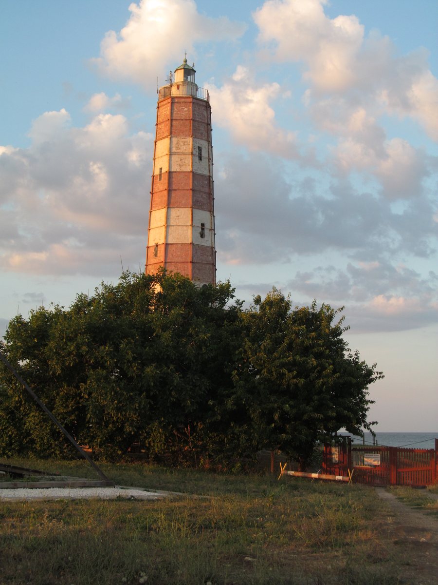 File:Shabla lighthouse, Shabla region, Bulgaria.JPG
Photo: Sborisova via Wikimedia Commons, CC BY-SA 4.0
Shabla at a glance
The Municipality of Shabla has about 40 km of Black Sea coastline; its beaches account for 22% of all beaches on the Bulgarian Black Sea coast. Cape Shabla is Bulgaria’s easternmost point. South of the cape, limestone cliffs, caves and underwater rock formations shape the coast. Lakes and lagoons also form part of the landscape, including Durankulak Lake, the Shabla-Ezerets Lake Complex and Shabla Tuzla.
Which coastal landscapes can you compare?
The coast has different features in different places. South of Cape Shabla, limestone cliffs and caves alternate with underwater rock formations. At Tyulenovo, reefs, steep sea cliffs and sea caves are part of the landscape. Some caves are above ground, some are partly underwater, and others are entirely underwater. The rocky coast north and south of Tyulenovo is part of the Natura 2000 sites “Kaliakra” and “Kaliakra Complex.”
You can find a different type of coastline in Krapets: there is an undeveloped beach about 7.5 km long, with dunes. When comparing landscapes, the long beach and dunes here contrast with the rocky coastal sections around Tyulenovo. These different coastal features can give your trip a specific focus, without implying anything about the facilities at individual accommodations.
What are the lakes and wetlands like?
Durankulak Lake is a Ramsar wetland and a BirdLife International Important Bird Area. The lake is of global importance for waterbirds, especially in winter, when large gatherings of geese play an important role. The lagoon is shallow and enclosed. It formed from former coastal bays that were cut off from the sea by a sandbar. Its formation and shape therefore differ from those of the rocky coastal landscapes.
The Shabla Lake protected area includes two coastal lagoons, Shabla Lake and Ezerets Lake, which are connected by a channel. A total of 247 bird species have been recorded in the Shabla-Ezerets Lake Complex. This figure represents a documented total; it does not refer to a current count. Shabla Tuzla, in turn, is a natural brackish-water lagoon separated from the sea by a sandbar about 80 m wide. Its mud is used for mud therapy.
Which places tell the story of the region’s history?
The lighthouse at Shabla on Cape Shabla dates back to 1768 and is the oldest lighthouse still in operation in the Black Sea–Mediterranean region. The archaeological complex of Karon Limen lies right next to the oldest lighthouse on Bulgaria’s Black Sea coast. Its surviving remains include a Roman bath and a fortress wall.
On the shore of Durankulak Lake, near the village of Durankulak, lies the archaeological complex of Durankulak and Hamangia. It includes the “Big Island” settlement mound and associated necropolises. The complex is home to the oldest stone architecture in continental Europe; it also includes the largest excavated prehistoric necropolis from the 5th millennium BC. The lighthouse, Roman and fortified remains, and prehistoric sites thus represent different historical periods.
Which experiences can help you plan your trip?
Sea fishing and underwater tourism are possible in Tyulenovo. Together with its reefs, cliffs and sea caves, these activities give it a coastal focus that differs from the beach and dunes at Krapets. The activities and initiatives of the “Slǎntse 1871” cultural center in Krapets are aimed at both local residents and visitors to the village.
For getting your bearings over longer distances: the Municipality of Shabla is served mainly by the I-9 main road. It is designated E-87 and forms part of the international corridor between Romania and Turkey.
Discover more destinations: Dobrich, Gorun and Bozhanovo.
FAQ
How long is the coastline of the Municipality of Shabla?
The municipality has about 40 km of Black Sea coastline. Its beaches account for 22% of all beaches on the Bulgarian Black Sea coast. Cape Shabla is Bulgaria’s easternmost point.
Why is Durankulak Lake important for birdlife?
The wetland is a Ramsar site and an Important Bird Area. It is globally important for waterbirds in winter, particularly because of the large gatherings of geese.
What archaeological features can be found in Shabla?
Karon Limen preserves the remains of a Roman bath and a fortress wall. The complex near Durankulak includes the oldest stone architecture in continental Europe and the largest excavated prehistoric necropolis from the 5th millennium BC.
How do Krapets and Tyulenovo differ?
Krapets is known for its undeveloped beach, about 7.5 km long, with dunes. Tyulenovo has a rocky coastline, where sea fishing and underwater tourism are possible.
For the broader travel overview: Dobrich Province.

