
Teschwitz: Hotels and accommodations
Accommodation in Teschwitz
Těšovice lies on the right bank of the Ohře.
Culture and history
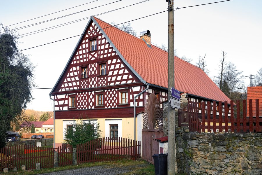
Several half-timbered houses have been preserved in Těšovice. The enclosed farm complex No. 9 dates from around the turn of the 18th to the 19th century and is a typical four-sided farmstead, or a Franconian house with a four-sided layout. The buildings of the so-called Těšovice manor are valuable examples of vernacular half-timbered architecture from the late 18th and early 19th centuries.
In a hollow on the former field road to Staré Sedlo, near the former hamlet of Na Kopci, approximately 250 meters south of the summit of Těšovický vrch, stands a medieval stone cross about one meter high. It is reinforced with four irregular ribs and bears a small engraved cross in its center.
Nature
There is a small so-called Těšovice waterfall in Těšovice. Near it stands a boundary stone of the Nostitz estate, with an anchor engraved on it as part of the Nostitz coat of arms.
Geographical setting
The mountains of Lobezský vrch, Chrudim, Buková, and Špičák are located in the vicinity of Těšovice. In the wider regional area are the Schlackenwerth Monastery, the Center of Europe monument, the Zwota Church, and St. Michael's Church in Bad Brambach.
Paths
A suspension bridge for pedestrians and cyclists connects Těšovice with Královské Poříčí across the Ohře. A green-marked hiking trail runs through Těšovice.
Other local pages
Ebmeth, Königswerth, Gossengrün, Josefsdorf, Schwaderbach, Lanz, Podstrani, Daßnitz
To the higher-level travel overview: Falkenau an der Eger District.

